When I first did St. Mark’s Summit hike last year, I had read about Mount Strachan and the approach via Christmas Gully. Scott had done this hike in fall, and we had talked about doing this hike in winter conditions. Last weekend, everything aligned and we finally did this hike in Cypress Provincial Park.
Pre-Trip Planning
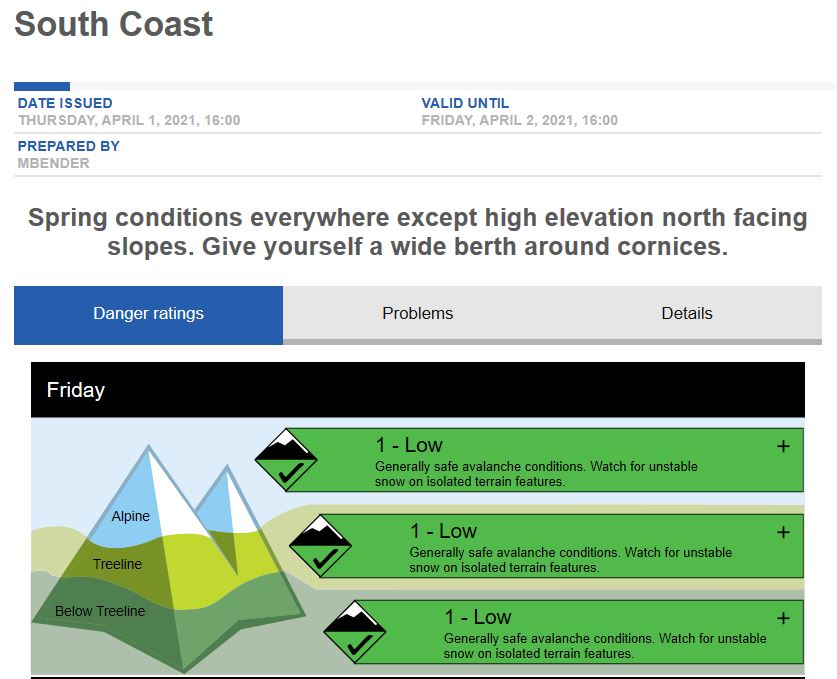
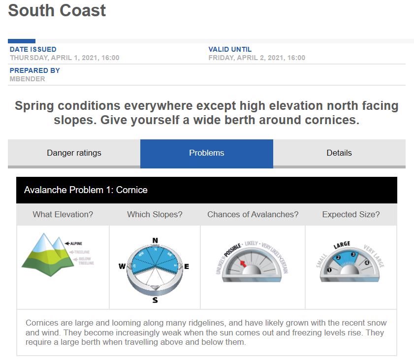
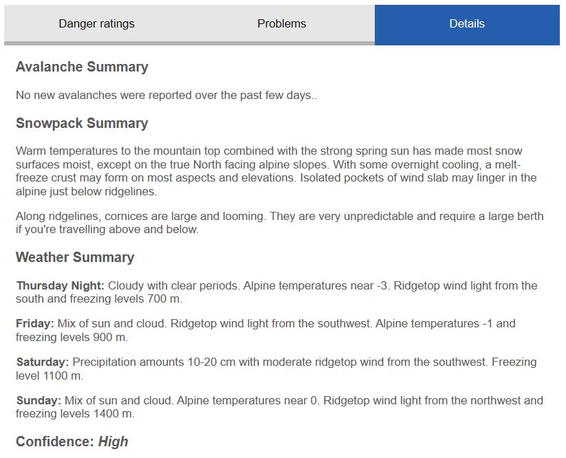
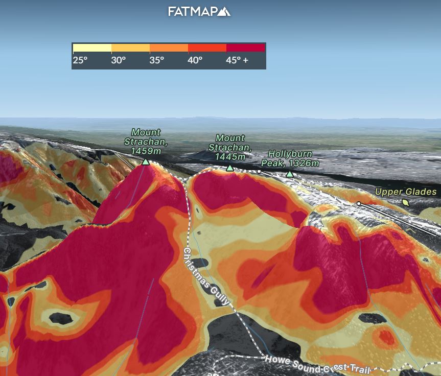
This hike goes through a couple of avalanche chutes, and the avalanche risk is even higher in Christmas Gully. Fortunately, the avalanche risk was Low/Low/Low for April 2.
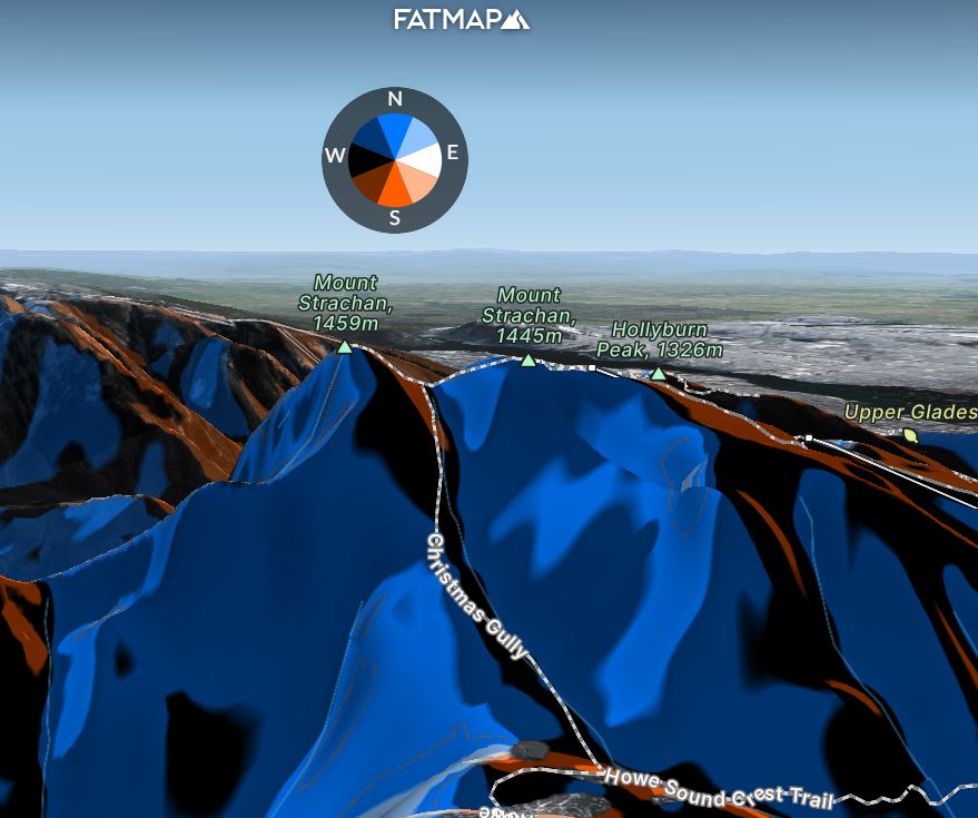
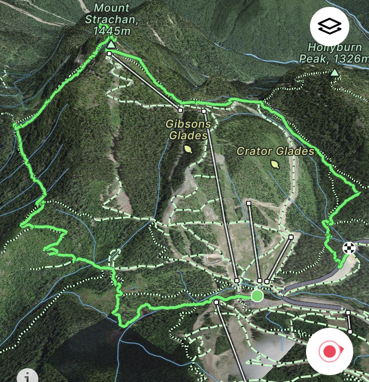
Recently I started using FATMAP to review the trail information, assess the terrain and visualize the route I will be taking on a hike/climb. When I did this for the Garibaldi NE Face trip, I had to download a KML file from GAIA GPS and upload it into Google Earth to get a 3D view. With FATMAP, I could do all my research in one place.
FATMAP provides a host of terrain tools (some are available only in the premium version). The feature I found quite helpful was Terrain Layers, which colour-codes the terrain based on Elevation, Aspect, Avalanche, etc. This information can be used with the forecast from Avalanche Canada to better understand the trail conditions.
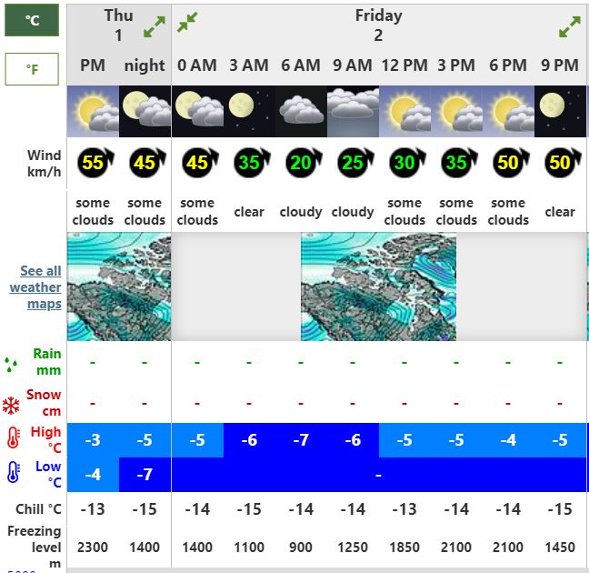
The weather forecast called for a cloudy day with temperatures below freezing at the summit in the morning.
Bowen Lookout Trail
Cypress Bowl Road is closed until 7 am in winter (if you are interested in reading more about why the road is closed, check out this article). Scott and I met around 7:15 am at the free parking lot (3B). We geared up for the hike and were on our way with a backcountry access pass by 7:30 am.
You can read my last post on the Black Mountain hike, where I share details about the parking situation and the backcountry access pass at Cypress.
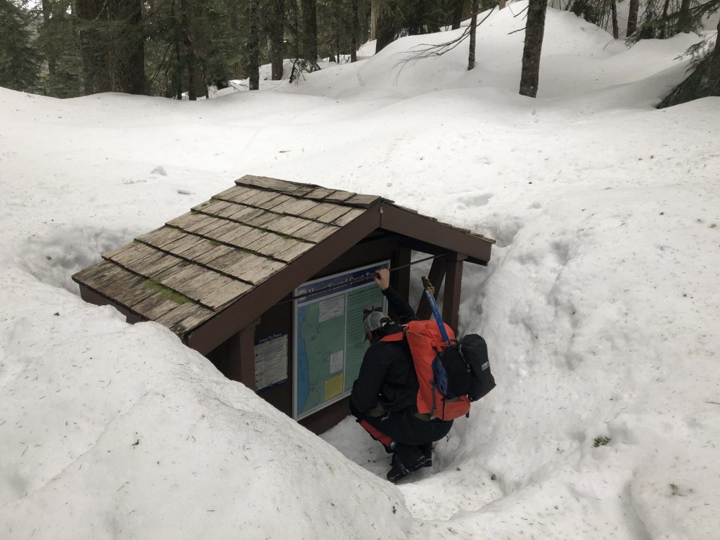
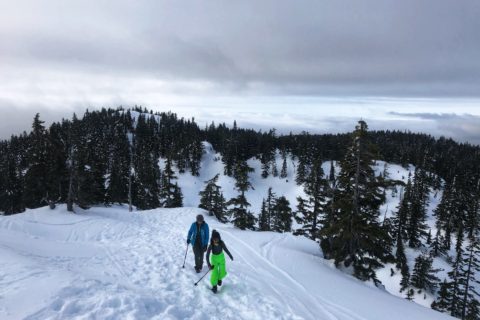
After a quick beacon check, we made our way through the backcountry access corridor at Cypress. We took the Bowen Lookout Trail and hiked past the Bowen Lookout junction on the Howe Sound Crest Trail. We reached the next junction where you can get a good view of The Lions on a clear day. The trail signpost at the junction was buried in snow.
We continued on the Howe Sound Crest Trail and reached Christmas Gully’s base just before 9 am. So far, the hike has been relatively flat, with less than 200 m elevation gain over 4.5 km (from 3B parking lot).
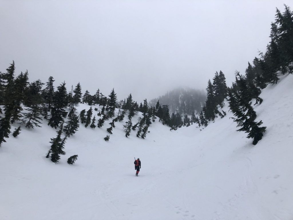
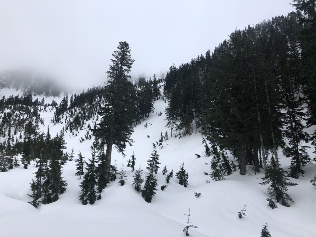
Christmas Gully
As we looked up Christmas Gully, we wondered if we should have brought snowshoes. After a brief break, we made our way up the gully. The snow was crusty, but we were able to kick steps with our mountaineering boots. Every now and then, we would punch through the snow, but it was not too bad.
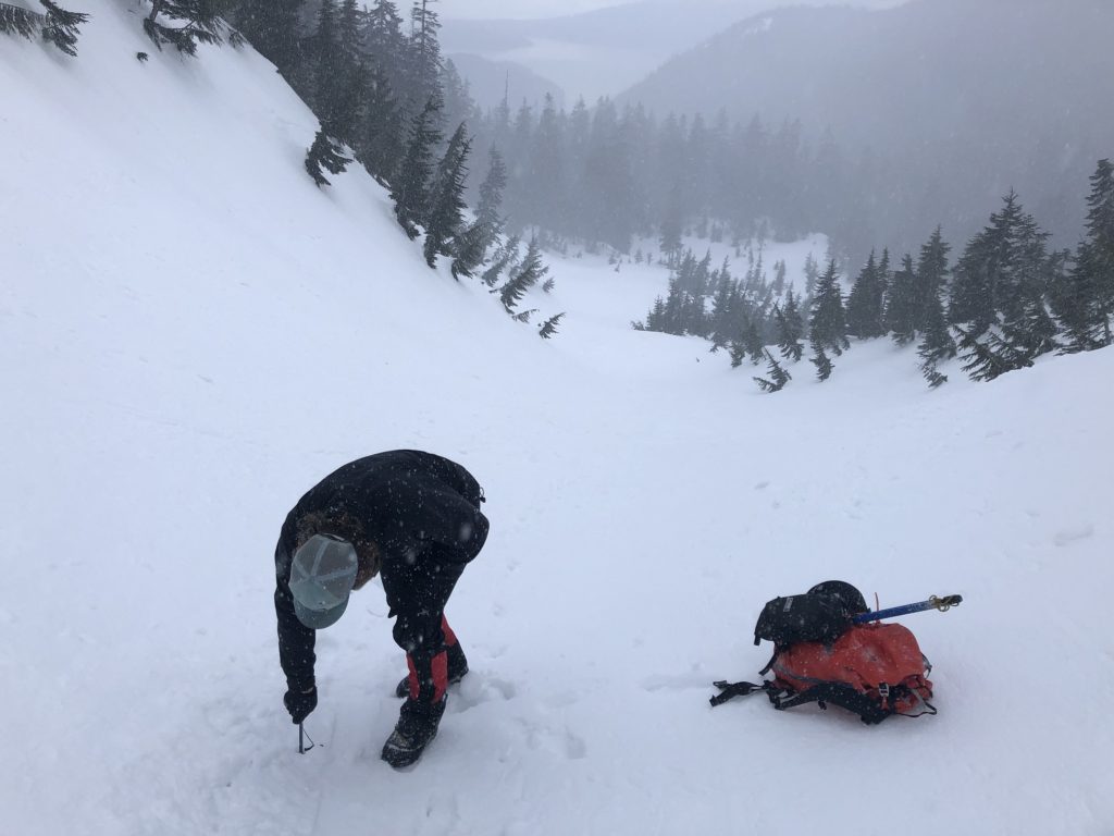
About fifteen minutes into the hike, we discussed the snowpack’s stability over the creek. Out of curiosity, we took out our probes to check the snow depth. Scott checked with his 240 cm probe, and he didn’t hit the ground. The probe I borrowed from Scott was slightly longer, but it went in all the way as well.
Scott and I took turns in kicking steps. We both had crampons in our backpacks but didn’t have to use them. As I punched through the snow, I thought about the loaded backpack (about 20 lbs) I was carrying as part of my training. Maybe it will help if I dumped the extra water, most likely not.


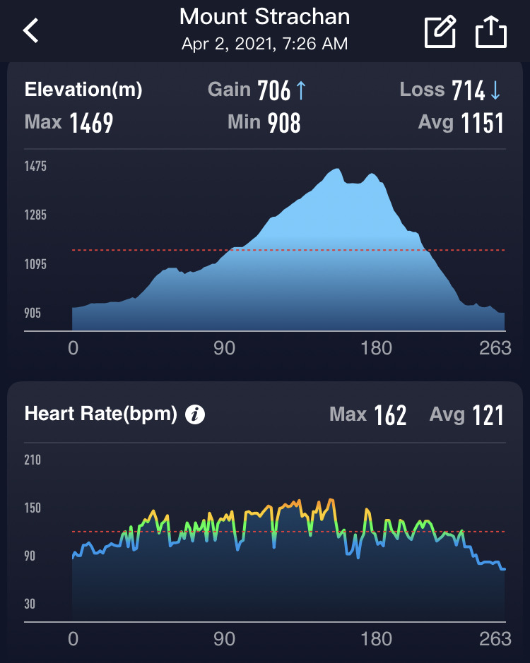
It took us just over an hour to hike up Christmas Gully, about 1 km long, with an elevation gain of 324 m (31% Grade, < 20 deg.). It was steeper in some sections but overall easier than what I had expected.
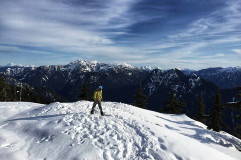
North and South Summit
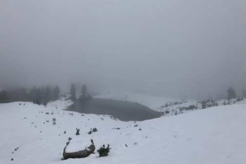
Once at the saddle between the two peaks, we saw tracks coming down the South Summit and going up the North Summit. In about 10 minutes, we were on North Summit (1459 m). As expected, we had high winds and no visibility on the summit.

Given the cornice hazard, we stayed away from the edge and soon made our way back to the saddle. After a brief snack break, we followed the tracks to the South Summit (1445 m).
The Descent
From the South Summit, we made our way to the top of the Sky Chair chairlift and then continued to hike down the Mount Strachan Trail. We thought going down would be relatively easy, but the tracks were not consistent. The trail is not marked, so I constantly checked the FATMAP app. At one point, I realized that we were going down the Old Mount Strachan Trail that would have led us to the Hollyburn Mountain trailhead.
It only took us a few minutes to get back on the trail. Soon we were at the junction of Mount Strachan and Baden Powell Trail overlooking a creek. The map showed a creek crossing, but I was unsure how we would drop down and climb up the creek. Scott went down a slope, tested the snow bridge and made his way up the other side.
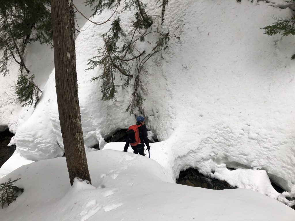
I followed him, and as I tried to climb up the other side, I found myself sinking deeper into the snow. After a couple of tries, I was able to get some traction and eventually made my way up to Scott.


Soon, we were at our second creek crossing. Scott was really excited; he was enjoying it. I just wanted to get through. Scott got down to the creek, stepped on the plank and tried to make his way up the short but steep snow wall.


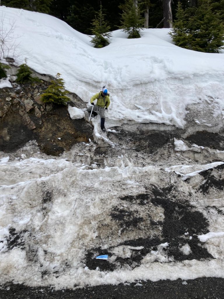
This one seemed more challenging, but we eventually made it to the other side. Crossing these creeks was probably the most exciting part of our Mount Strachan hike. We now heard people on Cypress Bowl Road and made our way down to parking lot 3A.
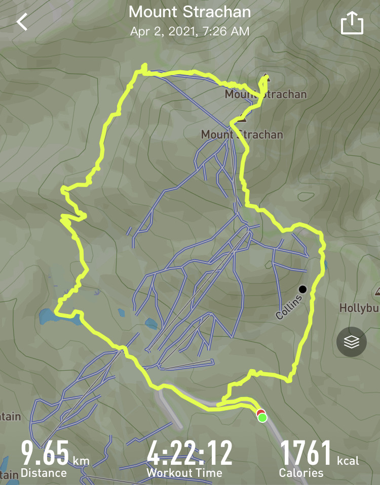
In total, we had hiked just under 10 km with about 700 m elevation gain.
If you plan to do this hike in winter conditions, review the avalanche forecast and trails on the mountain, and be prepared for backcountry travel.
Resources:
Cypress Provincial Park – BC Parks Website
Cypress Mountain – Resort Website
Trip Plan – AdventureSmart
Disclosure: I am not affiliated with any of the above individuals or organizations.
Did you enjoy reading this post? Please subscribe to get weekly updates. Thank you!
Wow, that looks super difficult. I’d like to take the hike precariously through your blog.👌
Thank you Ngoc. It was a fun hike, especially crossing the creeks.