During our India trip this year in November, Kasturi and I planned a Himalayan trek with Kavya. However, Kavya was not vaccinated and would have to do COVID-19 tests for air travel. So, we cancelled the family trek, and I decided to do a solo Kuari Pass trek in a day.
Trip Planning
India Hikes does an excellent job of documenting the treks, so I heavily relied on their Kuari Pass trek webpage in planning my trip. I also got the KML file from the India Hikes team. It helped me visualize the trek in Google Earth, and then I imported the GPX tracks in GAIA Maps for offline use. I also referred to Waymarked Trails, which is an excellent database of trails in this region.
Kuari Pass is rated as an easy-moderate trek when done over four days, excluding two days travel. It is about 21 km with roughly 1600 m of elevation gain. Based on my trips around Vancouver, this would be a moderate effort day trip. However, the altitude was the unknown factor. Kuari Pass trek starts at around 2250 m in Karchi and reaches a max elevation of 3850 m.
How many days should I acclimatize? Do I risk altitude sickness with 1600 m of vertical in a single day? People have made much harder trips in the Himalayas in a day, but I was unsure how my body would react to this effort.
I reached out to Jerry, who guides in the Himalayas, to get his perspective. Based on my training background, he said it is doable and suggested that I monitor signs for altitude sickness on the hike. We also discussed logistics and emergency plans for the trek, and overall I felt more comfortable with this undertaking.
Joshimath
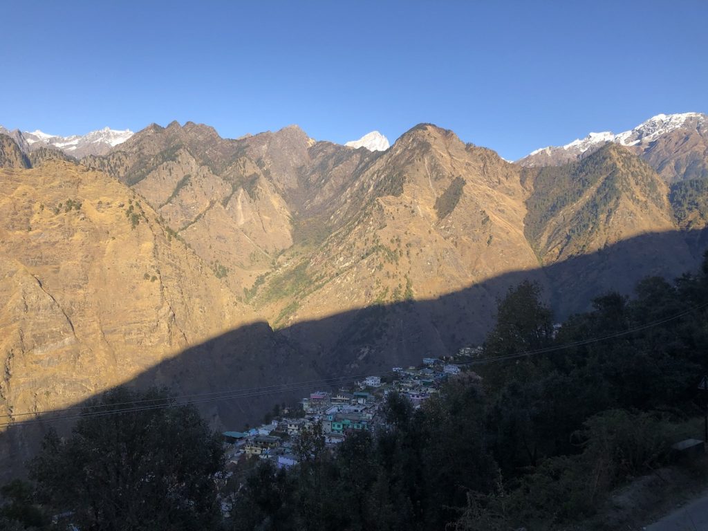
I was down with flu right after Diwali, so I had to postpone my trip by a week. On November 19, I took a Pune-Delhi-Dehradun flight and took a cab to Rishikesh. Kundan joined me in Rishikesh, so I stayed there two more days before heading to Joshimath, the closest town for the Kuari Pass trek.
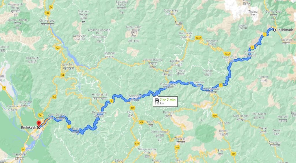
It is about a 250 km drive from Rishikesh to Joshimath and takes about eight to nine hours with a couple of breaks. It takes much longer if you use public transportation. Thankfully, Gautam from India Hikes helped me connect with their transportation team. So I could share the van with the India Hikes group heading to do the Kuari Pass trek.
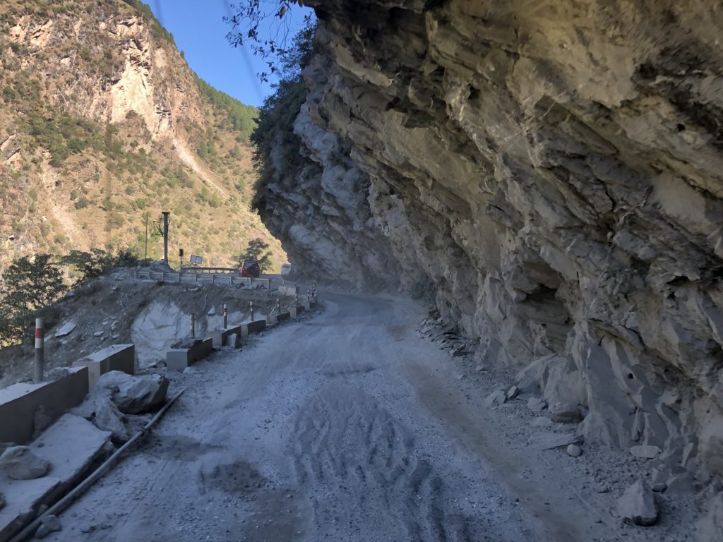
We left Rishikesh around 6:30 am. There was a lot of construction going on along the highway, but the drive was not bad for the most part. It was much better than the drive to Sankri for the Kedarkanth Trek with India Hikes in 2018.
The van dropped me off in Joshimath at 3:30 pm and continued to Tapovan. It is the base village for the India Hikes group heading to Kuari Pass.
Forest Permit
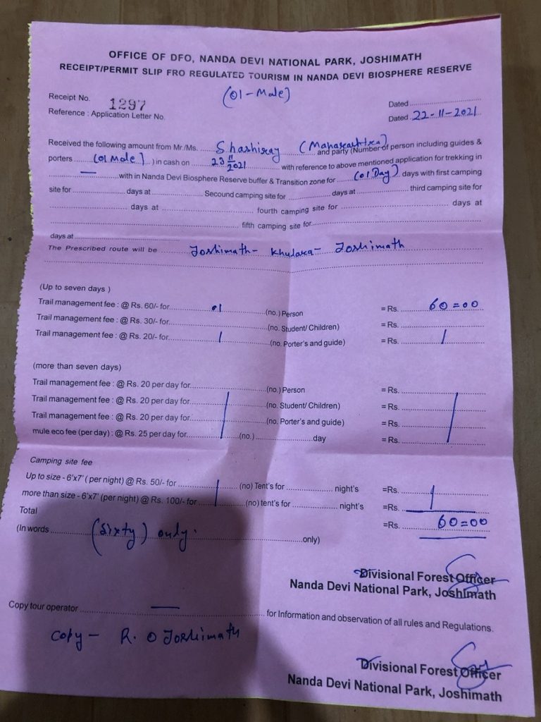
Since part of the Kuari Pass trek lies in the Nanda Devi Biosphere Reserve, I had to get a permit for the hike. India Hikes works with a local guiding agency to get their permits. I could obtain my permit from this local agency, but I would also be required to hire a guide from this agency, even for a day trek.
I contacted the Forest Office in Joshimath but got mixed responses on the permit situation. Once I arrived in Joshimath, I walked to the Forest Office (Google Maps location).
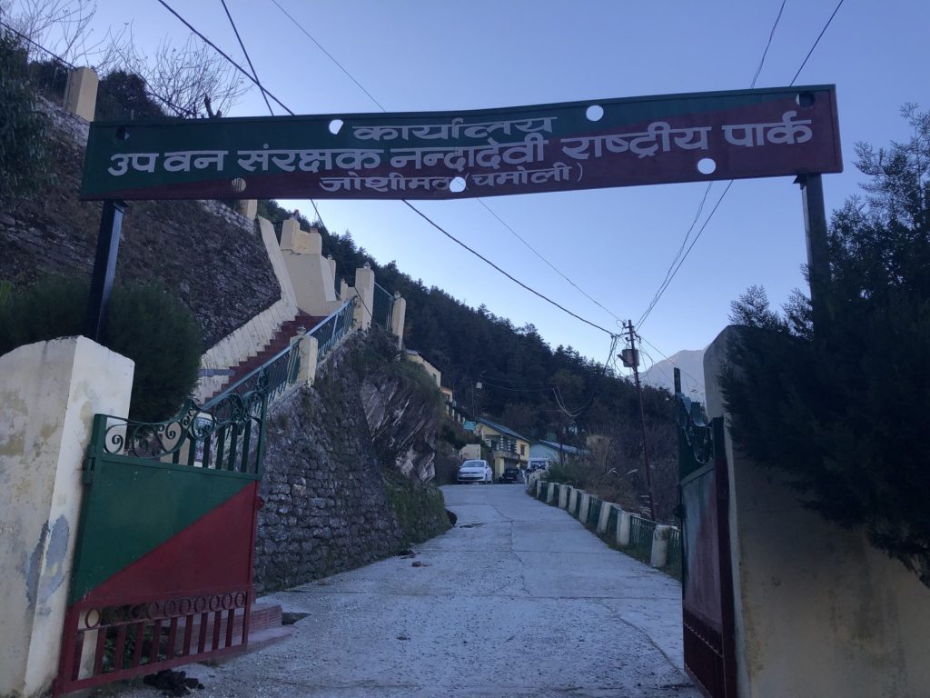
The clerks at the office were surprised by my request and were not comfortable issuing a permit. So, I had to go and talk to the Divisional Forest Officer. I explained that I was planning to do a day hike and wouldn’t camp anywhere in the forest. People who decide to camp, even for one night, have to work with a local guiding agency and get a guide.
It took a while, but finally, I got a day permit (INR 60 or ~ CAD 1) for November 23. One of the clerks took my contact number and asked me to call him back once I was done with my hike. He was not convinced that I would do this in a day.
I didn’t have a reservation for my stay in Joshimath. Someone had suggested Nanda Devi Expedition Hostel on Auli Road, but it was closed for the season. So I walked to the Sleeping Beauty Hotel down the road with good Google reviews. It was clean, and the rooms were much better than I expected. I settled on a room with a balcony on the second floor.
Before dinner, I did a short walk to get a sense of how I felt at this altitude. I hiked for about an hour, 3 km out and back with about 250 m elevation gain. I felt good.
Initially, I had prepared to pack stove, soup/noodle packets and emergency shelter for the hike. But then decided to go light and just carry everything in my daughter’s 12L day pack.
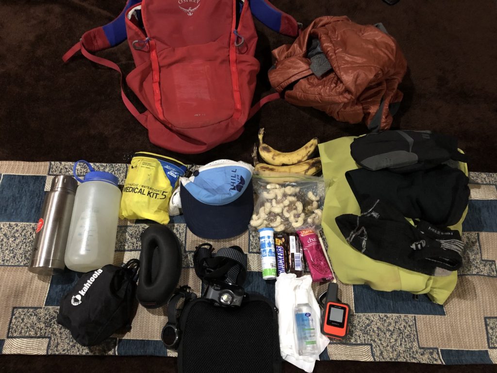
Gear in 12L pack – Microspikes, Sunglasses, Headlamp, Garmin inReach Mini, Medical Kit includes Sunscreen and Lighter, Toilet Paper, Hand Sanitizer, Insulation Jacket, Softshell Jacket, Hat, Balaclava, Extra set of Gloves and Socks, Phone, Charging Cable, Power Bank, Permit, Electrolytes, Snickers, Instant Chai, Mixed Nuts, Bananas, Nalgene Bottle and Thermos,
Karchi to Akhrotghetta
The next day, I left the hotel at 5:30 am and took a taxi to Karchi. Given the odd time, I had to book a private taxi. It was a 45-minute drive but cost me almost the same (INR 1000/~CAD 17) as the shared nine-hour drive from Rishikesh to Joshimath.
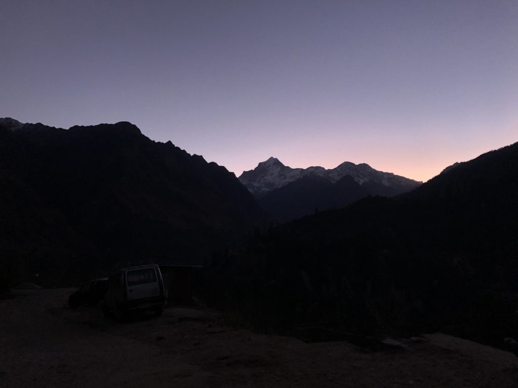
I reached Karchi at 6:15 am and soon started my hike. The trail through the village was quite obvious, but I was checking my maps at regular intervals.
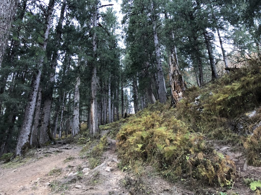
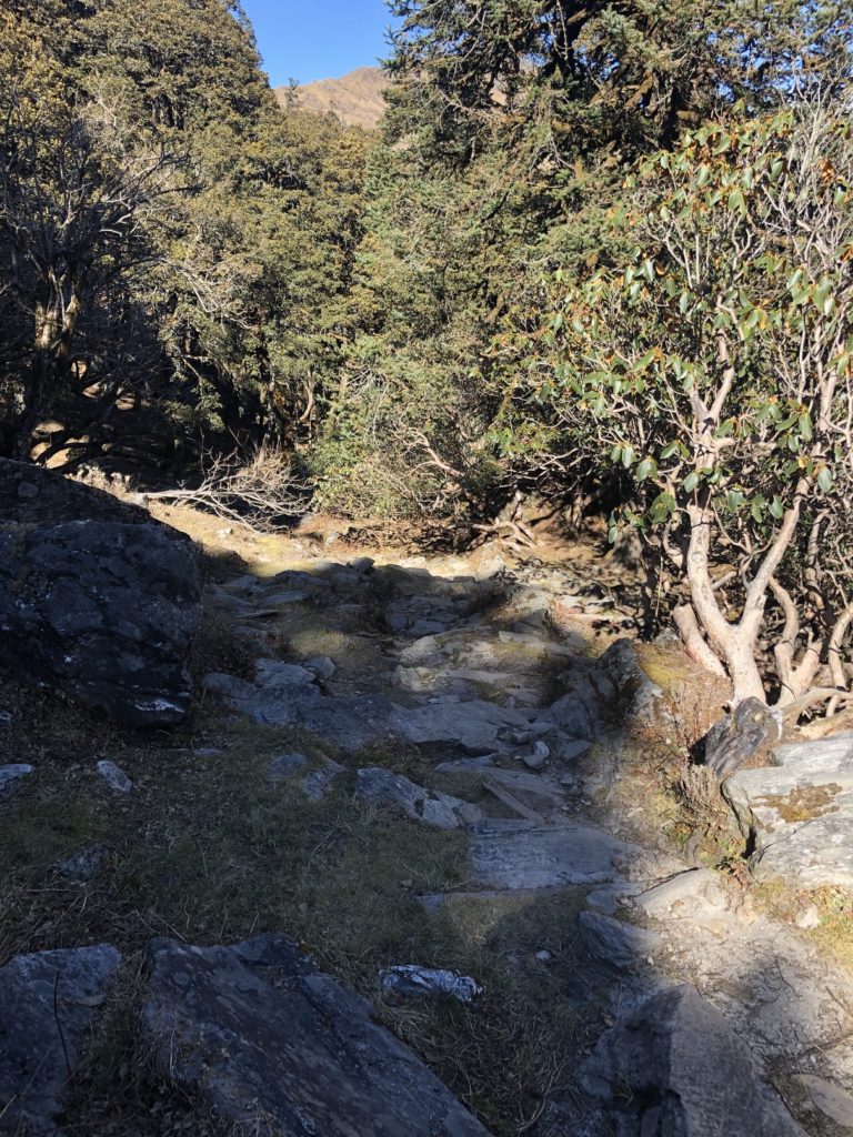
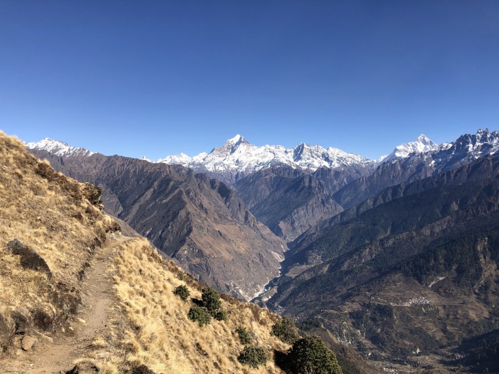
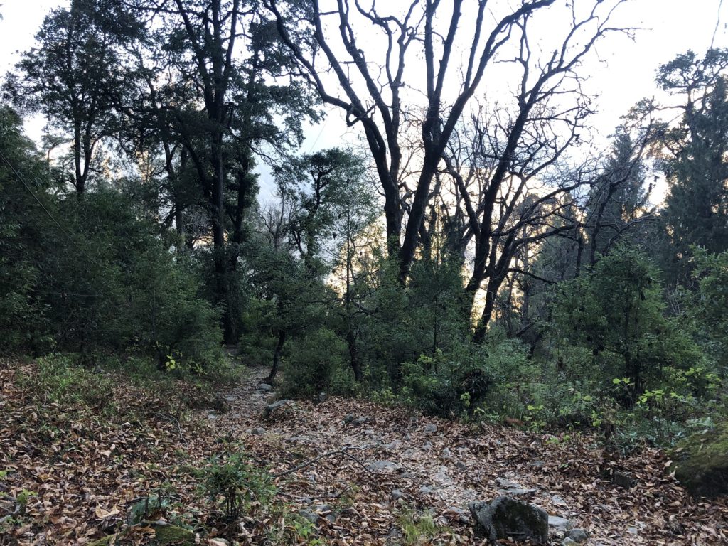
It was a relatively flat hike for the first km, and as it enters the forest, the trail climbs consistently at around 20% grade.
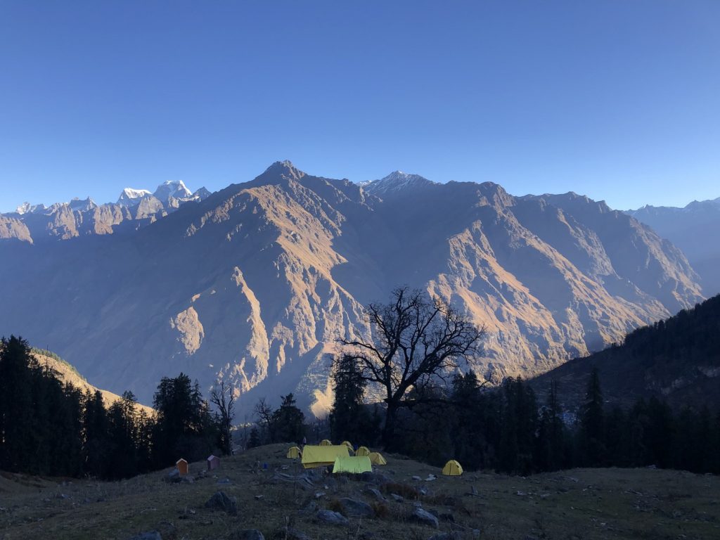
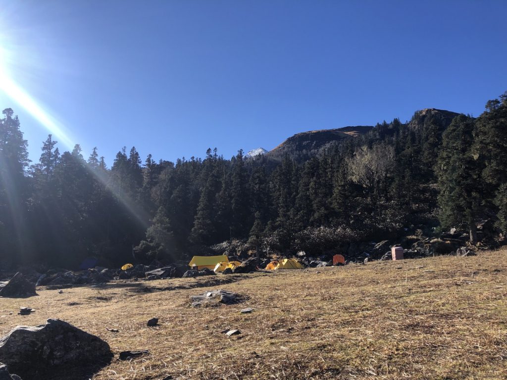
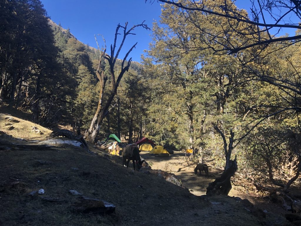
About an hour and thirty minutes into my hike, I reached Akhrotghetta – the first campsite for the India Hikes on the Kuari Pass trek. I briefly chatted with Sucheta, the trek leader for the India Hikes group camped there. She was kind enough to offer me chai and breakfast, but I continued my hike and took a break just higher up on the trail.
Akhrotghetta to Khullara
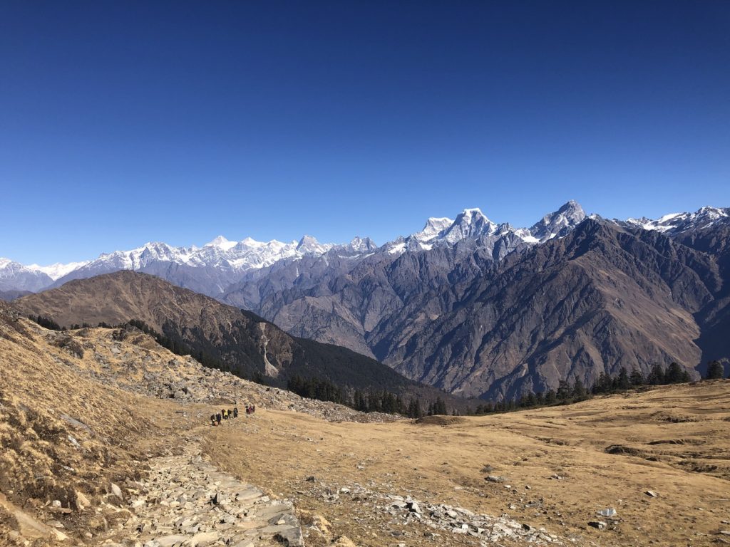
The sun was up over the mountains by now, and it was a beautiful clear day for the hike.
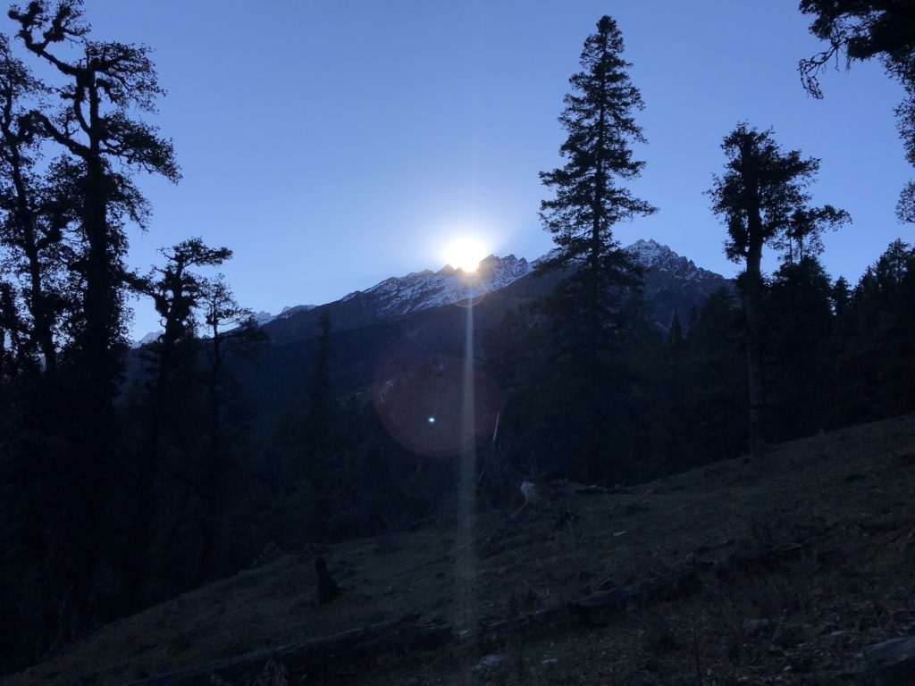
I was very conservative with my pace and monitored my heart rate to ensure it was below my aerobic threshold (155 bpm). The trail was easy to follow, and occasionally, I would look back to enjoy the views.
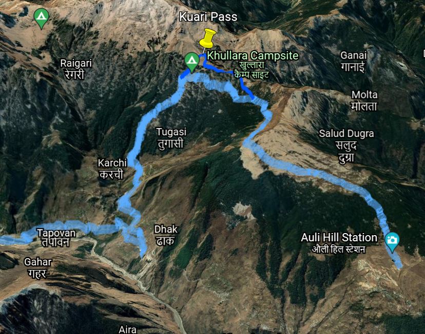
From Akhrotghetta, it took me an hour and fifteen minutes to reach Khullara – the second campsite for the India Hikes team. The group that had camped here had already left for Kuari Pass.
Khullara to Kuari Pass
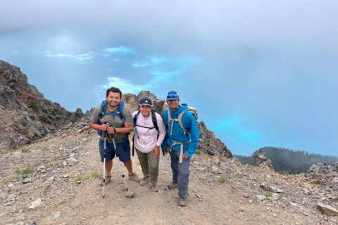
I caught up with the group higher up on the trail an hour later. Manthan was the group leader. Based on my trip plan, I would be heading back to Rishikesh the same day as this group. So I asked Manthan if he could help me coordinate with the transportation team and find a spot for me on the van back to Rishikesh. We exchanged numbers, and I agreed to call him the day after.
Shortly, I was at what seemed like a turnaround point based on the tracks shared by India Hikes. It was just past 10 am and I was not sure if I was already at the Kuari Pass. Maybe this is the turnaround point in winter, not sure.
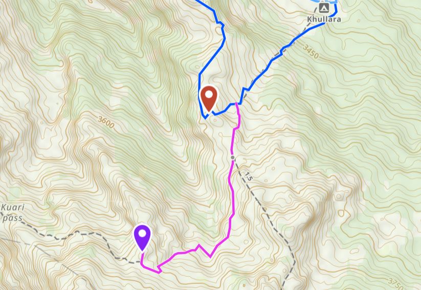
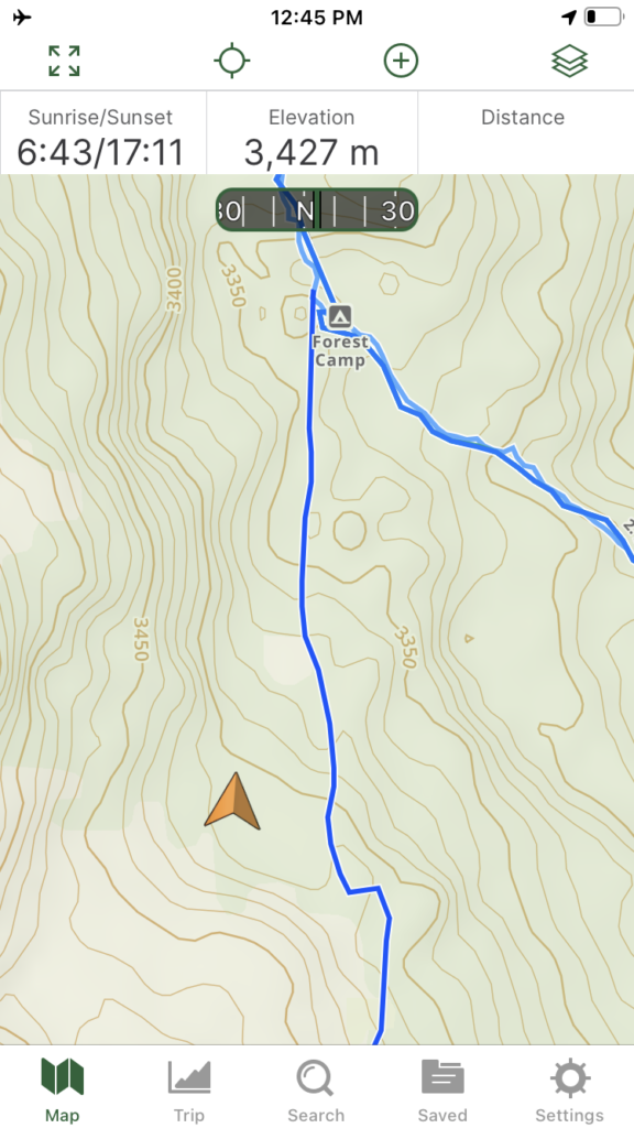
I saw another group ahead, so I decided to follow them. It was Trek the Himalayas group, and their trek leader confirmed that the Kuari Pass high point was further ahead. The actual Kuari Pass is further down the trail, but given the views and higher elevation, everybody turns around from this high point. In the GAIA Map above, the blue trail is from India Hikes and the magenta coloured trail takes you to the high point on Kuari Pass.
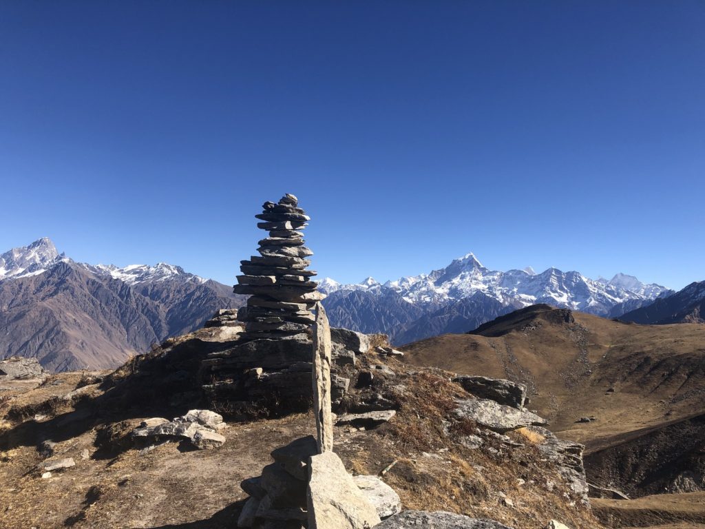
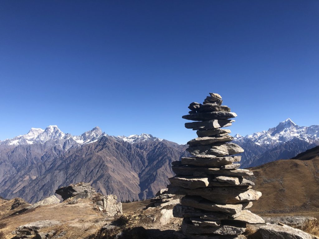
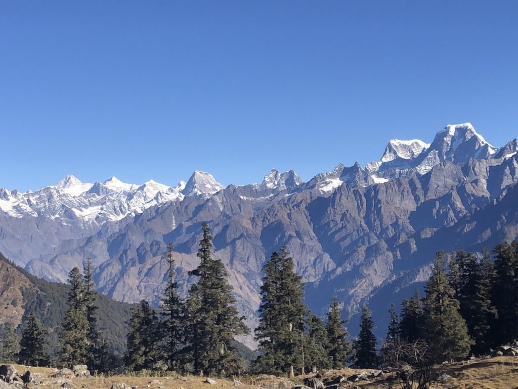
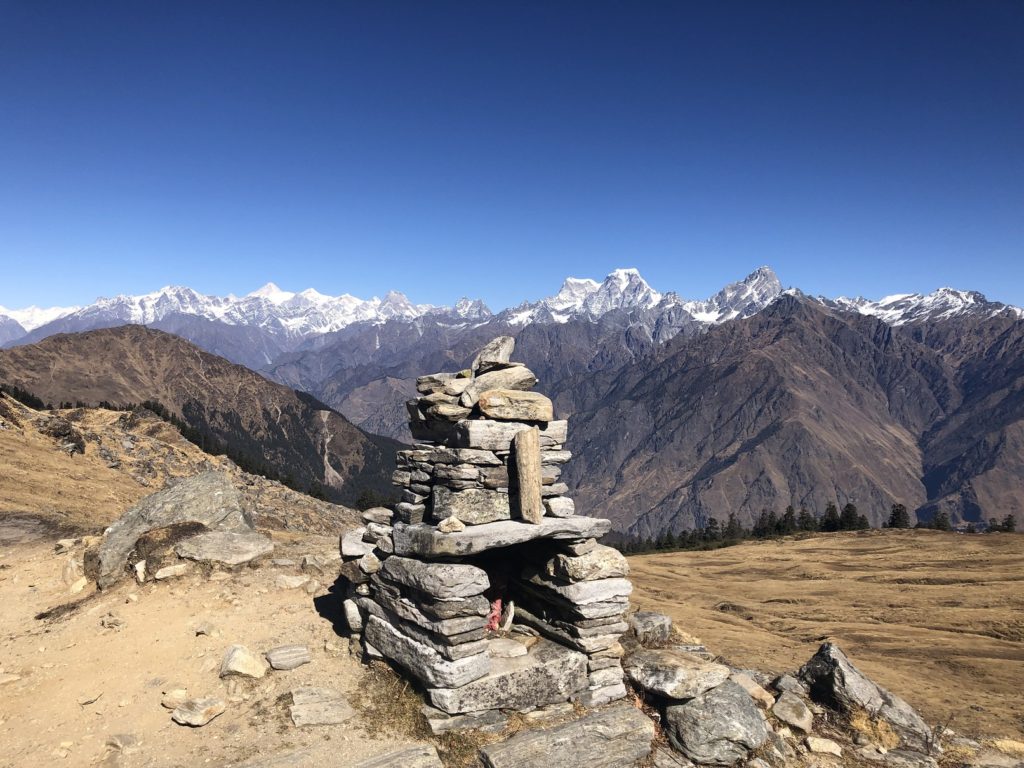
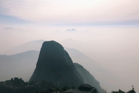
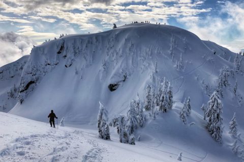
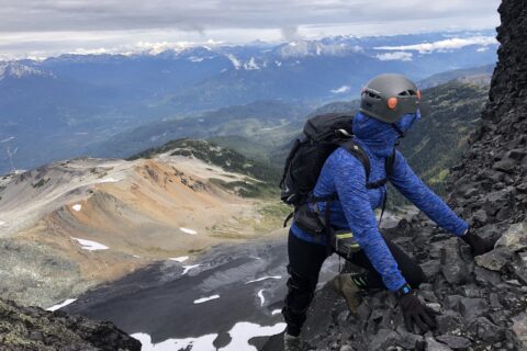
Finally, at 10:45 am, four and half hours since I started the hike from Karchi, I was at the Kuari Pass high point at 3850 m. I got lucky with the weather and got some fantastic views of the prominent peaks like Chaukhamba, Hathi Peak, Gauri, Donagiri, Neelkanth, Kamet, etc. in the Garhwal Himalayas. Check out this post by India Hikes that highlights some of these peaks.
Video from Kuari Pass: Use the options (three dot icon) to change the playback speed.
Kuari Pass to Tali
After a 20 minute break, I retraced my steps to the spot where the trail goes straight on the ridge and on the right, it drops down to Khullara.
I followed the narrow trail along the ridge, and it is in this section I found the tracks from India Hikes quite helpful. GAIA was not perfect, and sometimes it showed me I was off the trail when I was actually on it.
The hike through the forest was enjoyable. It took me just under two hours to arrive at Tali – the third campsite shared by India Hikes and Trek the Himalayas group.
Tali to Auli
After a brief chat with the India Hikes local staff at the Tali campsite, I continued my hike to Auli. I knew it was a long hike (about eight km) to Auli, but what caught me by surprise was the terrain. From Tali, I expected the trail would have a steady elevation drop, but it didn’t.
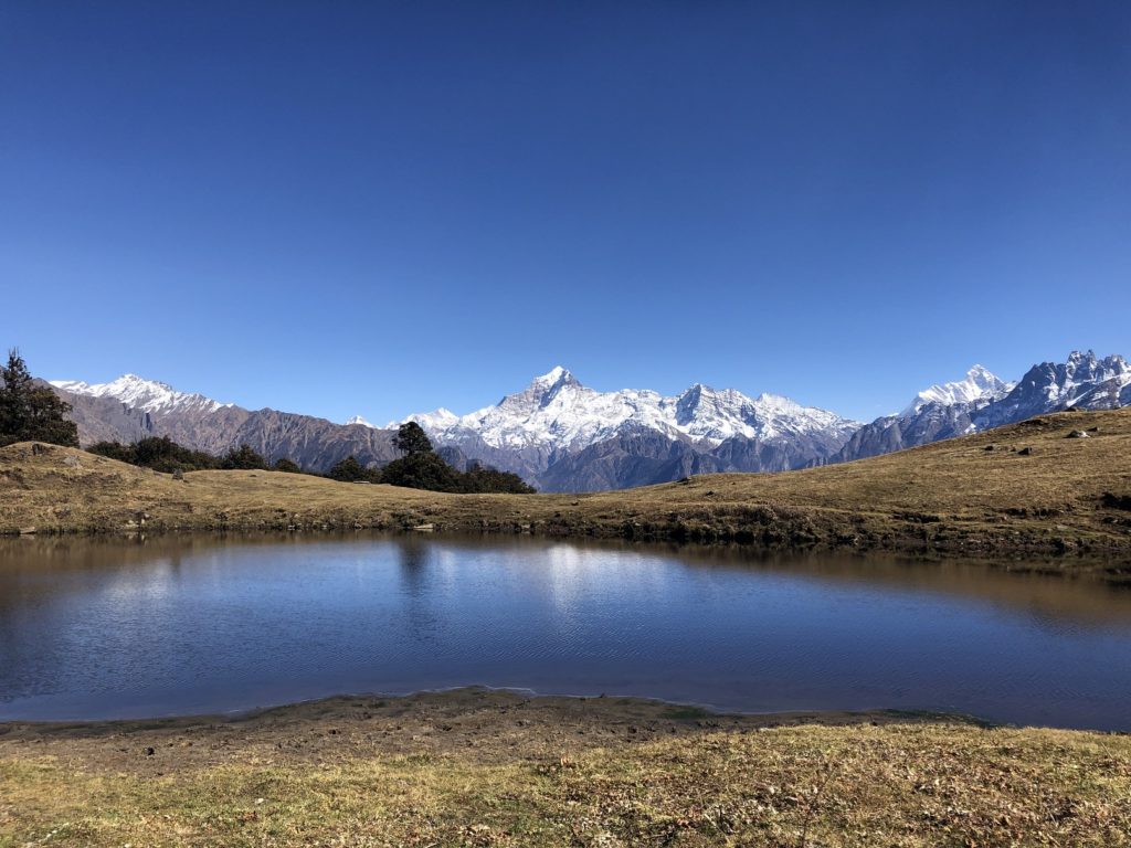
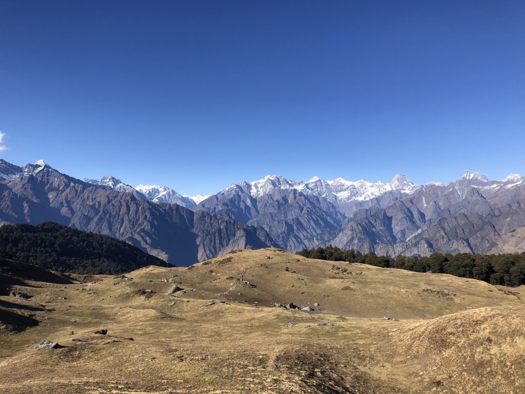
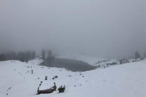
For the next one hour, I hiked through rolling hills and remained at an elevation of about 3500 m. The views opened up further to the east, and now I could see Nanda Devi, the second-highest mountain in India at 7816 m.
Around 3 pm, I reached Gorson Bugyal.
I met Santosh, another solo hiker who had come up from Auli to explore Gorson Bugyal and the surrounding area. From here, it was a short hike down to the forest.
Soon we could see the ski lift and other structures of the Auli Resort.
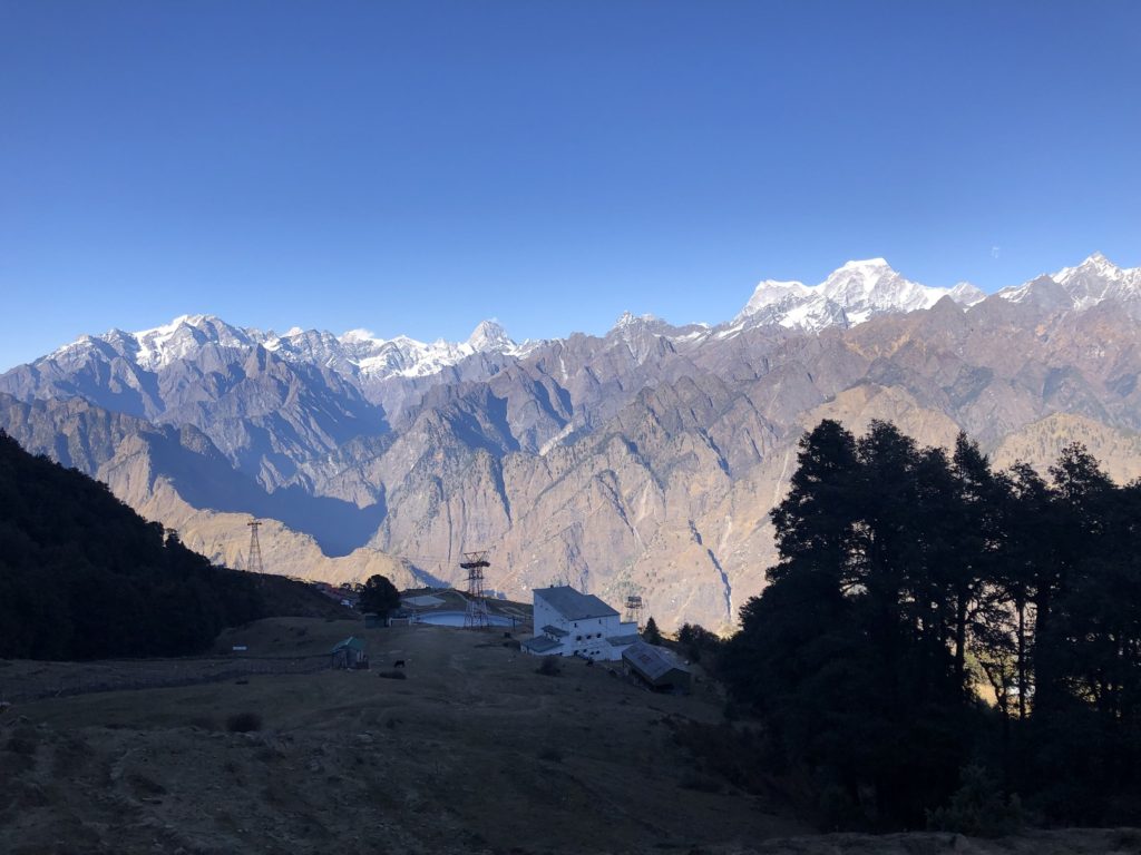
By 4 pm, I was at the Auli Resort gate connected by Auli road coming up from Joshimath. Technically the Kuari Pass trek ends here. I could have called a cab to pick me up, but I decided to hike down to my hotel in Joshimath since I had another hour of daylight.
It is about 10 km by road from the resort to my hotel. But hiking down the trail that cut through the switchbacks was only four km and took me another hour to get to my hotel.
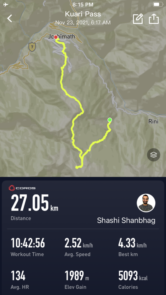
In total, it was around 27 km, with about 1989 m elevation gain (2278 m elevation drop as Auli is at a lower elevation than Karchi) in just under 11 hours. I was quite happy with the effort and felt good about my first solo day trek in the Himalayas.
Resources:
India Hikes: Kuari Pass Trek | Peaks seen from Kuari Pass
GAIA Maps: GPX
Waymarked Trails: Kuari Pass Area
Weather: Yr.No | India Meteorological Department
Training and Other Resources: Uphill Athlete
Disclosure: The links I have shared in the post and under the Resources section are not Affiliate Links.
Did you enjoy reading this post? Please subscribe to get weekly updates. Please share your feedback in the comments section below. Thank you!
Wow, that is one helluva day hike, considering the elevation above sea level! You seemed to have picked the perfect day weather wise. I remember hiking up to Auli from Joshimath during a trip in 2001 to the Bagini Glacier – https://accidentaltrekker.blogspot.com/2014/04/bagini-bouquet.html
Thank you Aloke. It was one of my best days in the Himalayas. Thank you for sharing your trip post from 2001. It’s always interesting to read about your experiences.
Dude awesome job and thanks for the detailed descriptions, hope to do it someday in the future
Thanks, Bala. Hopefully, we can do some climbs in this region.
Clearly laid out from start to finish. Gr8 post Shashi.
Thanks, Gopal. I am glad you enjoyed it.
Wow
Amazing it is really ispirational as solo hike and that’s in Himalaya
Lovely views and amazing narration.
Thanks
Varsha – Thank you for reading the post and for your feedback. I got lucky with the weather and had beautiful views of the Garhwal Himalayas.
Wow
Amazing it is really ispirational as solo hike and that’s in Himalaya
Lovely views and amazing narration.
When I start to read feels that I am also enjoying this treck.
India having very beautiful peaks.
We also had 1night and 1 day treck at Harish chandra fort with 13km trip
Thanks
Superb. The way you have detailed it out is just amazing. You are gifted as far as words and writing goes. To sum up….while reading I felt just like being there.
Makarand,
Thank you for reading the post and for your kind feedback.
great blog youve laid out the details perfectly i plan to go kuari trek
can you plese give me any assistance or help regarding any equipment like tent ill have to carry (going in late june ).
Devanshu – thank you for your note. Sorry I can’t help with any gear or have any suggestions as I did not carry one. My recommendation would be to find a local guiding agency or someone like India Hikes that can help you rent the equipment.
Really enjoyed reading this! Doing Kuari Pass as a solo day trek is seriously impressive – respect! 😄 Loved how you planned everything so neatly, from using GAIA GPS to getting permits in Joshimath and managing logistics with shared cabs and locals. That part about the trail vanishing under the snow made me anxious just reading it! Also, the views you described of Chaukhamba, Hathi Peak, Dronagiri, and Nanda Devi absolute magic. Doing the full climb from Karchi to Kuari and back in one day with limited sunlight That takes some real grit. This post is super helpful for anyone thinking of doing it solo. Definitely bookmarking this for my own trip! 🏔️🗺️🔥
Thank you Bhuvi for your comment.
Excellent writeup!
Is there any way to bypass the checkpost? I don’t want to bother with the BS permits. Officially there is no law against solo hiking – it’s basically a corruption ring by the forest clerks so only certain tour companies get access to the area.
Ruchir – thank you for your note. The check post used to be right on the trail coming down to Auli. Although, there might be ways to bypass it, I won’t recommend it. I heard now there is an online process to get the permit for Nanda Devi Biosphere. Check this page here – https://himalayandreamtreks.in/blog/how-to-get-mana-pass-permit
https://informatics.nic.in/news/1542