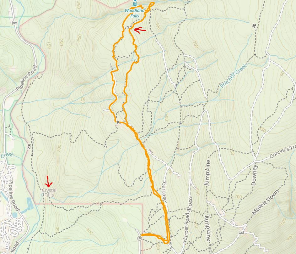
Kasturi was browsing the hiking guide on the Outdoor Vancouver website when she came across the Sawblade Falls hike in Pinecone Burke Provincial Park in Coquitlam. At 9 km and under 300 m elevation gain, it is an easy hike. We were looking for a short hike for Saturday afternoon, and the Sawblade Falls hike was perfect.
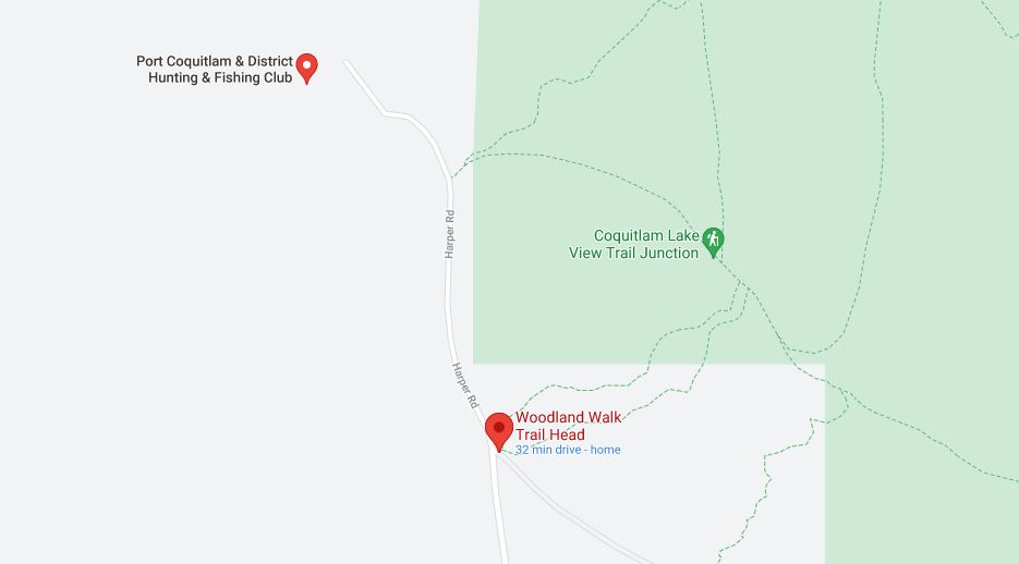
As expected, it was a busy afternoon, and we had to park south of the trailhead on Harper Road. There is a hunting and fishing club close by, so we could hear the shots for a while.
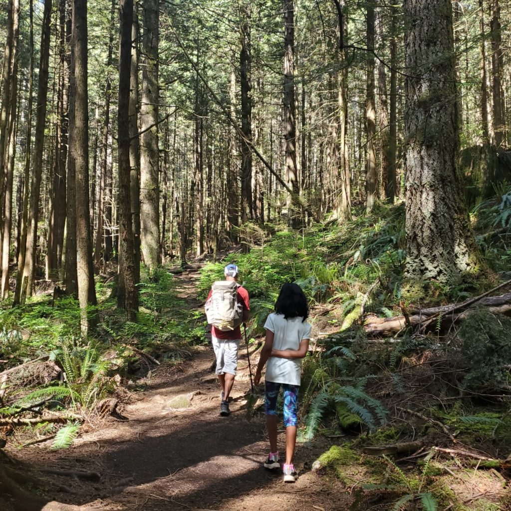
Woodland Walk
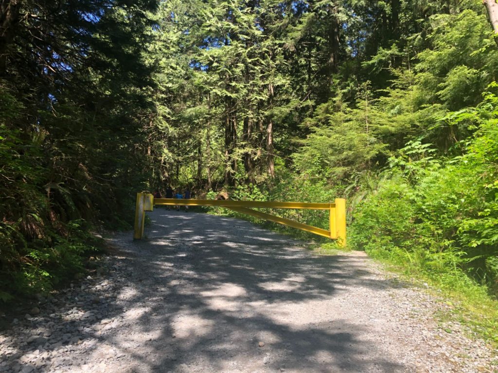
Past the yellow gate, we continued on the gravel road and soon arrived at a junction. Straight ahead, it was Harper Road access, and to the left, we had another gate and Woodland Walk trail. We turned left.
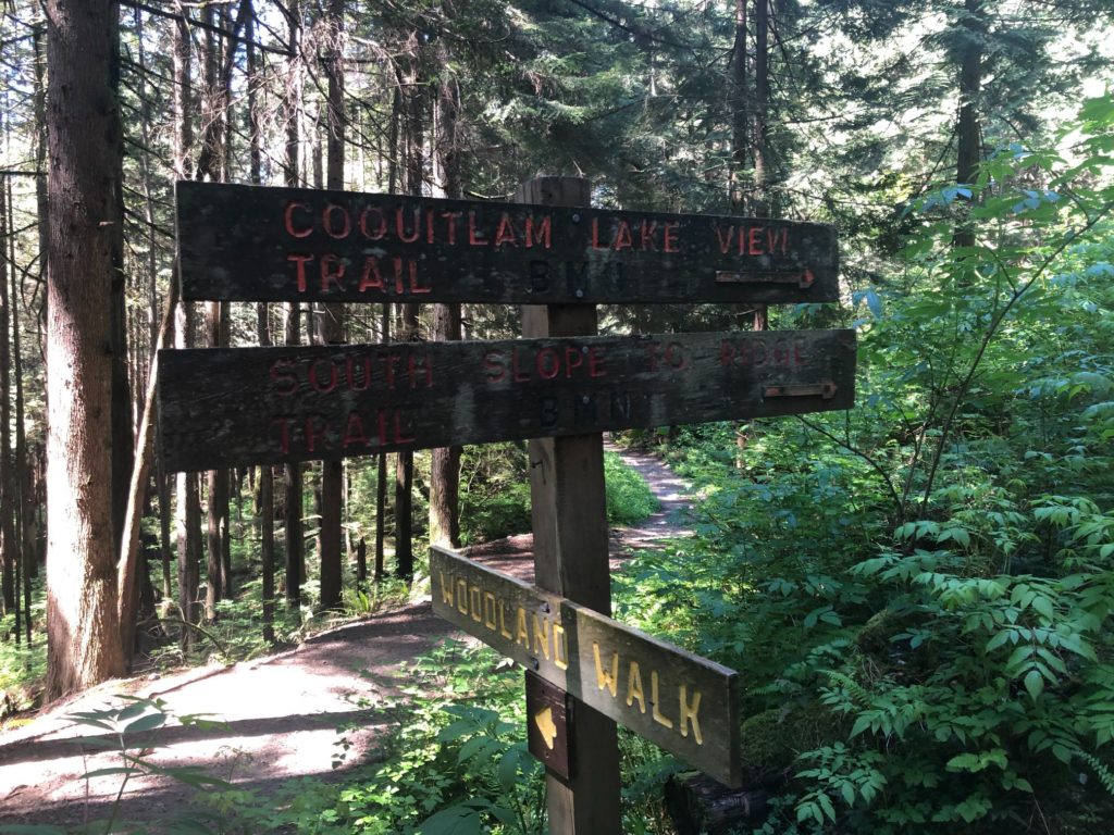
Within five minutes, we were at a fork. We took the lower trail marked as Woodland Walk. The upper path (gravel road) connects to Coquitlam Lake View Trail further ahead. I had downloaded the GPX tracks from Outdoor Vancouver and had imported the file into the GAIA GPS app. That was the extent of my pre-trip planning for this hike, but it helped us stay on track.
For the next km, the hike was on a flat trail and in the shade. Later it opened and connected with the gravel road. Now the hike was in the open on a wide road, and it was not so pleasant. A few minutes after we crossed the bridge, we were at the Upper and Lower Loop trail junction.
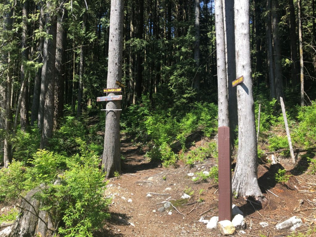
We took the Upper Loop trail. We would come down via the Lower Loop.
Lost Hikers on Upper Loop Trail
The hike from this junction to Sawblade Falls was my favourite section of the trail. It is a 2 km hike from here to Sawblade Falls with about 200 m elevation gain. The trail is marked well with signs at regular intervals.
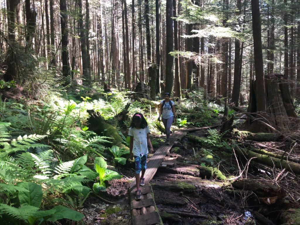
Around 4 pm, we came across two hikers who seemed lost. I had a quick chat to understand what is going on. They were trying to get to Crystal Falls and were navigating using Google Maps. I checked Crystal Falls on the GAIA GPS app. They would have to take the Upper Loop trail down, continue on Woodland Lake, and take another trail west to Crystal Falls.
The hikers considered their options and decided to go back up and hike down the Lower Loop trail. I didn’t understand, but probably they were more comfortable going down the same way as they had come up. I just hoped they would drop the idea of going to Crystal Falls as they wouldn’t have made it back to the car before sunset.
It is a maze of trails on Pinecone Burke Provincial Park. If you are not familiar with the area, I would highly recommend downloading an app like GAIA GPS, All Trails, etc., that you can use without a cellular network. Here is what Coquitlam Search and Rescue had to say when they rescued three hikers on this trail –
“We’d like to stress that hiking on Burke Mountain is a wilderness experience and requires more preparation than just a few searches on the internet. The trails on Burke are made up of old logging roads, mountain bike trails and hiking trails and can be difficult to follow without a map.”
– Coquitlam SAR
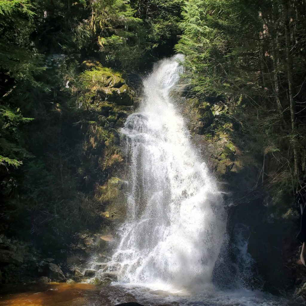
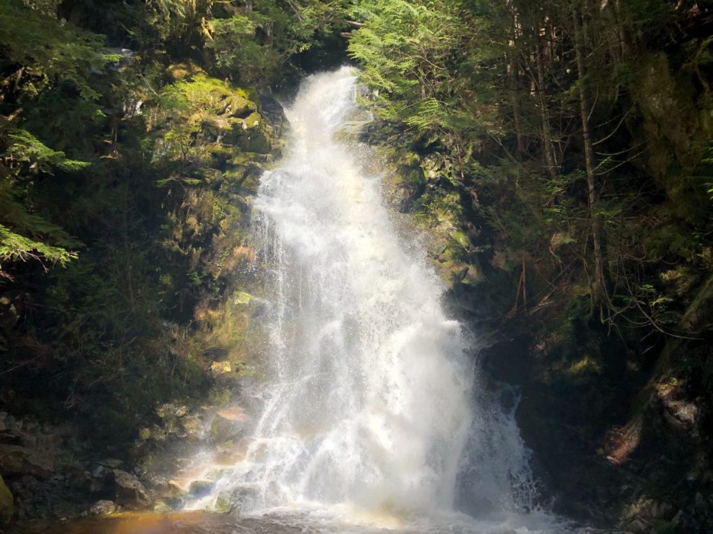
Sawblade Falls
We continued our hike on the Upper Loop trail and soon arrived at a junction. We took a right for Sawblade Falls. From here, it was a short hike to the falls.
We should have taken a snack break earlier, but it was too late when I realized it. Kavya, by now, was grumpy, just like the characters in the snickers ad. “You are not you when you are hungry.”
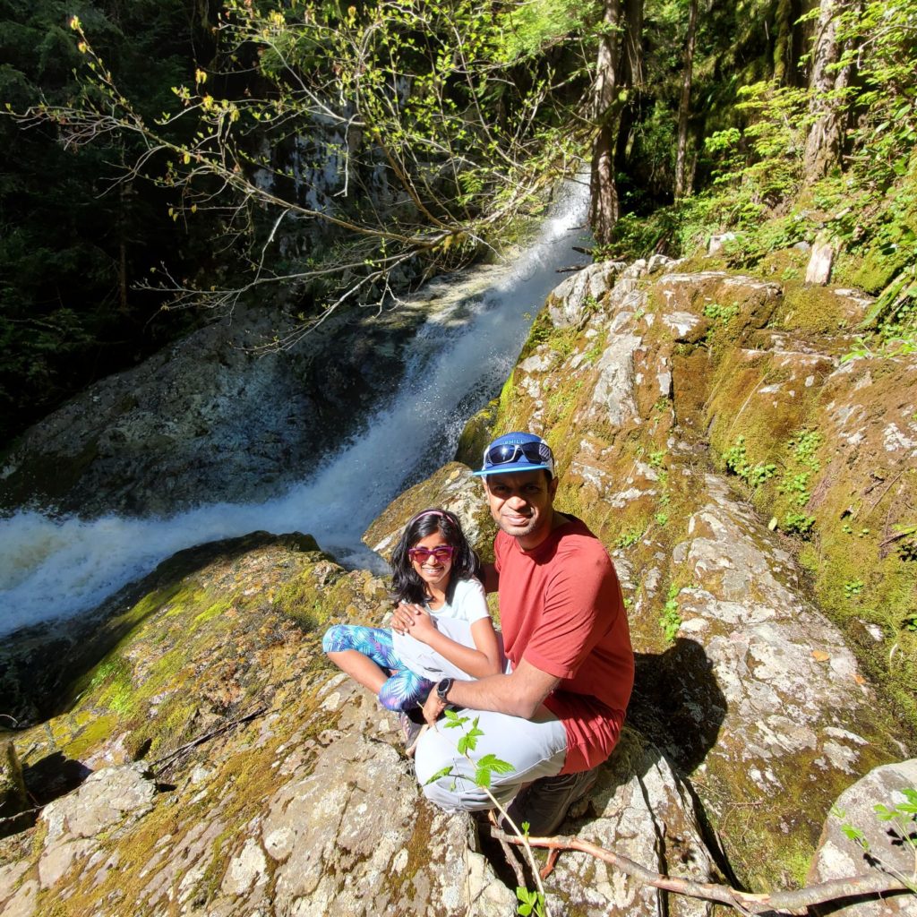
When we got to the bottom of the falls, she just sat by the side of the trail while Kasturi and I took some pictures. Sawblade Falls is a beautiful fall, and spring is a good time to be here.
A snack of oranges and water did the trick, and Kavya was back to her usual self. We hiked back on the trail to the Upper-Lower Loop junction and took a right for the Lower Loop.
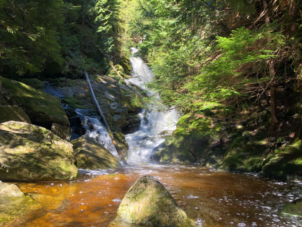
Woodland Falls
The trail descends steeply for the next half km. As we got closer to Woodland Falls, a small path went right, leading to the upper section of the falls. The rocks were slippery, so we didn’t venture further up.
After a short break, we were back on the trail heading down when we saw other hikers at the actual Woodland Falls viewpoint. It is an easy scramble down to the falls.
The hike back down was easy as we were on relatively flat terrain. It took us just about an hour from Woodland Falls to hike back to the parking lot. In total, it took us just under three and half hours to hike 9 km with about 400 m elevation gain/loss.
Pinecone Burke Provincial Park is such a huge park and relatively close to us. I hope to come back and explore some more trails in this area. And yes, the lost hikers we met earlier in the day, we saw them heading down the trail close to the parking lot.
Resources:
Pinecone Burke Provincial Park: BC Parks Website
Trail Guide: Outdoor Vancouver
Adventure Smart: Trip Planning
Disclosure: I am not affiliated with any of the above individuals or organizations.
Did you enjoy reading this post? Please subscribe to get weekly updates. Thank you!
We did this hike on Sunday 12th Feb with my 7 yr old son. Your article helped with what to expect in terms of the trails we should stick to and what to lookout for. Yes, it was a cold, rainy day but we enjoyed the hike and were glad to be able to cover both the falls! I was also surprised to see the kiddo enjoy this hike despite the weather. I think the last couple of years we have accepted the beauty of PNW climate and learnt to enjoy it in all its forms.
Thank you for taking the time to post this comment and share your feedback. I am glad you found the post helpful. Not an easy hike for a 7-year-old, so kudos to your son for completing it on a cold and rainy day.
“I think the last couple of years we have accepted the beauty of PNW climate and learnt to enjoy it in all its forms.” – So true!