In my last post, I shared how we planned and trained for Gidara Bugyal Trek in Uttarakhand. We arrived in India on October 23 and celebrated Diwali with family in Ahmednagar, Maharashtra. On October 29, we arrived in Dehradun and then took a cab to Mussoorie.
It was a busy weekend in Mussoorie, and it took us about 45 minutes to cover the last 3 km. Our cab dropped us off at the Library Chowk, and then we walked to our homestay.
Day 1 – Dehradun to Bhangeli
The next day, we got up early as the India Hikes tempo traveller was going to pick us up from Library Chowk at 7:30 am. In total, we had 21 people in our group, and nine of us were going to join from Mussoorie. Unfortunately, one of the two tempo travellers had an accident, and the rest of the group didn’t leave Dehradun till 8 am.
Around 9:15 am, we boarded the tempo traveller at Library Chowk and headed towards Bhangeli. Mussoorie to Bhangeli is about 160 km, but including a couple of breaks, it took us almost seven hours to cover this distance.
For the most part, the road through the hills was single-lane, with a steep drop on one side and the mountain on the other. Driving here is not for the faint-hearted, and I was glad not to be behind the wheel.
Bhangeli
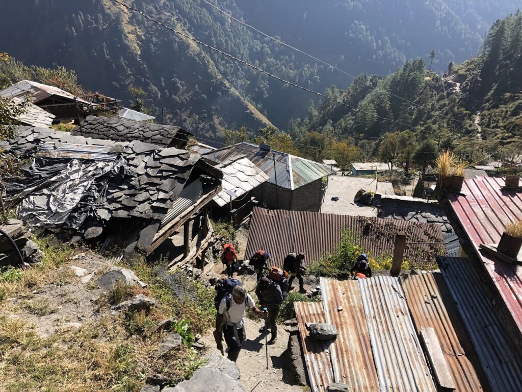
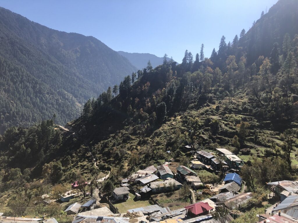
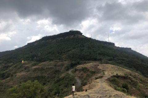
Around 4:30 pm, we were at the drop-off point for Bhangeli. From here, it was a 1.5 km hike to the village. It took us about 30 minutes to get to the village, and the short hike was a good teaser for the coming days.
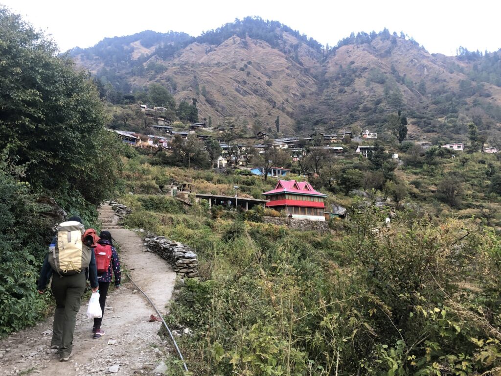
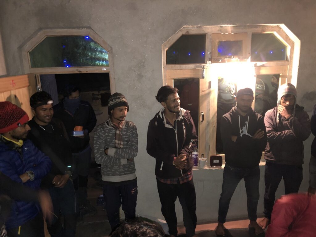
At Bhangeli, Pramath, our trek leader, welcomed us and then directed us to our rooms. Later in the evening, we got together and did the introductions.
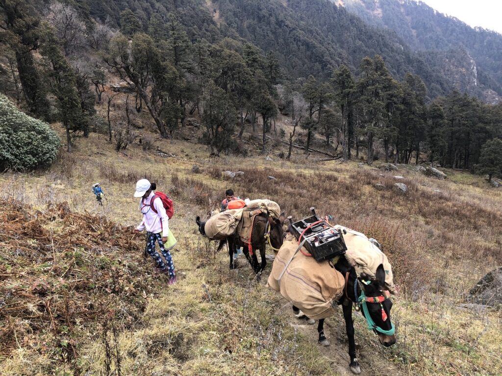
Pramath shared the high-level plan for our trek and answered questions. In addition to Pramath, we would have two local guides, KP and Kuldeep. We would also have a support/cook staff of around six people and six mules.
The mules would carry our tents, sleeping bags and all other support equipment. We would take our packs with jackets, water, food (snacks and packed lunch from India Hikes) and a liner bag that we all got from India Hikes. We also got an eco bag that we would use to collect trash on the hike.
Around dinner, we all got our BP, O2, and Pulse checked. I will share my O2/Pulse readings throughout the trek and the site altitude.
Bhangeli Altitude: 2328 m (7638 ft)
BP: 148/90 | O2: 98 | Pulse: 68
Day 2 – Bhangeli to Rikoda
Distance: 5.9 km
Cumulative Elevation Gain: 1046 m (3432 ft) of cumulative elevation gain and not just absolute difference in altitude between two sites. All distances and vertical metrics are approximate.
Starting Day 2, 7-8-9, was roughly our routine for the rest of the trek.
7 am – Black Tea (Ginger-Honey-Lemon)
8 am – Chai, Breakfast
9 am – Start Hiking
One trekker was not doing well and returned to Dehradun. The rest of us got together for a warm-up around 9:30 am and started our hike shortly after. We walked through the village for the first 10 minutes and went up to the trailhead.
Kuldeep was at the front, and KP stayed at the back. Pramath would move around to check on all the trekkers and ensure everyone was doing okay.
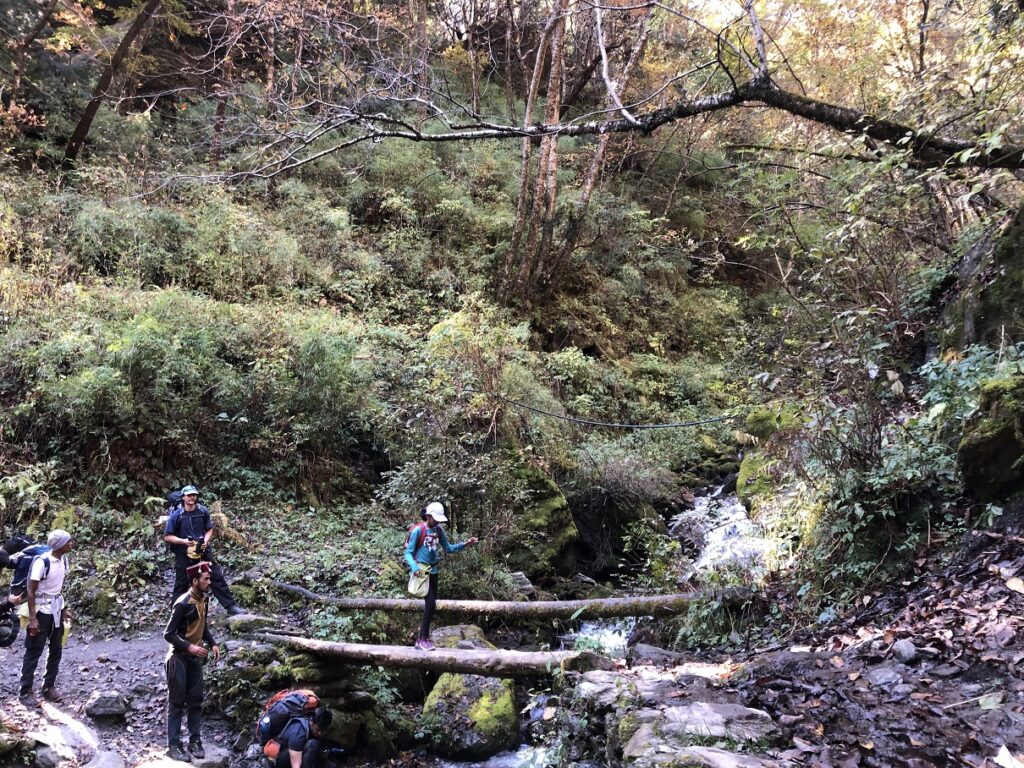
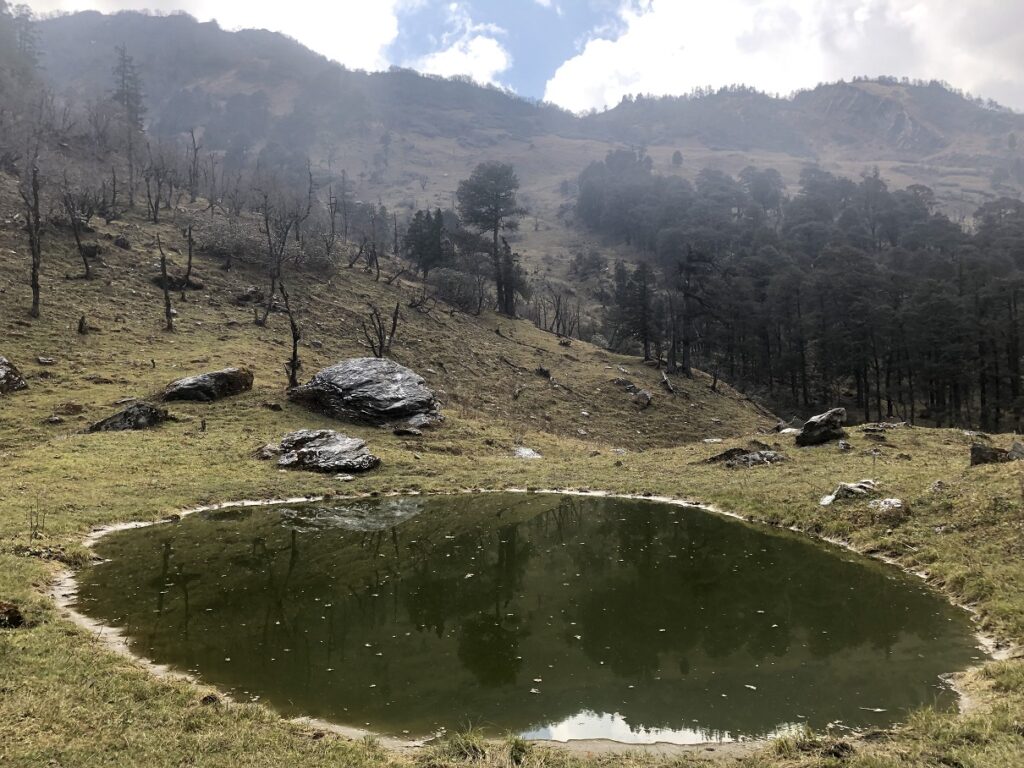
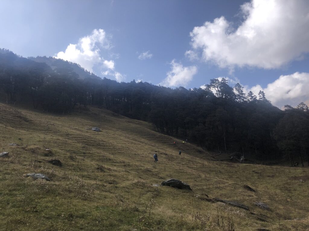
It was about noon when we reached our lunch spot. After a long break, we continued our hike on the steep trail to a pond near Munda Ka Thatthar. From here, it was relatively easy terrain, but we got some showers. Thankfully, it cleared up soon.
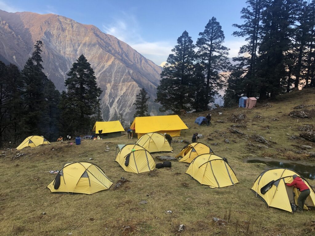
Rikoda
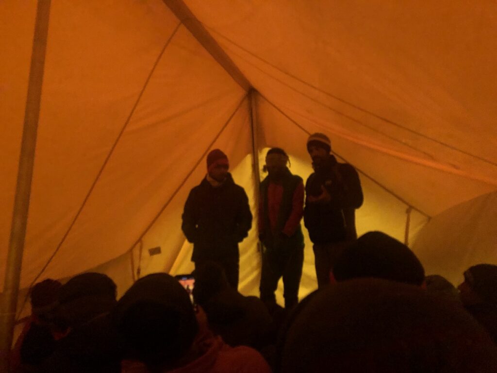
Around 4 pm, we reached Rikoda. The India Hikes staff had already set up the dining tent, and we all gathered inside it. We got a welcome drink and some snacks.
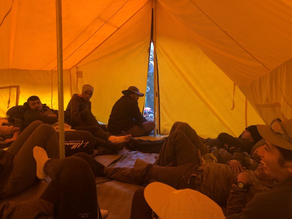
Later, Pramath gave us a quick overview of the tents, pit toilets with sawdust and some dos/don’ts around the campsite. At dinner, we again checked our O2/Pulse.
Rikoda Altitude: 3310 m (10860 ft)
O2: 94 | Pulse: 100
A few trekkers had a headache and started taking Diamox. Another trekker injured his ankle on the hike up and would hike down the next day with one of the guides.
Day 3 – Rikoda to Dhokrani
Distance: 3.2 km
Cumulative Elevation Gain: 590 m (1936 ft)
As we gathered for breakfast, Pramath took another O2/Pulse reading.
Rikoda Altitude: 3310 m (10,860 ft)
O2: 99 | Pulse: 68
I was surprised to hear that Jayanti sir, 63, was also planning to go down. He was one of the fittest in our group – a farmer from Gujarat who runs 10 km daily. He had come to the trek with his son and three nephews. Although he seemed okay at Rikoda, his BP was very high and as a precaution decided to head down.
We had to delay our start as the mules revolted and took off. No mules, no trek. Eventually, the staff managed to get all the mules back to the campsite, and we started hiking around 10:30 am.
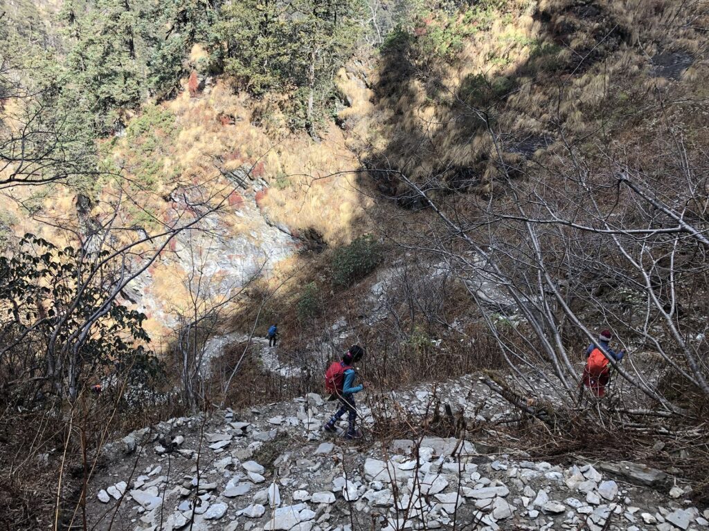
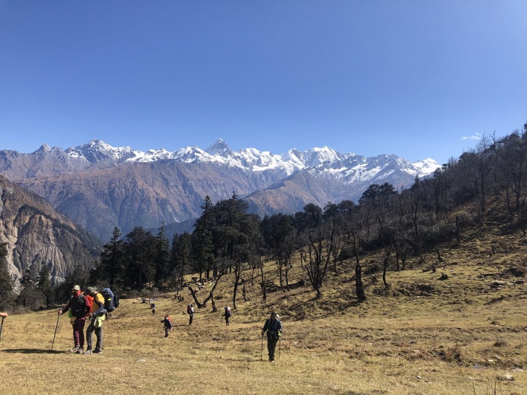
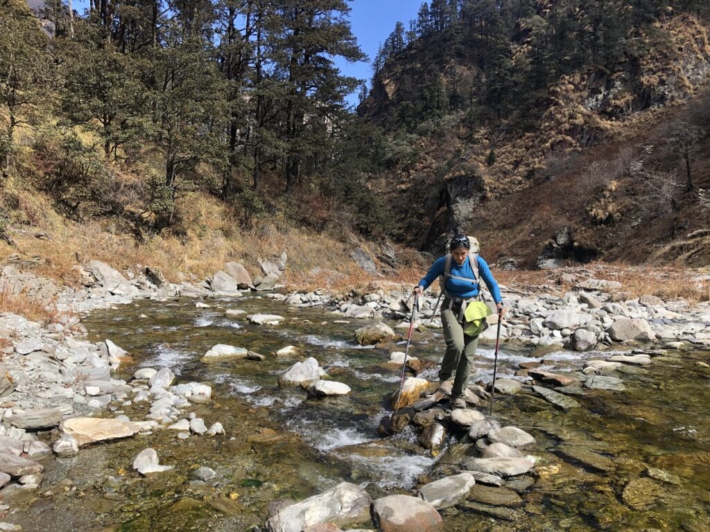
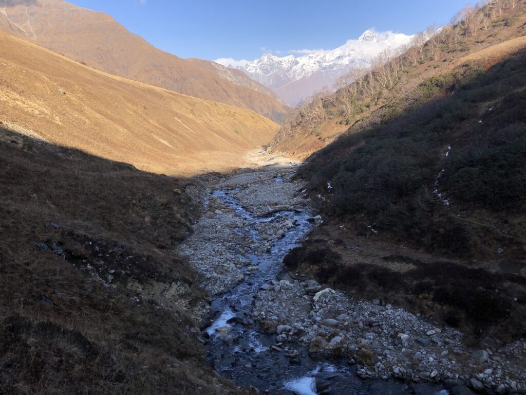
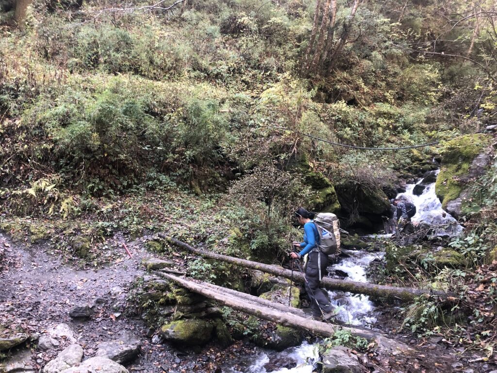
It was rolling hills initially, and then we dropped down to a river. Luckily, the water level was not too high, and we didn’t have to take off our shoes like the previous India Hikes group that crossed it two weeks back.
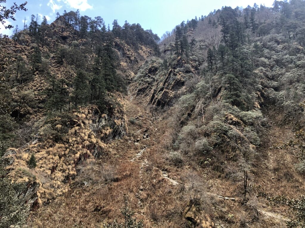
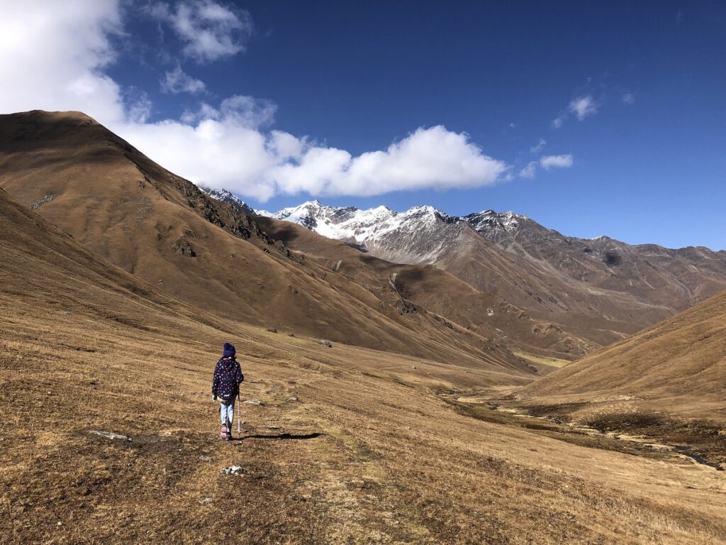
Past the river, the trail continues to an opening (Thiriya – some groups camp here) from where you see the steep climb ahead. Kavya was tired of this section, and we started counting steps to get her mind off the effort.
First, we would count to 50 and then check the heart rate on my watch. Then, we would take a breather till my heart rate dropped below 100 and start again.

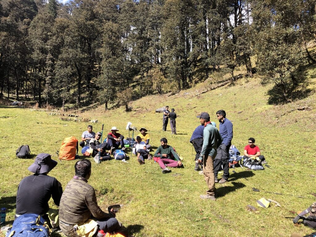
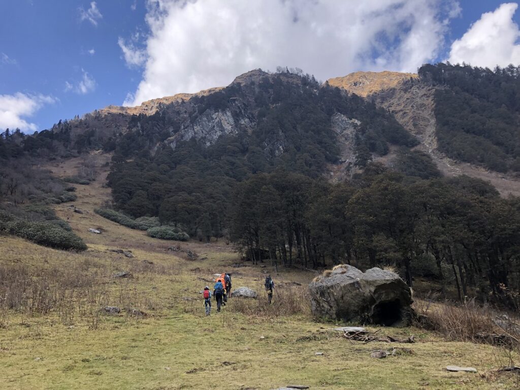
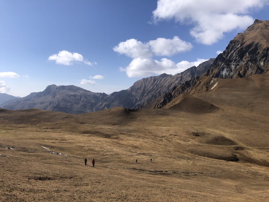
Around 1 pm, we arrived at a high point and took a break for lunch. From here, it was a relatively flat hike to Dhokrani. Kavya was super excited to see the campsite in the distance.
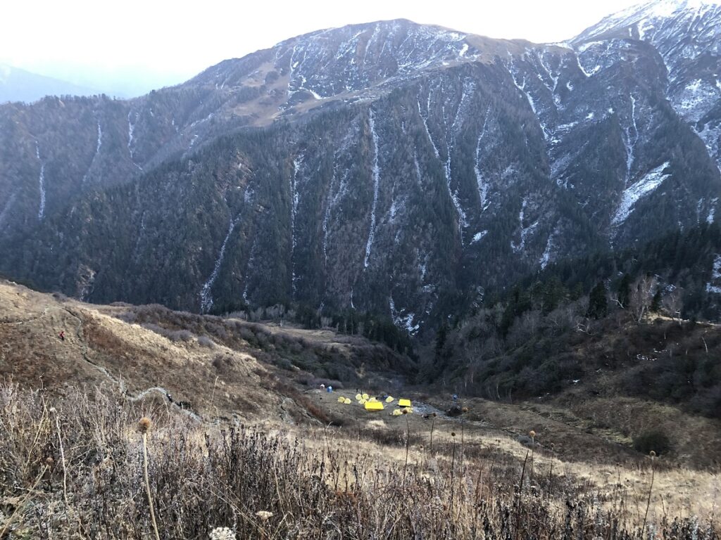
Dhokrani
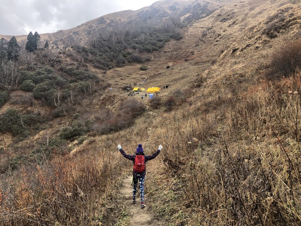
Just as we got into the dining tent, a hailstorm welcomed us. Later, Pramath came inside the dining tent and shared an update. Unfortunately, given the change in weather, we won’t be able to go to Thalotya, our next campsite, as the mules can’t go on icy trails. Instead, we would go to Gidara Bugyal top directly from Dhokrani and return via Thalotya campsite.
So, the next day, which was supposed to be an acclimatization day with a 2-3 km hike, turned into a 10-12 km summit day. Kavya was not happy. She was mentally not ready for this.
Pramath checked O2/Pulse for the group once we arrived and later at 9 pm.
Dhokrani Altitude: 3760 m (12,336 ft)
O2: 90 | Pulse: 68
For Kasturi, O2 was around 86. We had not been checking Kavya’s O2/Pulse as it was difficult to get a reading on her fingers. But at Dhokrani, we made an effort and finally got her reading. Kavya’s O2 was around the mid-80s.
Pramath recommended that everyone start a course of Diamox, at least half a Diamox. Kasturi and I had never taken Diamox before, had no headaches and wanted to see how we do without Diamox. Kavya had a slight headache and chest pain on the hike but felt better at the campsite.
I talked to Pramath and shared my thoughts on continuing without Diamox. We would hydrate well and take it easy on the next day’s hike. We would head down if we were hit with altitude sickness and couldn’t continue.
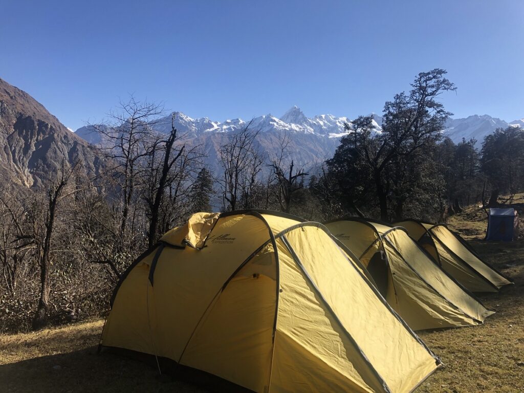
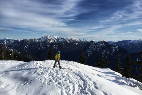
It was a cold night, and the temperature dropped to -11C. Although we hike, ski and are outdoors at these temperatures in Canada, it was our first time camping at this temperature. Thanks to India Hikes for providing the right gear (tents, sleeping bags, pads and liners) that made the night bearable.
Day 4 – Dhokrani – Gidara Bugyal Top – Thalotya – Dhokrani
Distance: 8.7 km
Cumulative Elevation Gain: 798 m (2618 ft)

We had a relatively early start and started the hike around 7:30 am. Kavya was slow and complained of chest pain and headache. An hour into the hike, she didn’t feel any better. So we took a break, and I talked to Pramath. We gave her half a tablet of Diamox and told her we would decide to continue or return to the campsite at Dhokrani top.
Kasturi and I had both made up our minds to head down. But surprisingly, after a 20-minute break, Kavya felt better and decided to continue. I don’t know what worked – whether it was the Diamox or if it was just the placebo effect combined with the rest. In any case, we were back on the trail.
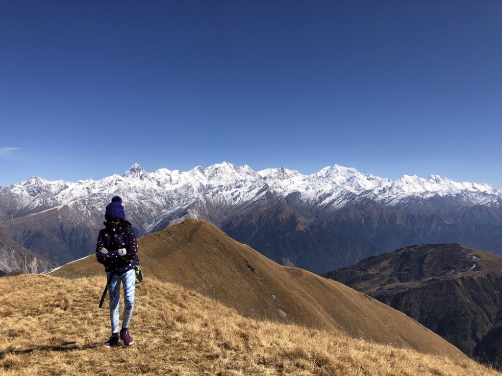
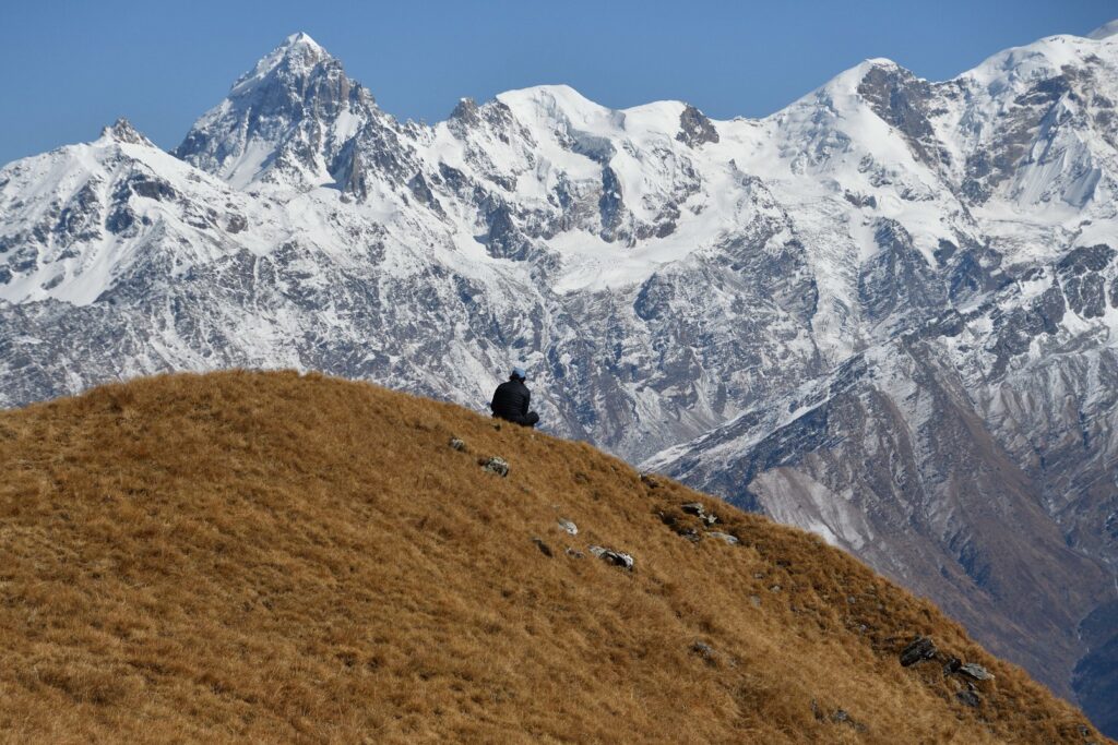
As we made our way up from Dhokrani Top, a ridge led to what appeared to be Gidara Bugyal’s highest point. It seemed straightforward, but at one section, we got off the trail and scrambled on the slope to get to the ridge.
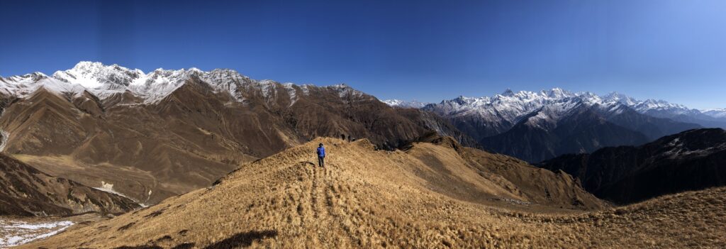
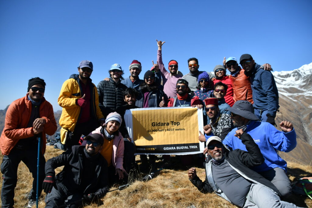
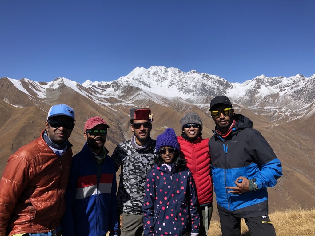
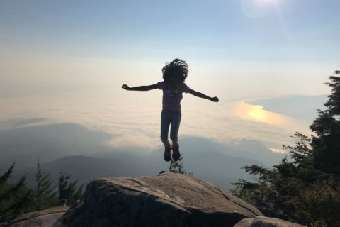
When we reached what seemed to be the high point, we realized that Gidara Bugyal Top was further ahead – probably another 30 minutes. It was a proud moment for Kasturi and me to see Kavya make it to the summit. It was her first trek at this altitude (4266 m, 14000 ft), and she reached the summit despite all the challenges.
A few years back, Kasturi had a skiing accident resulting in high grade ACL and MCL tear on her left knee. It took more than a year of physiotherapy for her to get back to a state where she could trust her knee. Since then she has been very cautious but has been hiking regularly. She didn’t get in as much training as she wanted, so was a bit skeptical at times. So, it was good to see her push through and reach the top on this moderately difficult trek.
Gidara Bugyal Trek – India Hikes Group Oct 30-Nov 5, 2022.
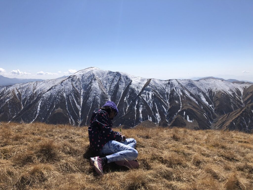
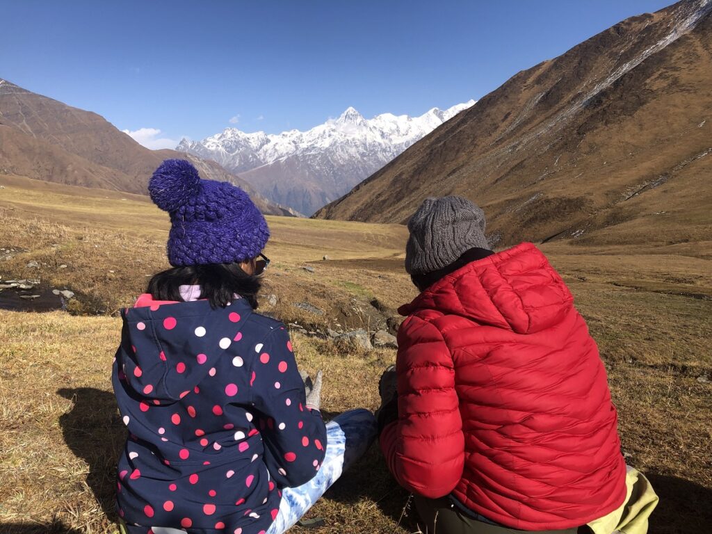
Pramath had a couple of surprises for us. First, we made tomato soup, which became Kavya’s favourite food memory from the trip. Then, he pulled out postcards and pens for all of us to capture our thoughts. Someone from our group called it an expensive and exhaustive way to get therapy. Everyone loved the idea. Che and I had similar ideas, and we tried to sketch the Yamunotri and Gangotri range on the postcard.
Just for fun, we checked our O2/Pulse.
Gidara Bugyal Top Altitude: 4266 m (14,000 ft)
O2: 89
Pulse: 63 (thanks to a long break)
Gidara Bugyal
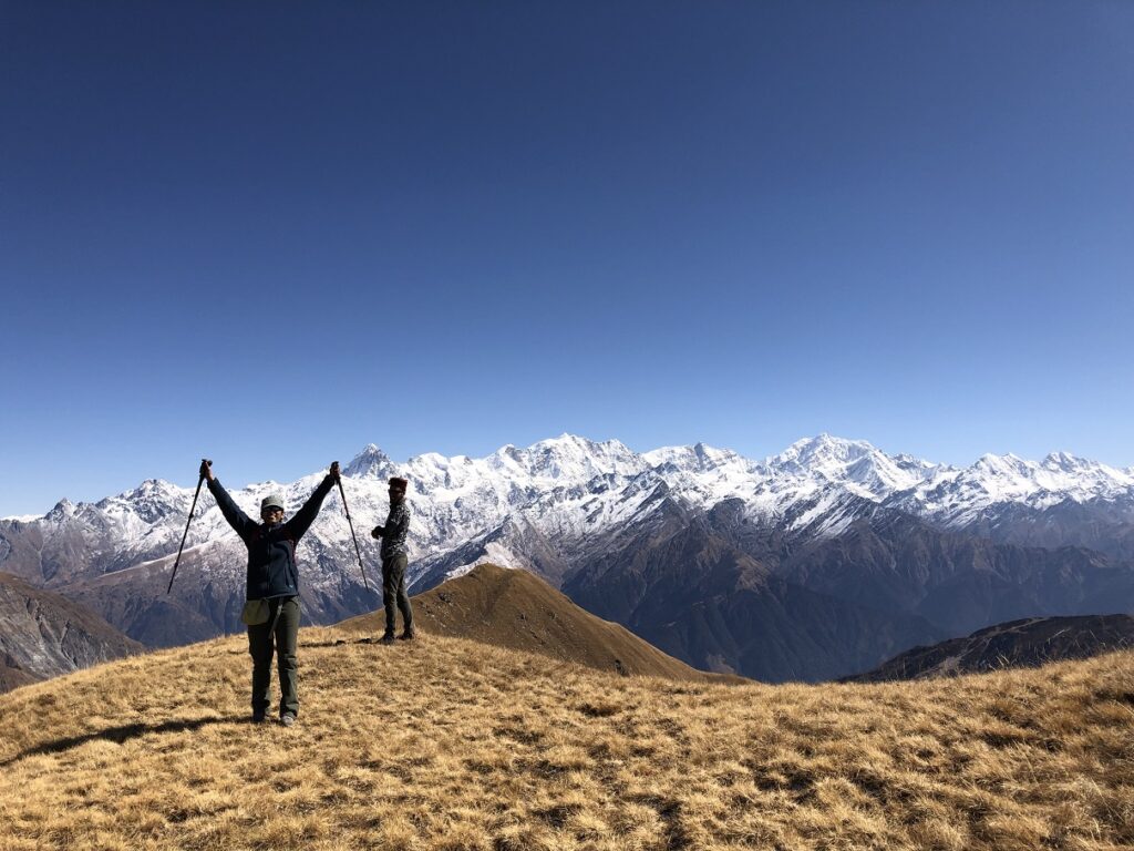
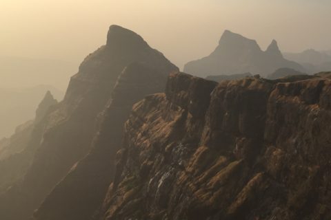
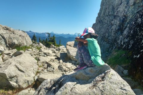
After almost two hours, we dropped down to the other side and got to the Bugyal (Meadows). It was not the best season to see the meadows, but it was still beautiful.
One of the guys from India Hikes cooking staff had hiked up and carried lunch (Veg Pulav) for the entire team. Having lunch on the meadows sitting next to the stream, and watching Srikanth Peak (6133 m, 20121 ft) was one of my favourite spots on the trek.
It was 4 pm by the time we got to Thalotya campsite. From here, we had the final climb to Dhokrani top and then the hike down to Dhokrani campsite. It was now cold, and Kavya was physically and mentally exhausted. So we were back to our counting steps game, but now we would take a break after 25 counts.
I tried to cheat and count every two steps, but Kavya soon caught up to what I was doing and kept me honest. It also took longer for my heart rate to drop below 100 when we would stop for rest. At one point, we were waiting longer than we were walking. However, Pramath and KP were very patient with us.
As we traversed to Dhokrani Top, Kavya started crying. She was cold and tired, but more importantly, mentally exhausted, not knowing when the trek would end. So we gave her mittens to put on and some food. Finally, we reached Dhokrani Top. Kavya got her energy back, knowing it was all downhill from here to the campsite.
As I thought about the trek route, I was glad that we didn’t stay at Thalotya campsite. As carrying a heavy backpack from Thalotya to Gidara Bugyal Top and then all the way down to Thiriya would have been really challenging. Also, Thalotya gets minimal sunlight and gets very cold at night. So, even though we had to change plans due to weather, I think it worked out really well.
We had a fantastic dinner and got back to our tent. An hour later, Kasturi woke me up. Kavya was shivering in her sleep. We woke her up, put on an extra jacket and after some time, she felt better.
Day 5 – Dhokrani to Munda ka Thatthar
Distance: 5.3 km
Cumulative Elevation Gain: 198 m (650 m)
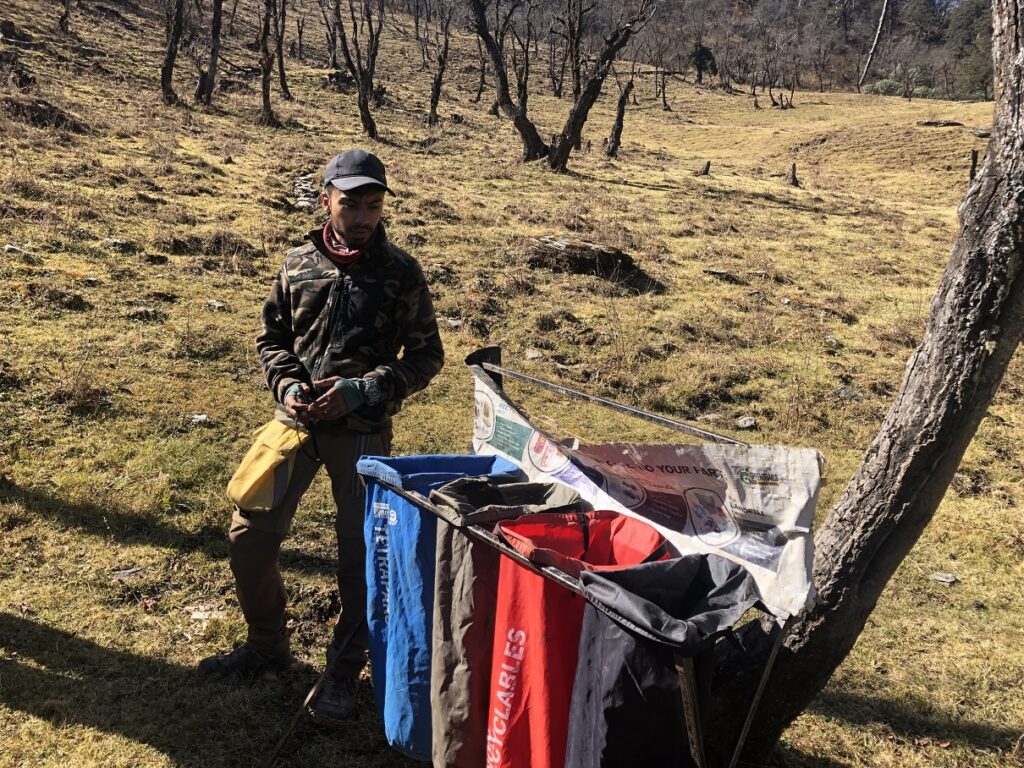
After breakfast, we had a cleanup effort to collect trash at the Dhokrani campsite, mainly around the stream. We found all kinds of garbage and filled a couple of trash bags.
Once we hiked down to the river, Pramath had another surprise, a challenge for us. He asked us to take a push-up position along the river so we could drink from the river at our lowest point. It was a fun challenge.
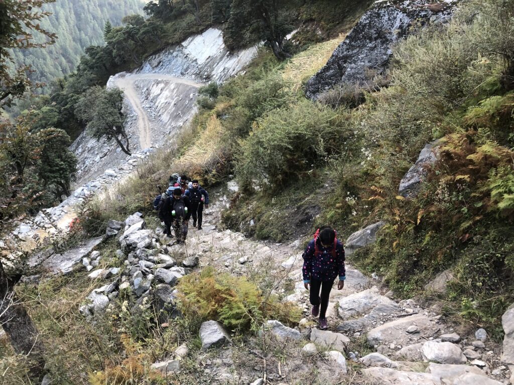
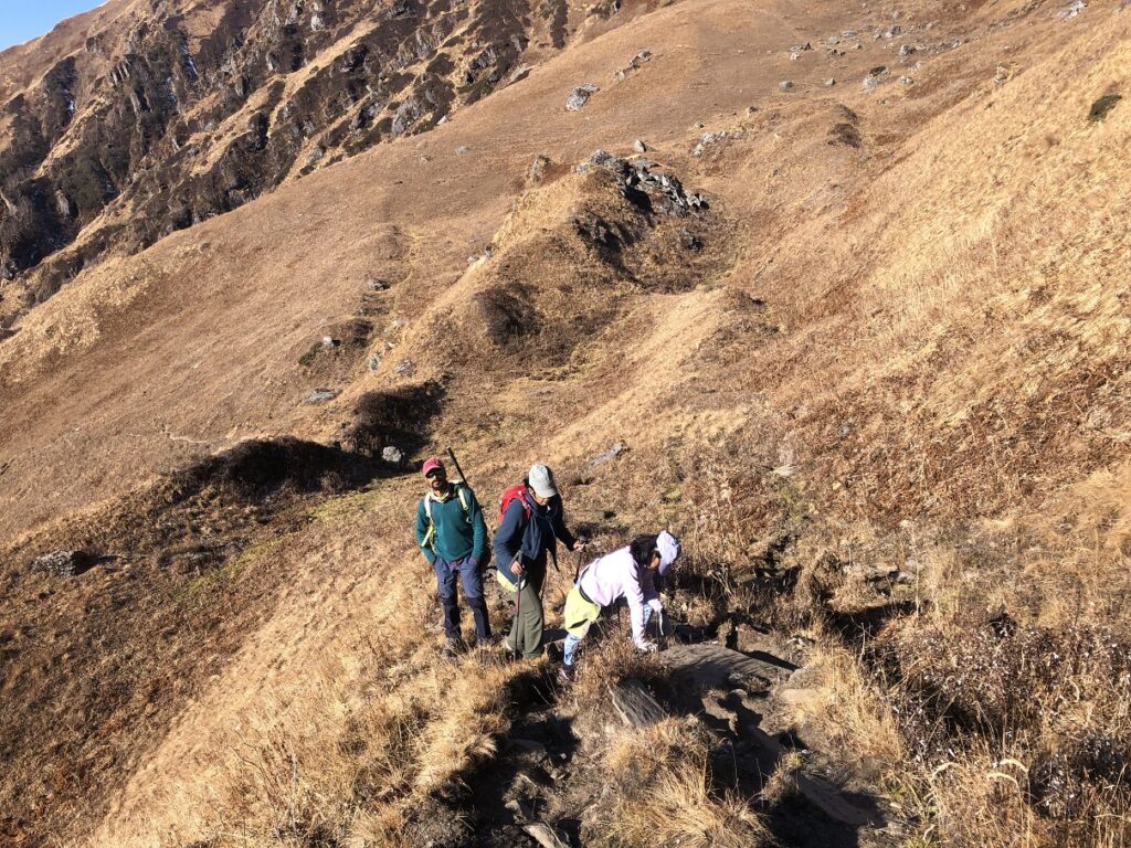
Ahead of us, we had the final climb of the trek. It was icy in some sections, but we made it to the top slowly and steadily. It was tiring, but Kavya was doing much better.
We hiked past Rikoda to reach Munda Ka Thatthar. Pramath and KP gave a quick overview of how to pitch India Hikes all-season tents. Then, we picked a spot and pitched our tent.
After evening tea and snacks, the fun continued as we all gathered at a flat spot near the campsite to play some games. We first formed a line with the shortest person in the front and the tallest in the back. Then we were asked to blindfold ourselves. Pramath, KP, and Kuldeep would move us around. The challenge was that we had to get back in a straight line in the same order.
Initially, it was chaos, but as people figured out their relative positions, we got back in line in the correct order. Next up was to get back in formation in M shape. We barely got it. Finally, we were split into two groups, one forming the letter O and the other creating the letter F. We were supposed to position ourselves to form the word ‘OF.’ O was easy, but F was messy.
Munda Ka Thatthar Altitude: 3270 m (10,728 ft)
O2: 95
Pulse: 71
Day 6 – Munda ka Thattar to Bhangeli
Distance: 3.5 km
Vertical: -936 m (- 3071 ft) (drop)
This was the easiest day of the trek, and it took us less than three hours to get down to Bhangeli. In total, we had hiked just under 27 km with close to 2650 m (8694 ft) vertical with a total moving time of just over 21 hours.
Here is a snapshot of our trek in FATMAP when I upload the GPX file –
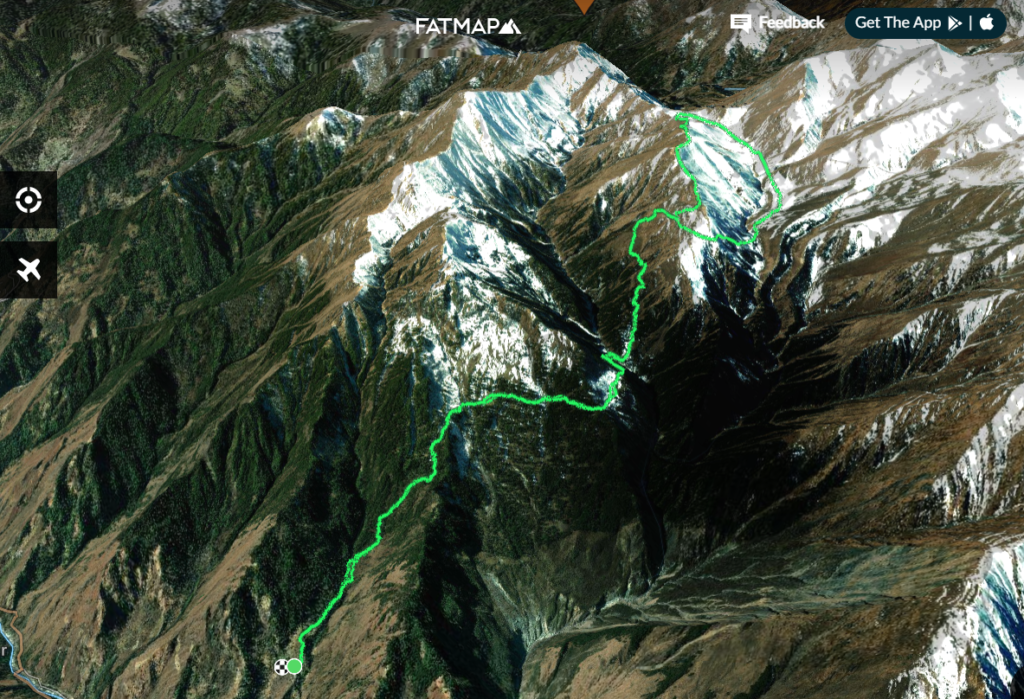
Kuari Pass trek was easier than this trek at around 27 km (including the hike down from Auli to Joshimath) and close to 2000 m elevation gain. I did it in under 11 hours last year and wondered if Gidara Bugyal Trek would be doable in a day if one is well-acclimatized and the trail is snow free. I asked Kuldeep this question, and he responded that locals do it in about 13-14 hours. That would be an exciting challenge.
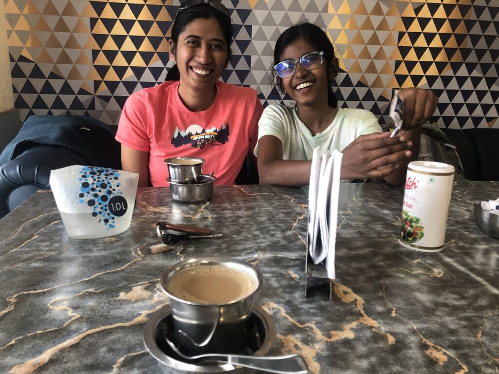
We got our bags from the cloakroom and then returned to the same rooms we used on Day 1. After a good break, we were back for snacks and were surprised to see Pani Puri. Kavya ate as if she had been starving on the mountain.
Later in the evening, we all got together to share our experiences. For Kasturi and me, our first multi-day trek was Sandakphu back in 2007. Since then, we have been fortunate enough to share many adventures. But this was special as it was the first family trek in the Himalayas.
I was glad we decided to go with the India Hikes group, as we met quite a diverse group. But, more importantly, Kavya had a lot of fun chatting with everyone, playing Uno and solving puzzles.
As they say, “It takes a village…” I am glad Kavya had an opportunity to interact and learn from everyone. Of course, she enjoyed all the attention being the youngest one in the group. Thanks to everyone in the group for writing a message for Kavya. It means a lot, and she will treasure these messages for years to come.
India Hikes Team
Kudos to the India Hikes team for managing this trek well. Right from the start, my experience with everyone at India Hikes has been amazing. Suhas Saya was very helpful in selecting the right trek based on the mountain conditions in November. He even shared contacts of local guides as I was initially planning to do a private trek.
Debadrita was very open about the conditions on the mountain and the challenges on this trek. As an Experience Coordinator, she ensured the group had all the information about the trek and were well prepared.
A picture with people who made it possible – KP, Kuldeep and Pramath
Pramath is one of the newest trek leaders at India Hikes and did an excellent job. His professional demeanour and leadership skills were commendable. Pramath was always there for the team and ensured everyone’s safety on the trek. The postcards and fun games he arranged just took the trek experience to the next level.
Finally, kudos to the real heroes who made this trek possible. KP, Kuldeep and the entire cooking staff – Robin, Amit, Prakash, Subodh Rana, Deepak Singh Rana and Mahesh Singh Rana.
KP and Kuldeep were more than local guides on this trek. They would patiently walk with the group, making sure no one got hurt or lost. Once at the site, they would help the staff set up tents, serve dinner and do everything else needed to support us.
The cooking staff served some fantastic dishes (including jalebi and gulab jamun) throughout the trek. They probably got up at 5 am or earlier to ensure we got black tea, chai and breakfast. Some days, we also got packed lunch. Cooking in freezing conditions at high altitudes is hard. But they made it look easy, and the food was excellent.
As an organization, India Hikes is committed to promoting trekking that minimizes the impact on nature. Through its recycling program, India Hikes has done an excellent job cleaning up the mountains across different parts of India. The other aspect I like about India Hikes is its support for DIY trekkers in the form of detailed documentation, logistics and other support. I experienced this firsthand when I relied on India Hikes to travel between Rishikesh and Joshimath for the Kuari Pass trek last year.
Day 7 – Bhangeli to Dehradun – Rishikesh
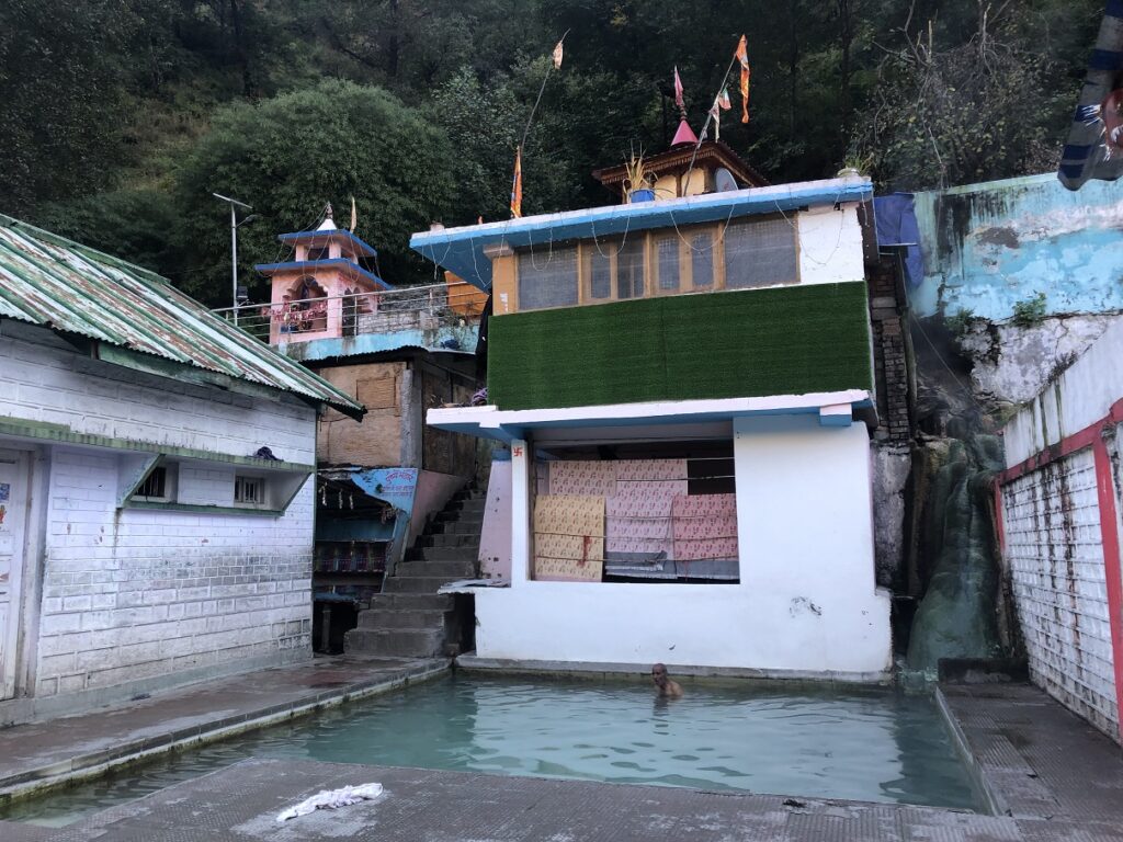
On the last day, we left Bhangeli around 6:30 am and hiked down to the pickup point. We stopped by Gangnani Hot Springs, which was refreshing after the trek. Although Kavya and Kasturi mentioned that the women’s area of the hot springs was not so clean.
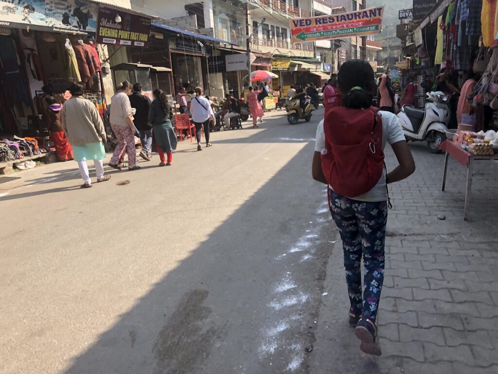
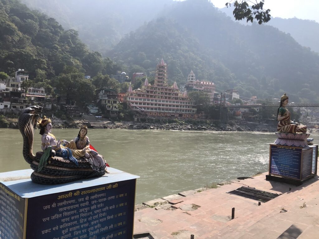
It was a long drive back to Dehradun. Kasturi, Kavya and I took a cab to Tapovan in Rishikesh. I was in Rishikesh last year and thought it would be a good place to relax after the trek. So for the next three days, we just walked around Rishikesh and enjoyed the sights and the food. Kavya’s favourite part was driving to Kunjapuri Temple on an Activa bike.
Overall, it turned out to be a much better trip than I had expected, and as a family, we made some fantastic memories that we will cherish for a long time.
Resources:
Gidara Bugyal Trek – India Hikes | Aloke Surin Trip Report
Trail Info from our trek: FATMAP
Popular Autumn Treks in India – India Hikes
Weather: Yr.No | India Meteorological Department
Disclosure: The links I have shared in the post and under the Resources section are not Affiliate Links.
Did you enjoy reading this post? Please subscribe to get weekly updates. Please share your feedback in the comments section below. Thank you!
Wow, that’s an amazing hike! A big congrats to all, especially Kavya for pushing through to reach the summit. Me, I’d stick to the hot springs.
Thank you Ngoc. Hot springs are nice too! 😉
😍Sir, you trekked very well, I have done many treks from Bhangeli village, I have also done many treks with Gidara’s India hacks, shared the explanation with many people and got to learn from many people. You would have liked to get something new to learn from Gidara bugyal in future also you have given credit to the local, you have understood well how
the hill is, thank you sir
Thank you for reading the post and for your comment.
Hi Shashi, very interesting reading! 2019 was the very first time that India Hikes ran this trek and John and I were ahead of their schedule by 2 days, and did meet them between Thiriya and Dhokrani. While their group stopped at Dhokrani, we went ahead to climb the slope above it and then descended to Thalotya to camp there. One detail from your account really surprised me : the suggestion of starting a course of Diamox at a relatively low altitude to all! I am 67 now and have never used any form of drug to help acclimatize faster during all my Himalayan trips, some of which have taken me to altitudes well above 20,000 feet. I have never been an athlete, my pulse rate is atrocious, and I have never checked my O2 levels (back in the day we did not even have any portable gadget to check all that!), I have never “trained” for a high altitude trek nor any of my mountaineering jaunts. The only rule I have always followed is always carry a reasonably heavy backpack and conditioning automatically happens in the first few days of a trek!
Aloke – thanks for sharing your perspective. Regarding acclimatization, I agree that hiking at a slower pace and letting your body acclimatize naturally would also be my preferred approach. Even 10-15 years back, I don’t think the use of Diamox was common. Nobody in my YHAI group used it on Sandakphu (2007) and Sar Pass (2008) treks. From India Hikes’ standpoint, Diamox is an easy way to prevent altitude sickness with no side effects (other than Diamox being a diuretic). From a logistics standpoint, it probably makes it easier for India Hikes to have everyone stick to the schedule and move as a group rather than allow some individuals to take more time to rest and acclimatize at certain campsites. I just hope that trekkers learn more about acclimatization and do it naturally rather than relying on Diamox.
Hey Shashi Gr8 trek info with the distance and elevation details. Simple and crisp description of the places and challenges makes it interesting read. Kudos 👍 to Kasturi on completing the trek after recovering from the ACL and MCL tear. Congrats 👏to Kavya on completing her first trek. Many more to come.
Thank you Gopal for reading the post and sharing your thoughts. Yes – many more to come!
Hi Shashi, I am looking for the GPX file for Gidara Bugyal, would you have that available by any chance?
Hardik – sorry just saw your note. I will email you the file.