
I had signed up for Farbod’s trip to Mount Sir Donald Northwest Ridge towards the end of July 2019, but it was postponed due to weather conditions. A week later, the plan changed to climb locally at Tricouni Peak North Ridge (5.4 Alpine Rock). Just two weeks before this trip, I had climbed South Early Winters Spire – Southwest Rib with most of the people in our group.
Drive to Trailhead
On Aug 4, 2019, we met at St. David’s Church at 6 am. There were 10 of us, and it was my first time climbing with Lily and Bill. We made our way to Tricouni Peak trailhead in two Jeeps and one Subaru.
The plan was to drive to the trailhead via Chance Creek Forest Service Road (FSR). After two hours of driving, I could see why you need a 4X4 vehicle for this road. For the first time, I tested the limits of my Subaru or maybe just the limits of my driving.
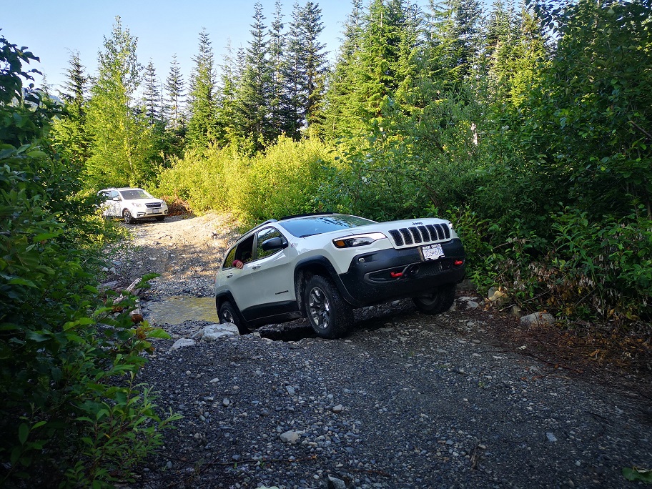

Once the tires started spinning, we parked the Subaru and squeezed in Seb’s Jeep. Jafar and Seb did an excellent job of getting us to the trailhead.
High Falls Lake Hike

The first section of the hike was through the muddy alpine meadows. It got better as we gained some elevation.

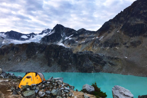
It took about an hour to get to the Higher Falls Lake. It is a beautiful alpine lake and an excellent spot for camping.

We kept to the right of the lake and walked across the steep terrain.


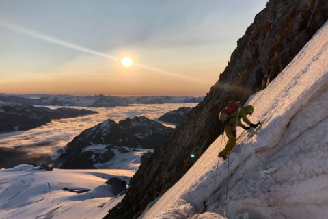
We hiked up the snowfield to the col. Once we got on the North Glacier, we split into three teams and roped up.
North Glacier
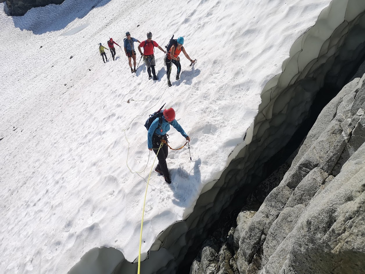
Team 1 – Farbod-Lily-Slawomir, Team 2 – Seb-Bahareh-Nasim-Jafar, Team 3 – Bill-Youliana-Shashi
First, we had to cross the glacier and get on the rock. The snow had separated from the rock at the moat, but it was still manageable.
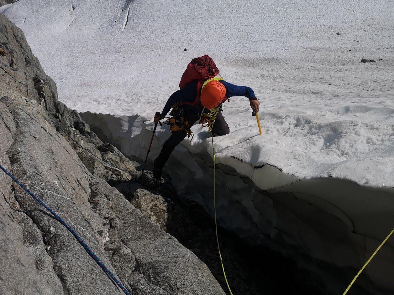
Slawomir took the lead and crossed the moat on belay. He then set up a belay station for the rest of us.
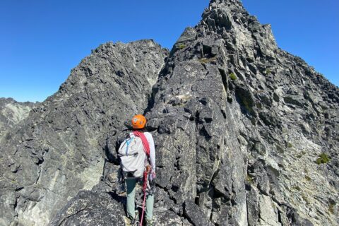
North Ridge
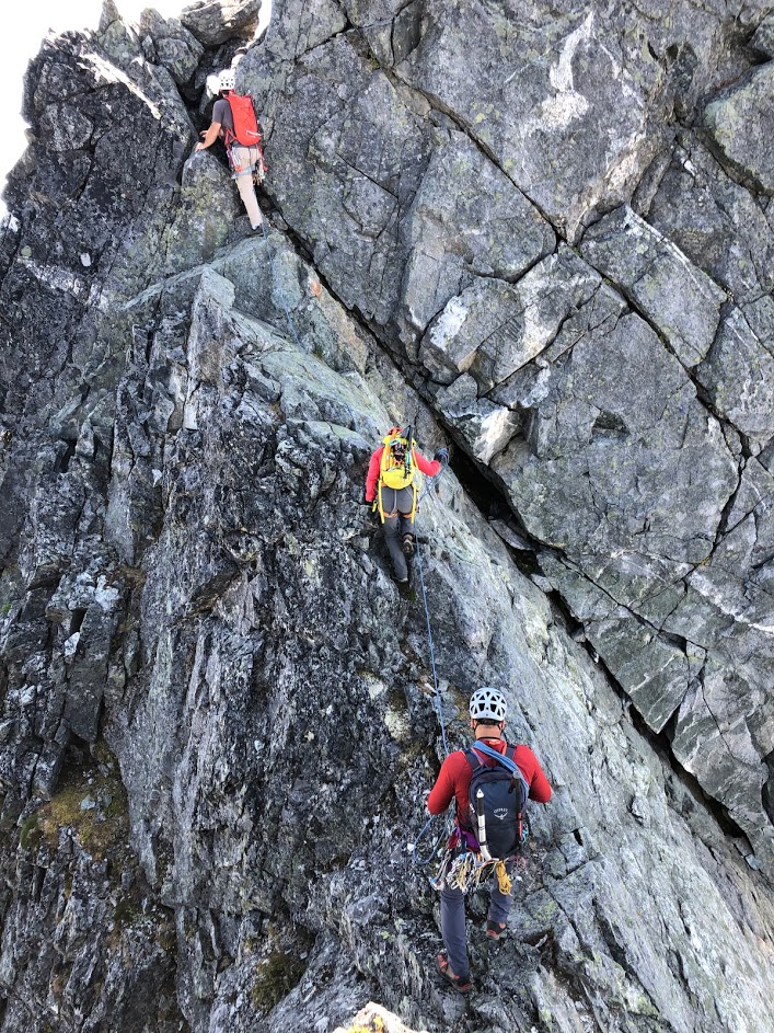
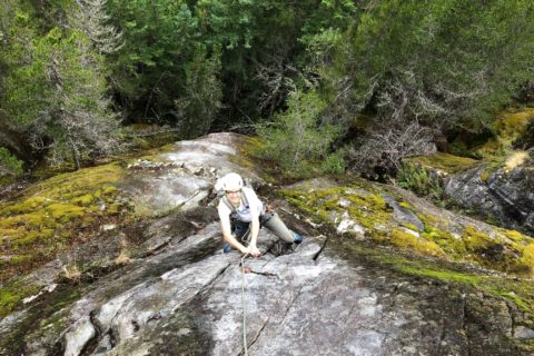
Bill and I took turns in leading the next few pitches.


As we climbed up, we saw the two teams waiting as Slawomir was making his way across another snowfield.

After a quick break, we crossed the snowfield and scrambled up to access the ridge.

It was a relatively easy scramble, but we protected some sections, and slowly made our way to the top.

Once on the top of the ridge, the route ahead was not clear. The GPX tracks were not helpful, as the tracks went back and forth. Probably, this is where other climbers get confused as well. Farbod took a route on the left side of the ridge.

Our group continued on the ridge, and we saw a potential route where we could drop to the notch and climb to the summit. Once the route was confirmed, Team 2 followed us to the notch.

Farbod and team made the traverse from down below and reached the notch around the same time.
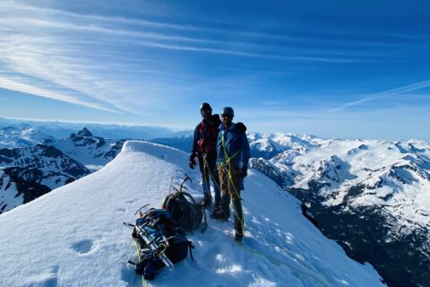
Climb to Tricouni Summit
From here on, it was an easy climb to the Tricouni summit (2075 m). Around 2:30 pm, we were at the peak and settled in for lunch break.

It was a clear day, and we had amazing views from the summit.

Scramble Down to the Lake

Around 3 pm, we started our hike down the other side. Here again, route finding was a bit tricky as we downclimbed some steep sections on the West side of the mountain.
I was wearing La Sportiva Nepal Evo’s as the rubber sole of the Trango boots had come off. The heavy boots were okay for the most part except for the section in the picture below. I would have been more comfortable in the lighter alpine boots.

Once down on safe ground, we referred to GPX tracks. We made our way back to the South ridge and down the East Face to the lake.

A few adventurous souls among us took a dip in the lake. I was happy just to take off the boots and enjoy the view.

We got back to the parking lot around 6:30 pm. It was roughly a 10-hour trip. We drove back to Squamish and stopped for dinner. Few of us had to build an appetite, so we did 20 push-ups in the parking lot.

It was another fun BCMC trip led by Farbod and I had an awesome alpine climbing experience. Thanks to Lily, Youliana and Bill for sharing their pictures.
Resources:
Guidebook: Scrambles in Southwest British Columbia by Matt Gunn. Provides a good description of the other (scramble) route.
Tricouni Peak Trip Report:
North Ridge – Altus Mountain Guide | Scramble Route – Steven Song
Weather: Mountain Forecast
If you are in Lower Mainland, check out British Columbia Mountaineering Club for trips and courses.
Mountains 101 is an online course and provides an excellent overview of the mountain world. It is a free course offered by the University of Alberta on Coursera.
Glossary of rock, ice and mountain climbing terms.
Disclosure: I am not affiliated with any of the above individuals or organizations.
Did you enjoy reading this post? Please subscribe to get weekly updates. Please share your feedback in the comments section below. Thank you!
Amazing Anna
Punith – thank you!
Tumba chanda madi baredidi Raja .yella photos nodide, olledu unto.
khoop chan
Do you happen to have a GPX for this route?
Sent you an old GPX file earlier this month. It might not be accurate. I recently did this trip again and can send you the new GPX if you need it. Let me know.