I first climbed Sky Pilot via the West Ridge in 2018 and wanted to try the other route – East Face via Gunsight Couloir (alpine PD rating). It is typically done early in the season before the bergschrund on Gunsight Couloir opens up.
Jack Casey posted a trip report on July 5 on the BCMC Facebook page with pictures from his recent ski trip in the area. It seemed like the couloir was still in shape and the East Face route was doable. So I contacted some friends, and finally, we had a group of four – Neha, Holly, Jesse and myself for this climb.
Pre-Trip Planning
In my last post, I shared my approach to planning an alpine climbing trip. I used the same template to create a plan for the Sky Pilot trip.
I mainly referred to the Alpine Select guidebook, which has a brief route description and one photo of the East Face route. Another guidebook – A Guide to Climbing and Hiking in the Southwestern British Columbia, refers to this route as Gunsight Gap.

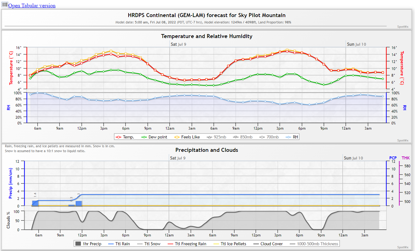
Weather-wise we had some showers on Friday, and more were in the forecast for Saturday afternoon. Some models forecasted rain as early as 11 am. Based on recent trip reports and the route we planned to take, avalanche risk was low.
At a high level, we planned to leave early and start hiking from the gate at Shannon Creek FSR by 4:30 am, summit by 9 am and back to the car by 1 pm.
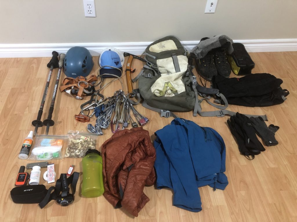
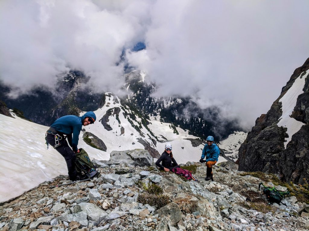
Given the conditions and the route, we didn’t plan to take much gear. After packing everything, my bag weighed about 16 lbs. Neha would bring her 50 m rope in case we need it in some sections.
Approach
We reached the Shannon Creek FSR gate by 4:45 am and hit the trail by 5:00 am.
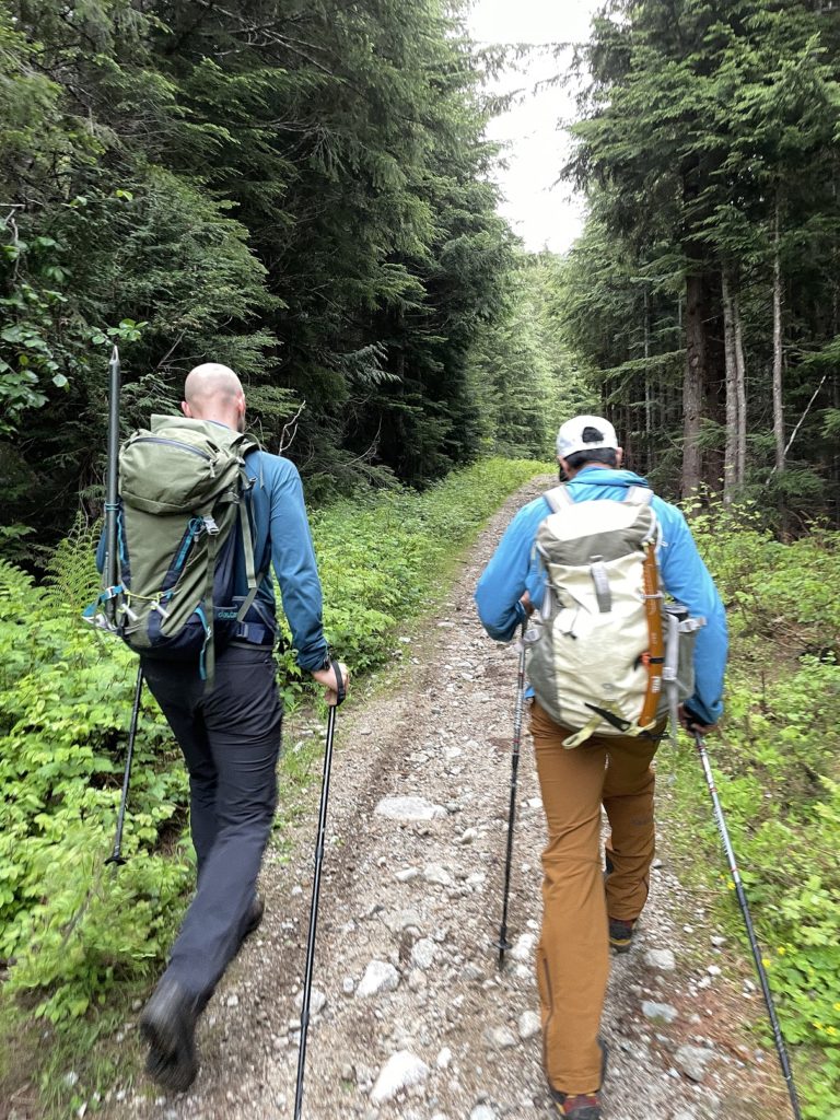
The approach to the base of the Gunsight Couloir was the same as my Sky Pilot North Face trip. However, my backpack was much lighter this time, and the trail was snow-free till we hit the Sky Pilot Trail near Shannon Creek.
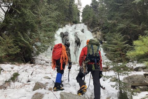
It took us about three hours to get to the base of Gunsight Couloir.
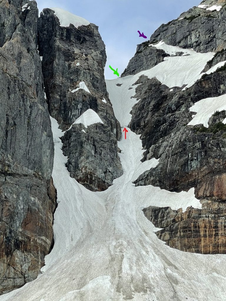
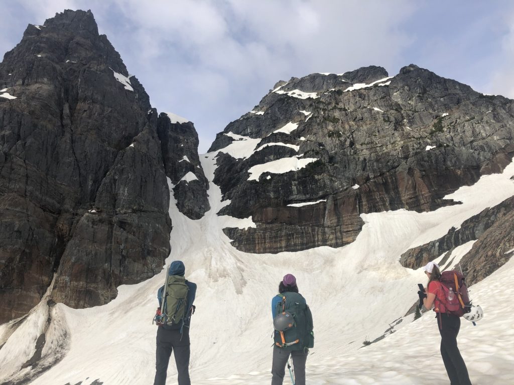
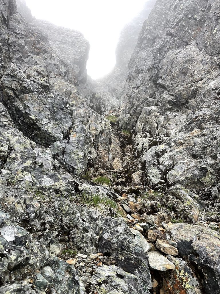
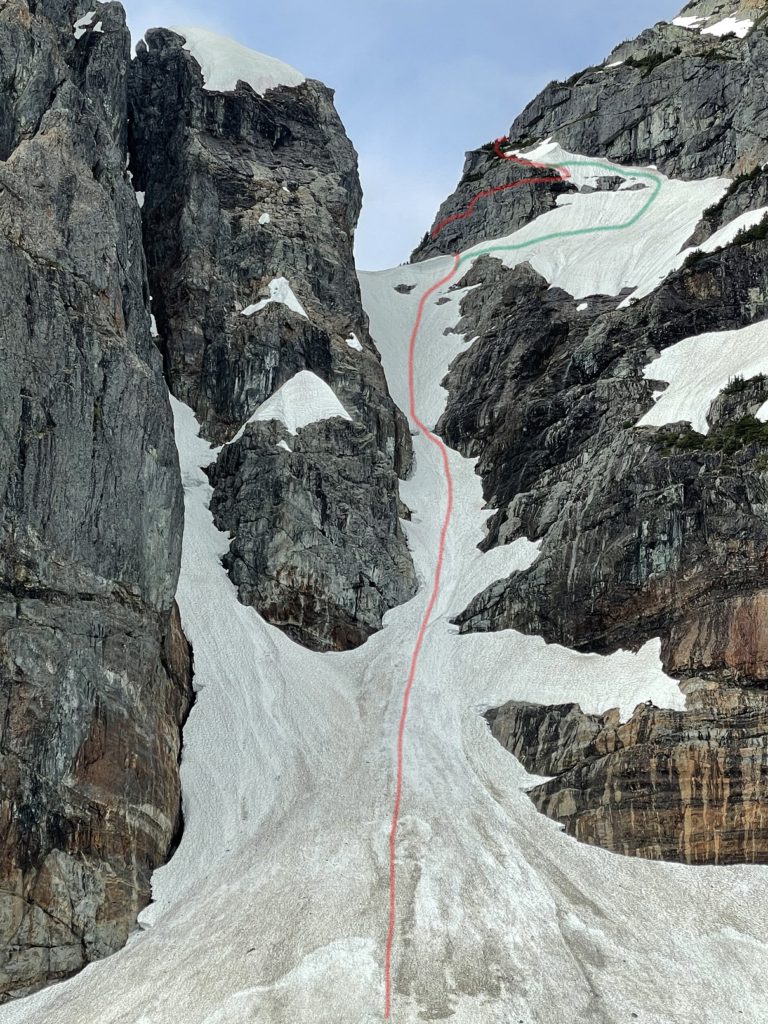
We could see an opening in the bergschrund (red arrow) and were not sure if we would be able to get past it. Higher up, there was a cornice at the Gunsight Gap (green arrow), and we wondered the best approach to get on the East Face (purple).
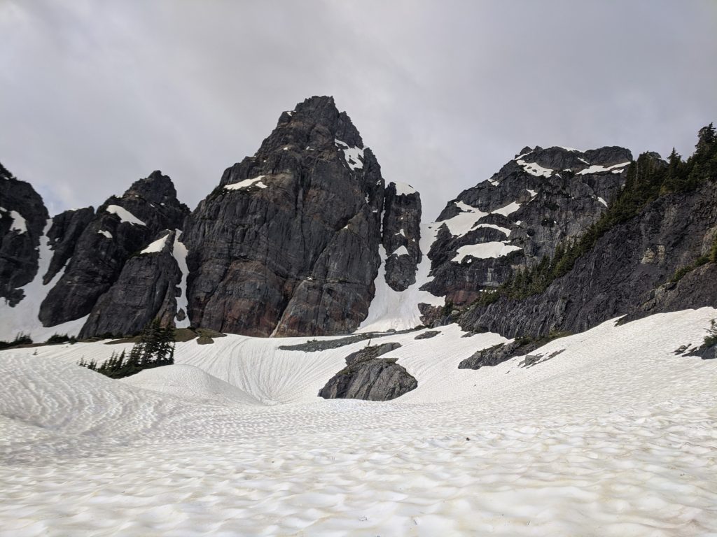
Gunsight Couloir
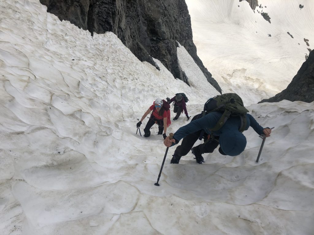
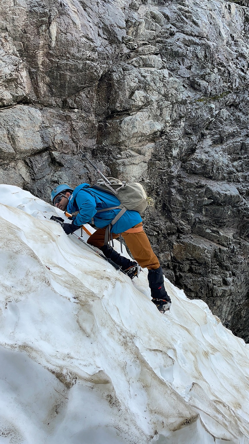
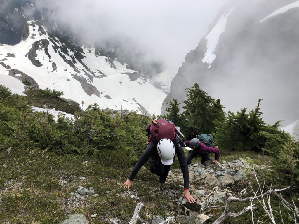
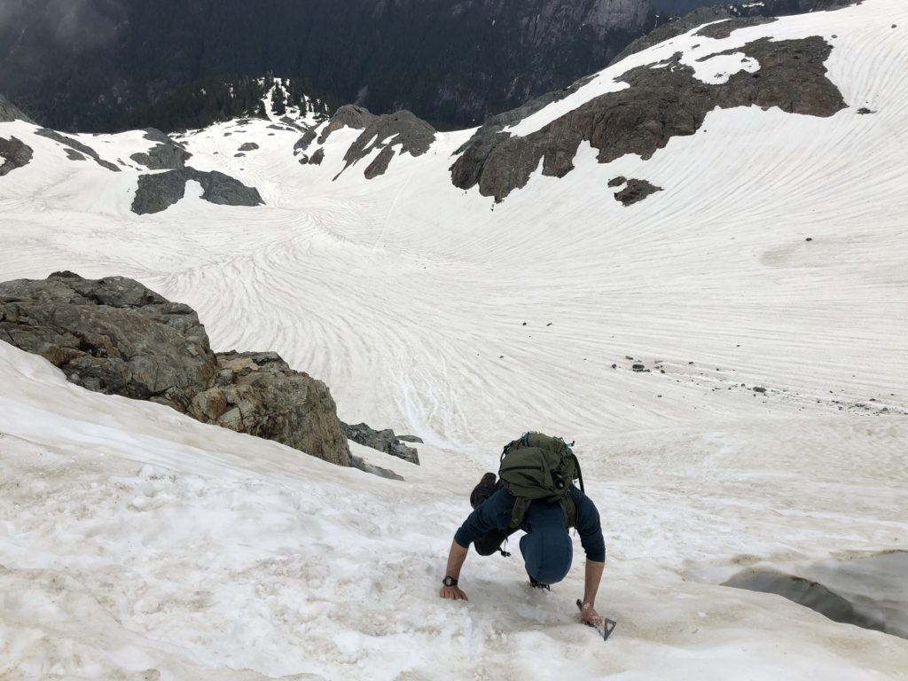
After a break, we put on our helmets, harness and crampons and made our way up the couloir.
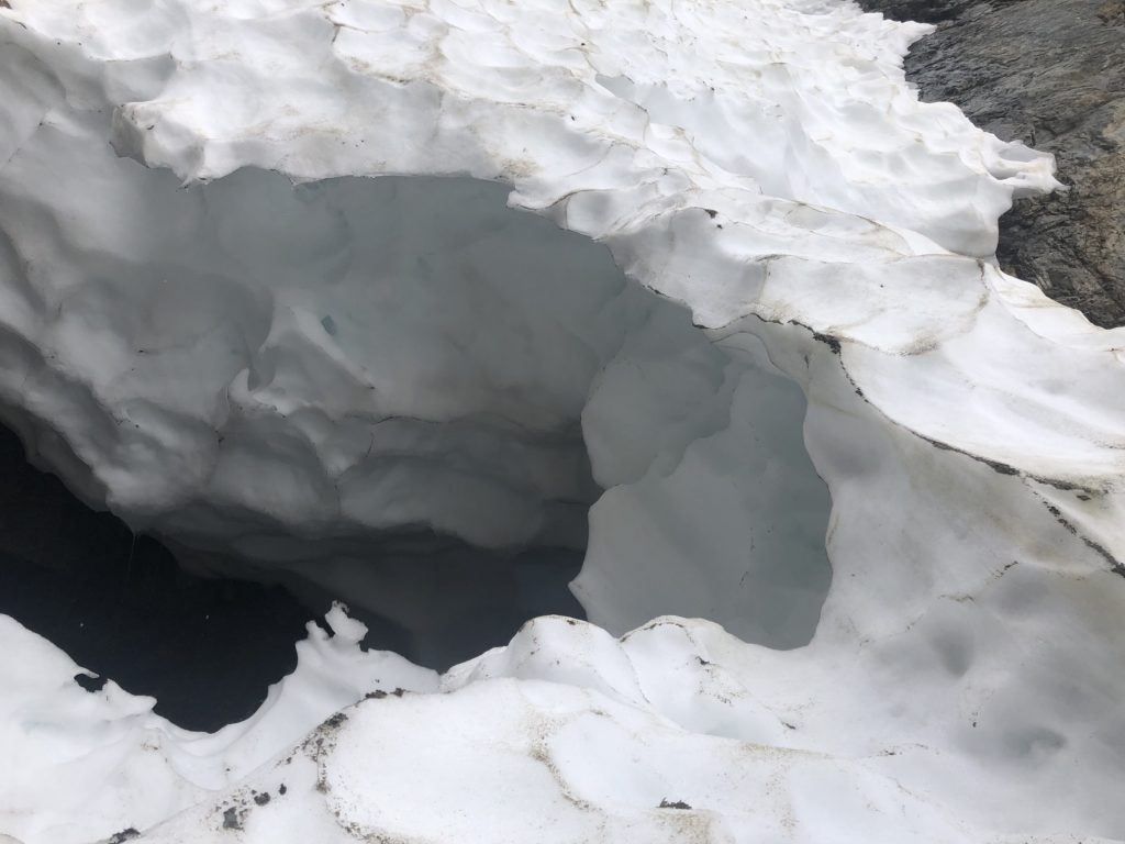
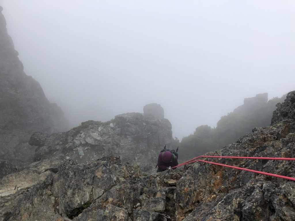
Once we reached the bergschrund, we saw a narrow bridge connecting the snow slopes, and it was less than one foot thick in some sections. Beyond the bridge, the snow slope was wide and thick but unsupported.
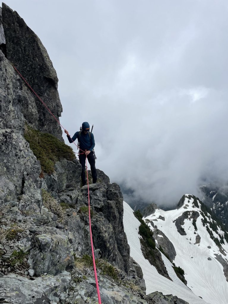
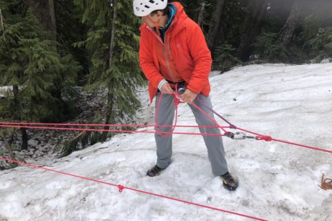
Considering the conditions and the consequences of a fall, we decided to rope up. I would go up first while Neha belayed me about 5 m down the slope and secured herself with an ice axe. Jesse suggested he could also lead from the other end of the rope, and then we could belay Neha and Holly, saving us some time.
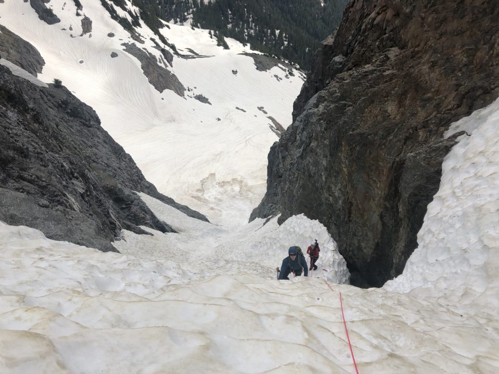
I gently made across the snow bridge, ensuring I didn’t step on the thinnest section of the bridge. It was quite a relief once I cleared the snow bridge and climbed up the slope to a safe position. Once up, I secured myself with the ice axe by plunging the ice axe into the snow and tying a clove hitch.
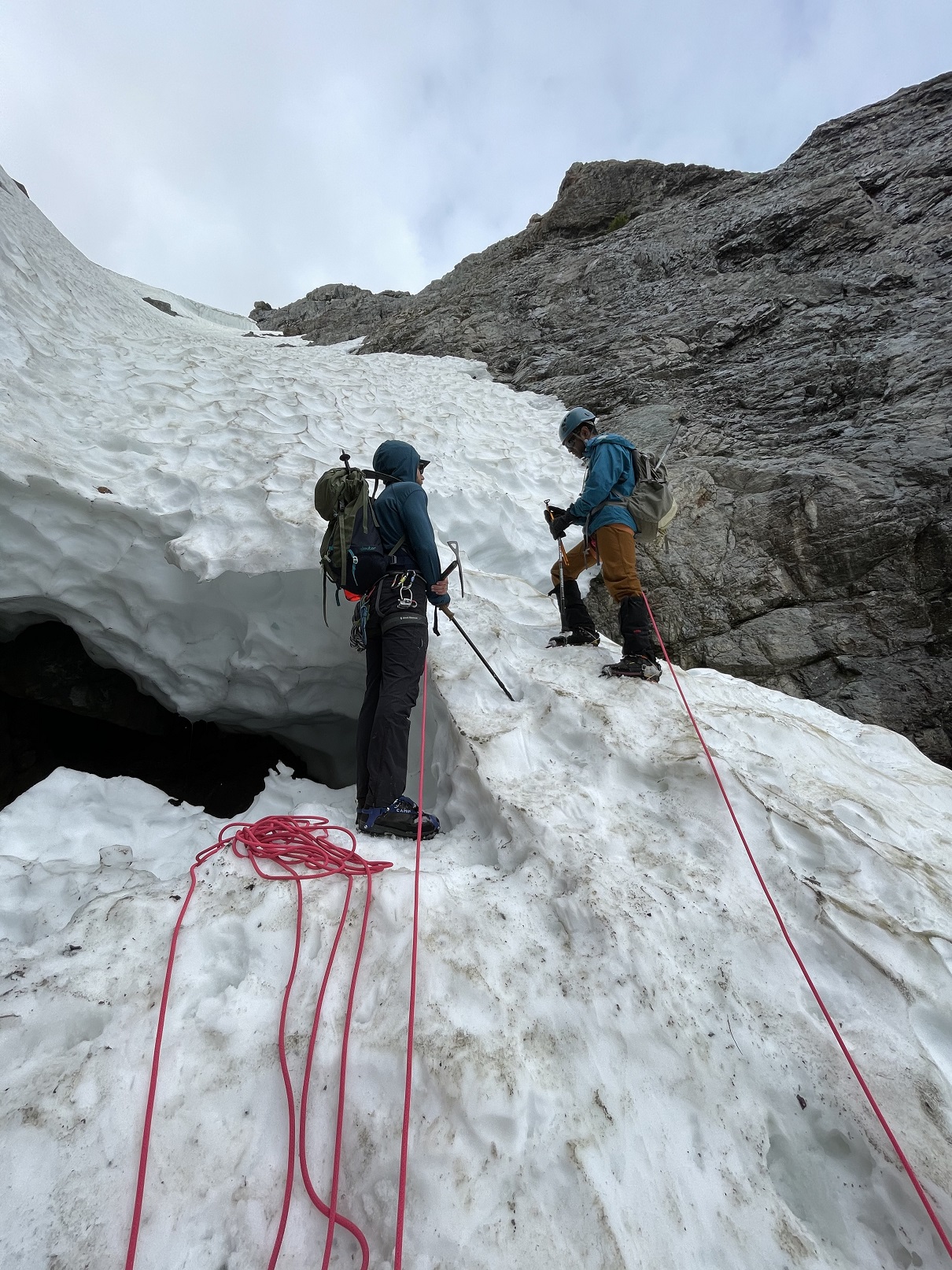
As Jesse came up, he built a t-slot anchor. Considering the snow conditions, I think it was a better anchor, so I also made one and buried my trekking pole in the t-slot. This video explains both the anchor methods –
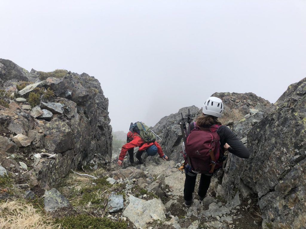
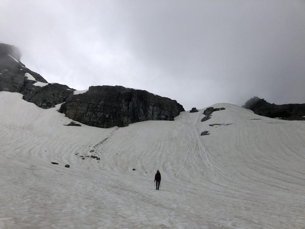
Holly and Neha came up soon after, and we started our climb up to the Gunsight Gap.
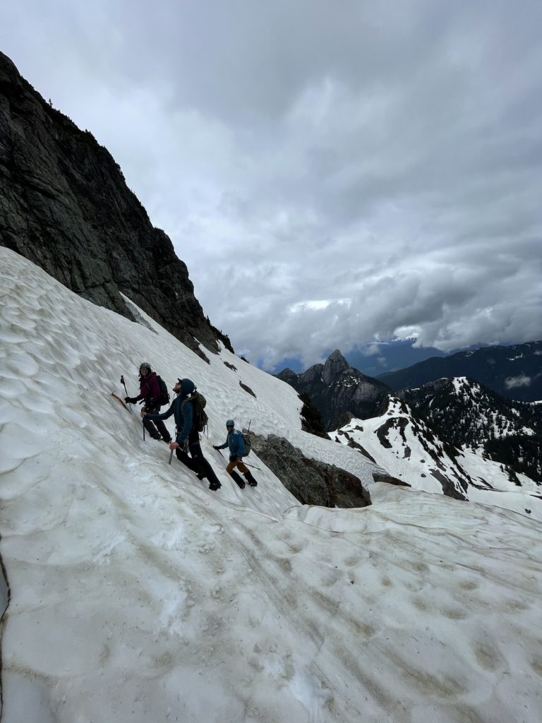
East Face
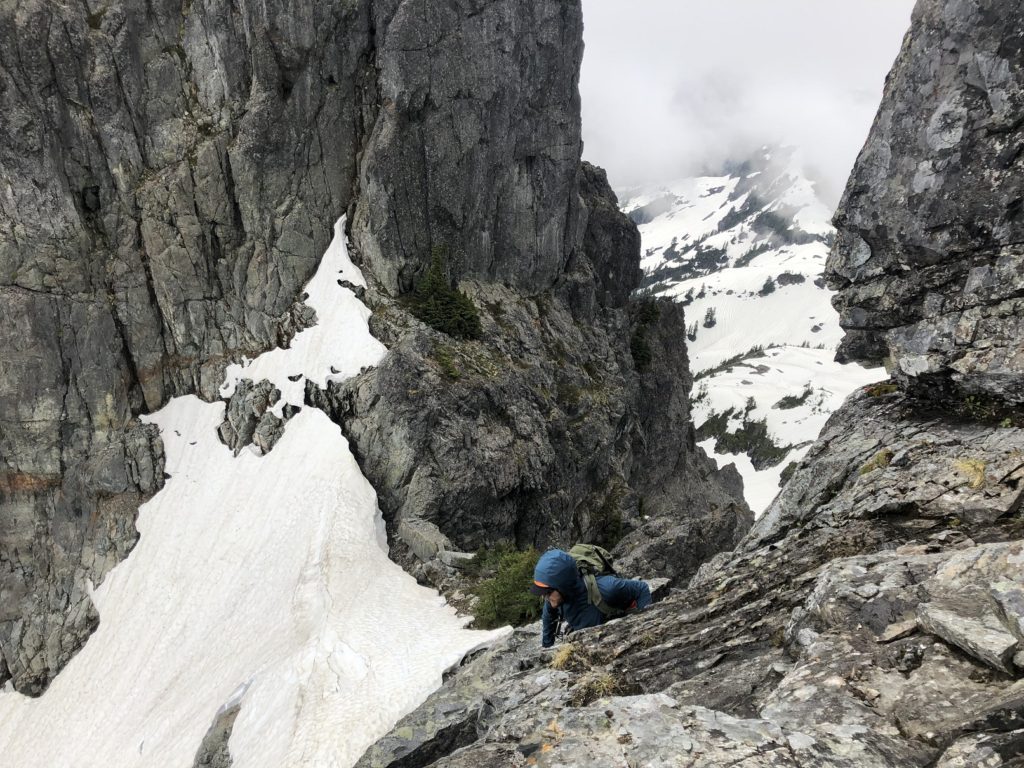
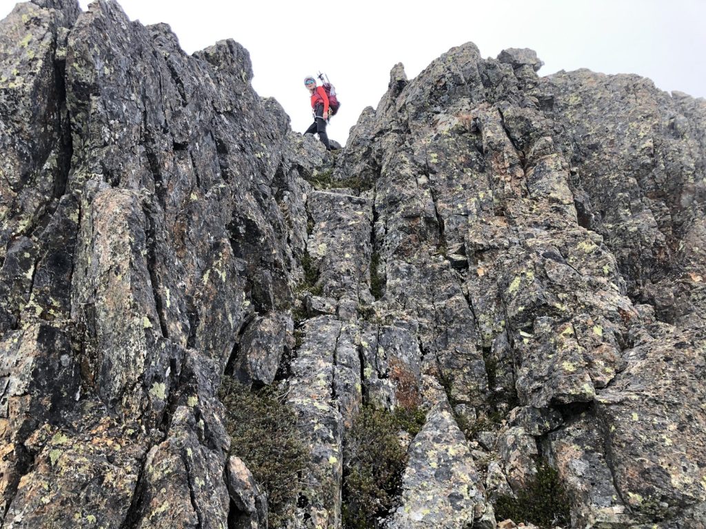
We now had to figure our way up from the Gunsight Gap to get on the East Face route. There were a few ledges connected by short climbs and I thought it would be doable.
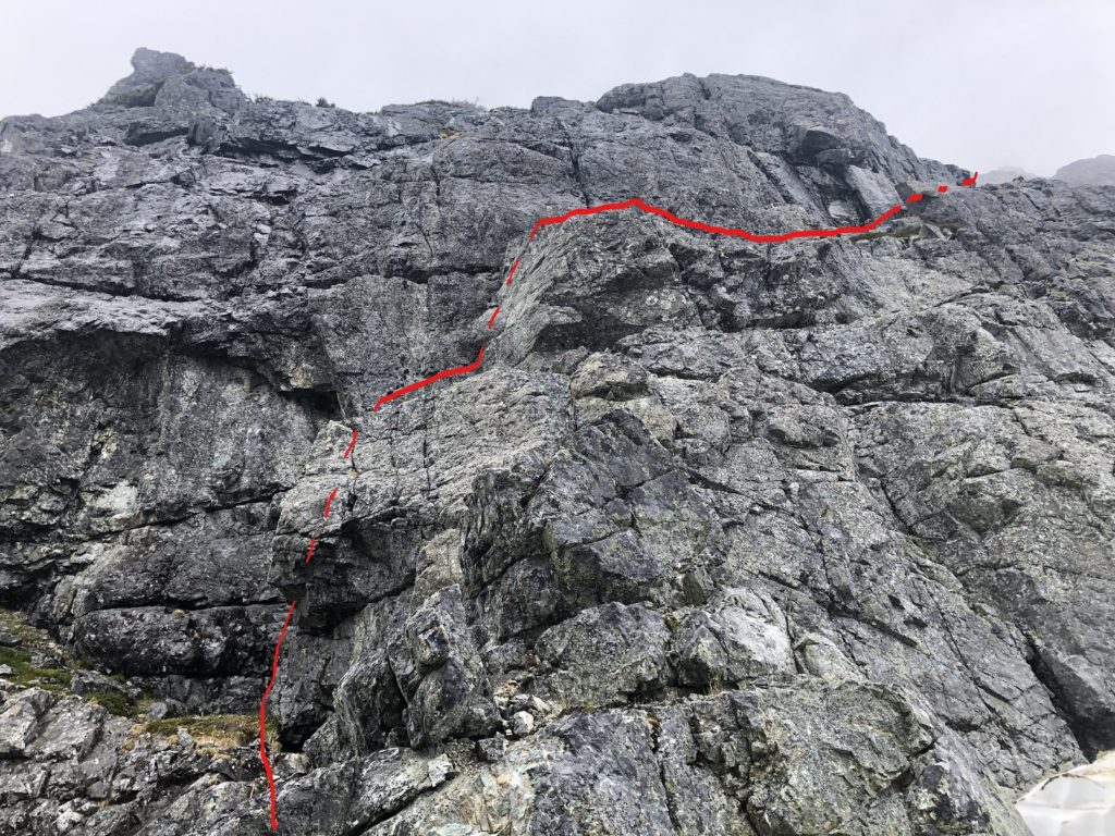
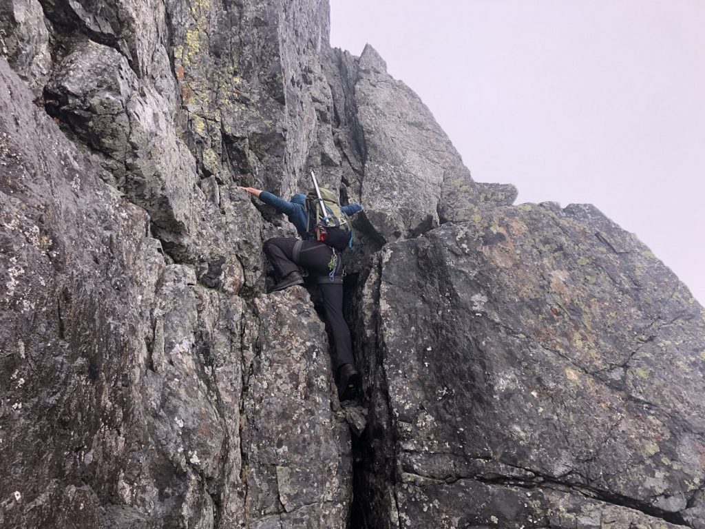
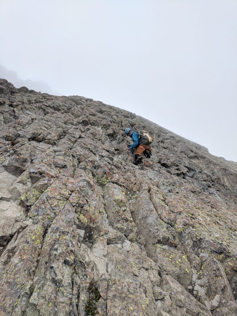
Jesse went up first, and then we followed. It turned out to be more challenging than expected. The rock was wet, and the climbs connecting the ledges were in the 5.5-5.6 range.
More than the technical difficulty, the wet rock and climbing in mountain boots slowed us down. It was not a PD, class 3-4 scramble route that we had planned, and we realized we were off-route.
Jesse and I had a brief chat about our options, and I decided to go ahead to find the route while Jesse belayed the rest of the group up to a ledge. There was also a huge block we would use to rap down in case we couldn’t find the route.
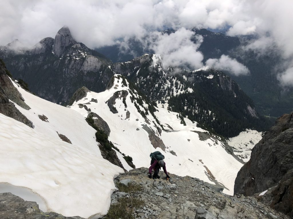
I moved slowly over the exposed terrain, always maintaining three points of contact. To get to the next ledge, I had a short but wet climb, and here again, I was very cautious. Once up, I continued on the ledge, which ended on a snow slope. Unfortunately, I couldn’t see any signs of the East Face route.
It had been seven hours since we had left the trailhead. Fortunately, it had not rained, but we had to make a decision soon. After chatting with Jesse, I decided to go up the snow slope and give a final try to find the route. A Marathi song, “vaat disu de ga deva…” (literal meaning – God, let me see the way…), was on my mind. And thankfully, I did see the route –

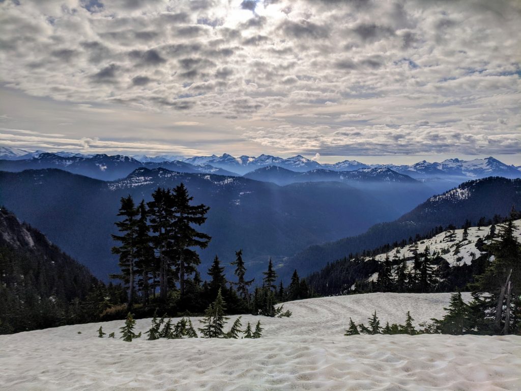
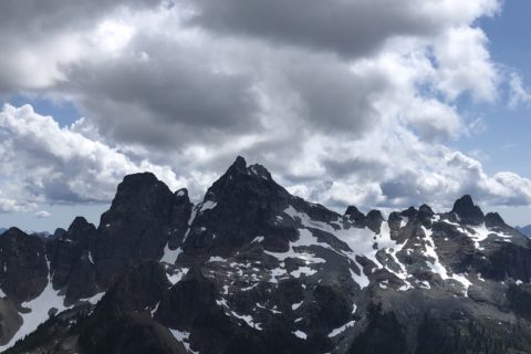
From here, I had a beautiful view of the Ledge mountain –

Neha, Holly and Jesse came up next, and they were as relieved as I was to be finally on the scramble route.
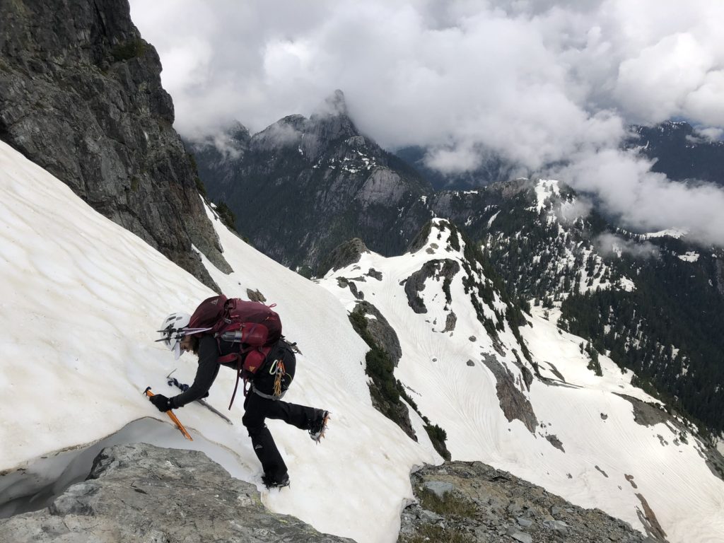
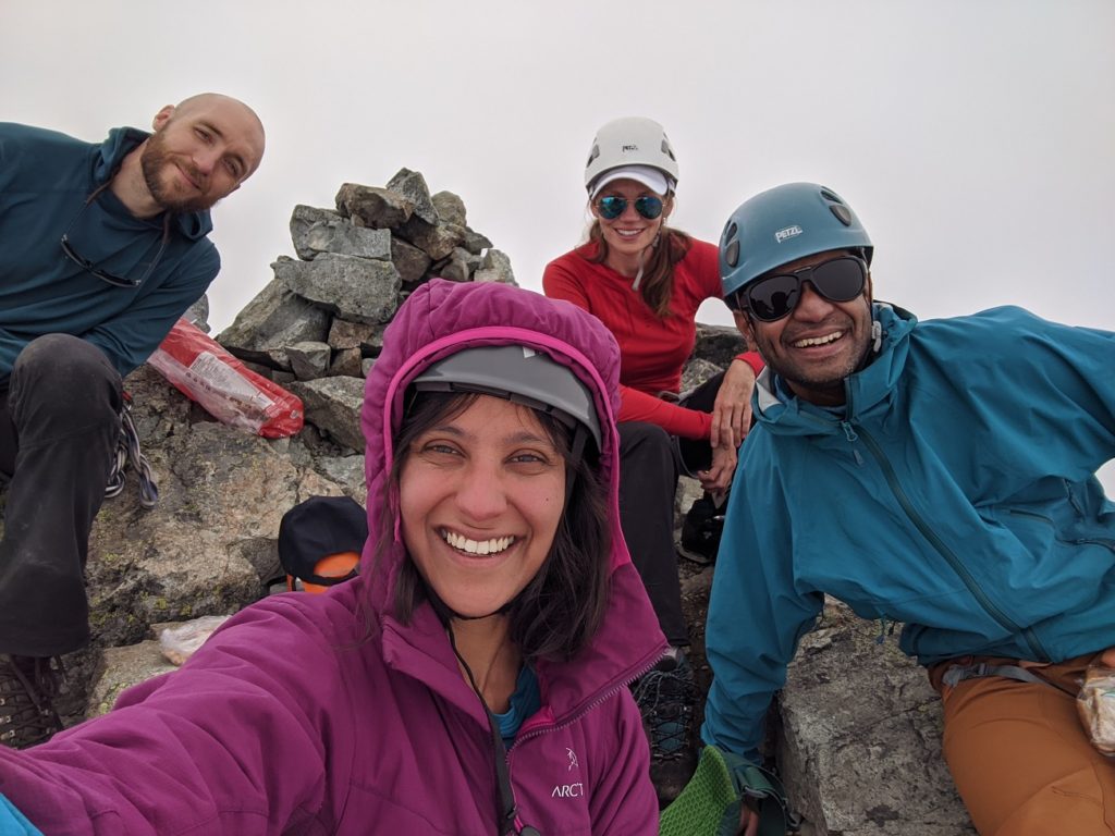
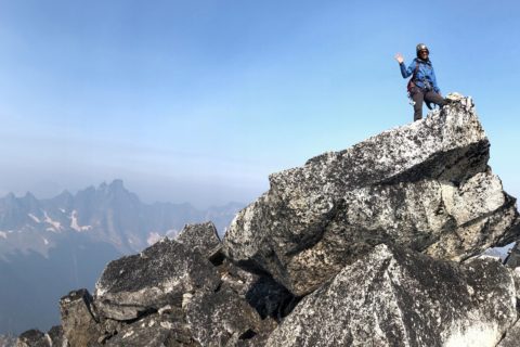
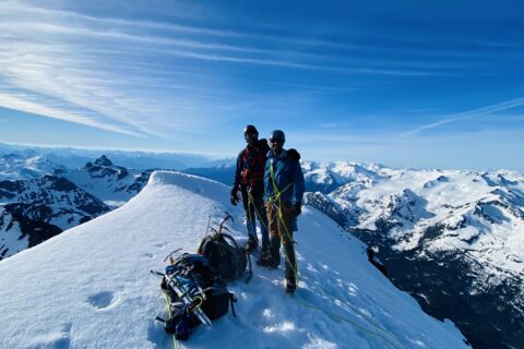
From here, there was some bushwhacking, but not challenging to find our way up, and it took us less than 40 minutes to arrive at the summit.
The clouds had rolled in by now, and we didn’t have any visibility.
Descent
After almost a 30-minute break, we began our descent. Holly went down first and down climbed a steep gully.
Neha was right behind her but didn’t feel comfortable going the same route, so she set up the rappel. Luckily she was carrying the rope and not Holly. As Neha rappeled down, we realized that Holly had mistakenly gone down the wrong route.
Neha rappeled down first, and we helped a hiker get down the route as he used the rope as a handline. Jesse went next and flipped the rope to the gully on the left (climber’s right) to help Holly climb up.
Eventually, we all got back on the descent route (West Ridge) and made our way to the Pink Slab. Fortunately, it was not wet and made for a straightforward descent.
Our final down climb was down to the Stadium glacier.
By 4 pm, we had cleared the glacier and continued our descent along the Sky Pilot Trail.
It took us another hour to get down to Shannon Creek and the Habrich Spur trail. It was 6:40 pm by the time we got back to the car. The total round trip was 21.7 km with about 1475 m vertical in 13 hours and 40 minutes.
Trip Debrief
The trip didn’t go as planned, but it was a great learning experience for everyone. Here are the items from our trip debrief –
Route –
- Start time: Early start time was good. No change
- Gunsight Couloir: Bergschrund crossing was sketchy, but the team felt safe with how we handled it
- Scramble: We missed the route and did more technical climbing than needed on the route.
Gear –
- Rock Pro: We had adequate gear for the climb. I was carrying a set of stoppers, and I should have left the gear with the group as I went ahead to find the route. At one point, I felt a set of cams would have helped to set up the belay, but it was a short section, and I managed it with a hip belay.
- Rope: One 50 m rope was enough. Even a 60 m half rope would have been okay for this climb
Communication –
- Overall we did a good job of communicating during the trip. Individuals spoke up when they were not comfortable in some sections, and we then used ropes for safety.
- One area where we could have done better is discussing the decision to continue climbing when we couldn’t find the route and how a change in weather might have impacted our climb. Jesse and I briefly chatted about this, but it was not a group discussion.
- Using two-way radios would have helped when I went ahead and lost visual contact with the group.
Risk Assessment –
- We spent a lot of time discussing different risks at the bergschrund – thin snow bridge, unsupported snow slopes, leader fall, follower fall, etc., and the group felt good with the decision-making.
- The group felt that I was taking a bit more risk climbing unroped over some exposed terrain and climbing wet/slippery sections.
- On our descent, we lost the route again, and probably we should have stepped back the moment the down climb got harder than expected.
- Back on the glacier, we decided to cross it unroped based on previous climbing experience on this pocket glacier and understanding of its crevasses (smaller)
Territory Acknowledgement
I would like to acknowledge that this trip took place on the unceded territory of the Coast Salish peoples, including the territories of the xʷməθkwəy̓əm (Musqueam), Skwxwú7mesh (Squamish), Stó:lō and Səl̓ílwətaʔ/Selilwitulh (Tsleil-Waututh) Nations. I commit to learning about Indigenous peoples and issues and making reconciliation an ongoing effort.
Source: Native-Land Pronunciation Guide: First Nations.info
Resources:
Alpine Climbing: Alpine Savvy Video Series | Steve House Alpine Principles
Glossary of climbing terms.
Avalanche Canada – Forecast | Avy Savvy – Online Avalanche Tutorial | Recorded Webinars
Weather Forecast – SpotWx | Yr.No | Windy
AdventureSmart – Trip Planning
Disclosure: The links I have shared in the post and under the Resources section are not Affiliate Links.
Did you enjoy reading this post? Please subscribe to get weekly updates. Please share your feedback in the comments section below. Thank you!
Great narrative Shashi with your trademark attention to excruciating detail! Thanks for sharing.
Thanks, Aloke for reading the post and for your note. I really appreciate your support.
Awesome trip report. I was up there on July 2nd. I was thinking the Gunsight Couloir would have still be doable then.
Thank you! Yes…the snow bridge would have been in slightly better shape on July 2.