Avalanche Skills Training 1 (AST-1) with Canada West Mountain School (CWMS) is a 2-day course that includes a virtual classroom, an online meeting and field sessions. This course helps individuals understand the basics of an avalanche, recognize avalanche terrain/hazards, and introduces companion rescue.
Last month, BC Mountaineering Club (BCMC) posted an AST-1 course conducted by CWMS for Jan 23-24. Most of my friends from BCMC have taken this course and had recommended it, so I signed up. It would be eight of us from BCMC and a mix of skiers and snowshoers for the AST-1 course.
Virtual Classroom
A week before the course, CWMS sent details about the virtual classroom. The online material is a mix of videos, quizzes, exercises and relevant documents and is really well done. I went through the material on my laptop, and it was easy to navigate and complete all the activities.
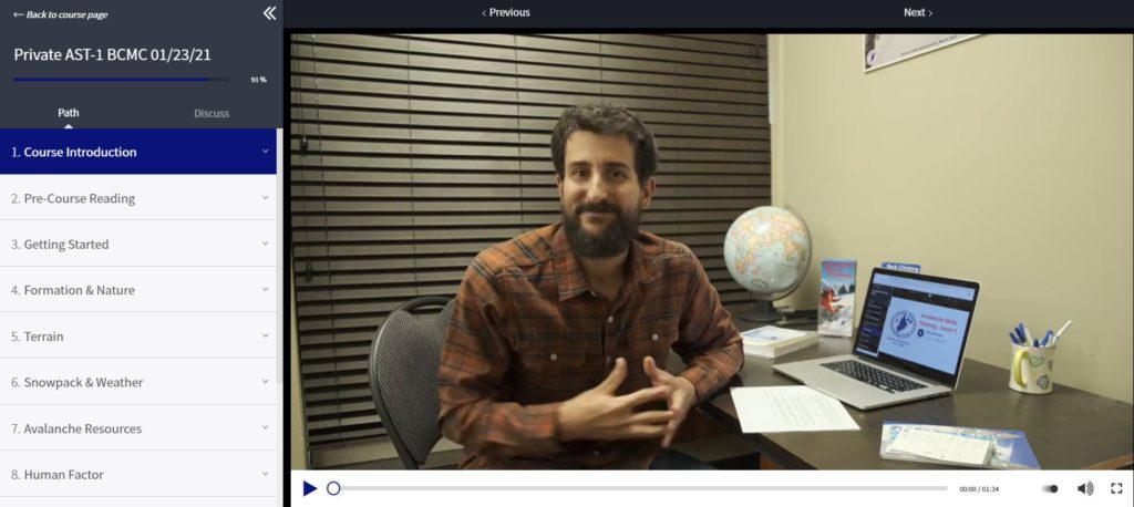
Brent Hillier was the guide for the virtual classroom. His videos are very engaging, and Brent does an excellent job of going through the basics. The virtual classroom covered a lot of topics and helped me prepare for the field sessions.
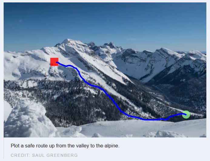
One of my favourite activities of the virtual classroom was to map a route for a given terrain. The goal was to find a path from the valley to the alpine by avoiding avalanche terrain. I would drag the cursor through different areas to see the risks and related details.


This exercise made me really think about different features on a mountain and assess avalanche hazards. Understanding the pros and cons of a forested area, runout zone, cornices, ridges, etc., was key to finding a safe path. Here is one of the safe routes –
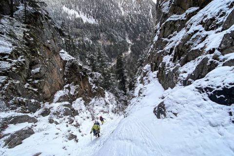
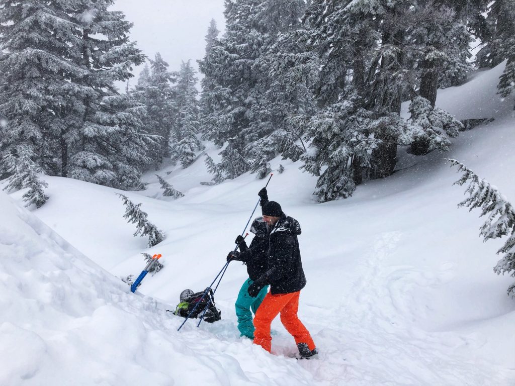
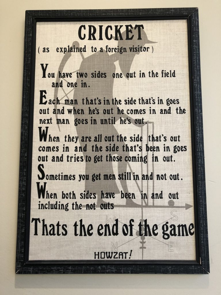
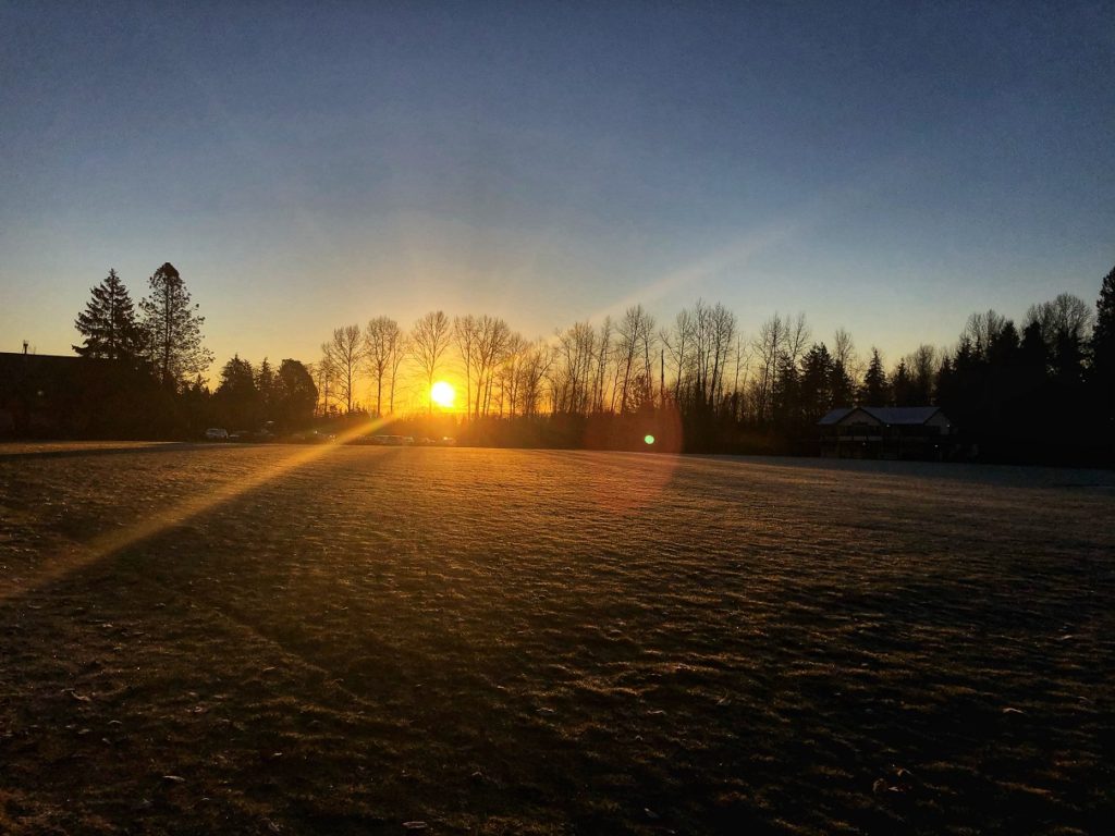
Day 1 – Field Session
Our first day of field session was at West Vancouver Cricket Club. The club started in 1955 and is one of the largest cricket clubs in Canada. As you enter the clubhouse, you see quite a selection of books related to cricket. On the top floor, there is an impressive collection of memorabilia.
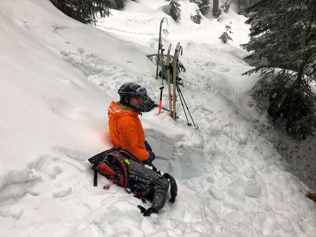
Richard Haywood would be our instructor for the AST-1 course. He handed out a bag with the waiver forms and Avalanche Canada AST handbook, and Avaluator trip planner. After filling out the forms, we were out on the field. It was a beautiful and cold winter morning.
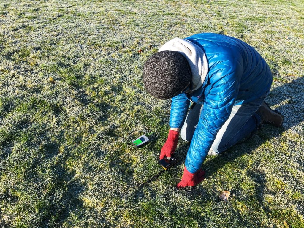
Transceiver
We started our session with the avalanche transceiver (beacon). In our group, we had a mix of BCA and Mammut Barryvox transceivers. I had borrowed the avalanche kit from Slawomir when we met last week for the Thunderbird Ridge hike.
Richard went over the basics of carrying a transceiver, different modes (off, send, search) and some of the best practices. We paired up and did some simple exercises to get comfortable with using the transceiver. I paired with Shawn for the AST-1 course. We took turns and started out with a coarse search 20 m away and then did a fine search to locate the transceiver.
Probe & Shovel
Next up was the probe. Here again, we had different models (BCA/G3), and each had a unique way of locking the probe after deployment. The most significant difference was the length of the probe and varied from 240 cm to 320 cm. Based on the snow level we measured the next day on Mt. Seymour, I think a 320 cm probe would be better for Coastal BC.
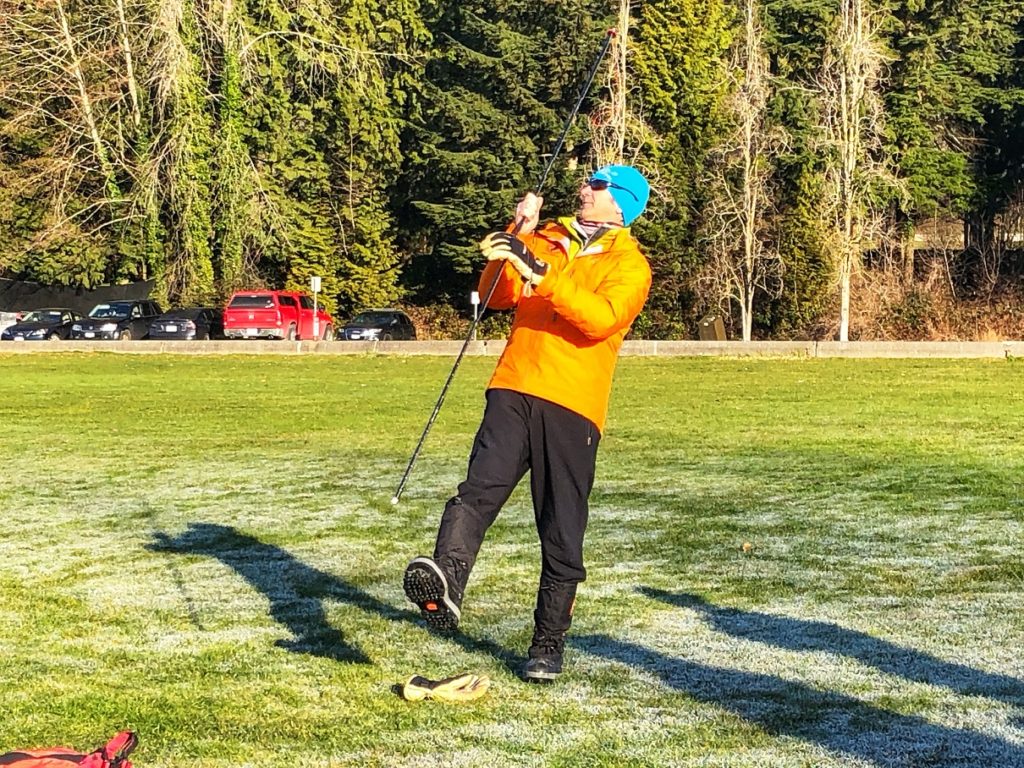
Richard explained the right probing technique – perpendicular to the slope and spiralling out from the fine search point. The key point was to leave the probe in once you have a hit and have identified the right spot. We obviously didn’t do any actual probing and just did some mock exercises.
Next up was the shovel. Relatively, the least technical but physically tiring aspect of rescue. Richard demonstrated the right shovelling technique (paddle) and highlighted the importance of taking turns every 45 seconds-1 minute.
After reviewing the gear, we packed everything up inside our backpack and did some mock rescue scenarios in a group of two and four. The field exercises had its limitations, but it was still helpful as we tried to assess the situation, coordinate with the group members, and execute each step. We wrapped day one of the field session around 11:30 am.
Day 1 – Zoom Session
I drove home to Langley and, after lunch, joined the Zoom session at 2 pm. On our call, we mainly reviewed the resources on the Avalanche Canada website and some other tools/websites that are helpful in trip planning.
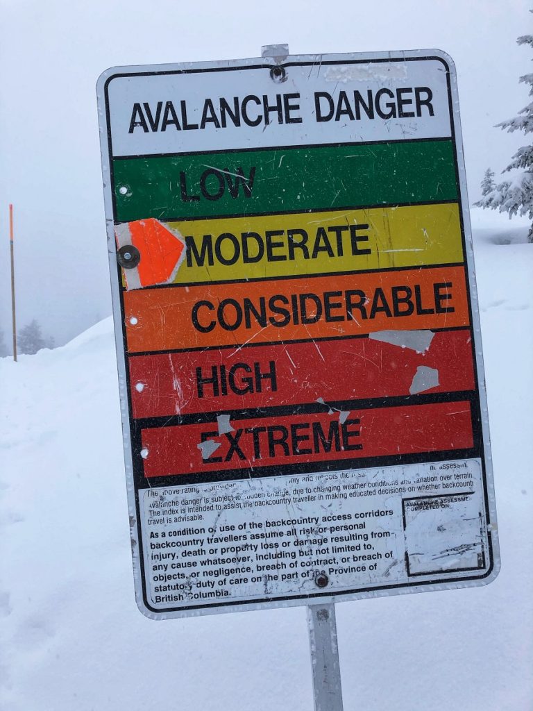
Avalanche Canada Tools
Richard walked us through the Avalanche Canada website, highlighting different regions for which the forecast was available. Then we zeroed in on the South Coast avalanche forecast covering all North Shore mountains.
The screenshots below are from Jan 24 (Sunday afternoon). Still, it provides a sample of information we reviewed on Jan 23 (Saturday afternoon).
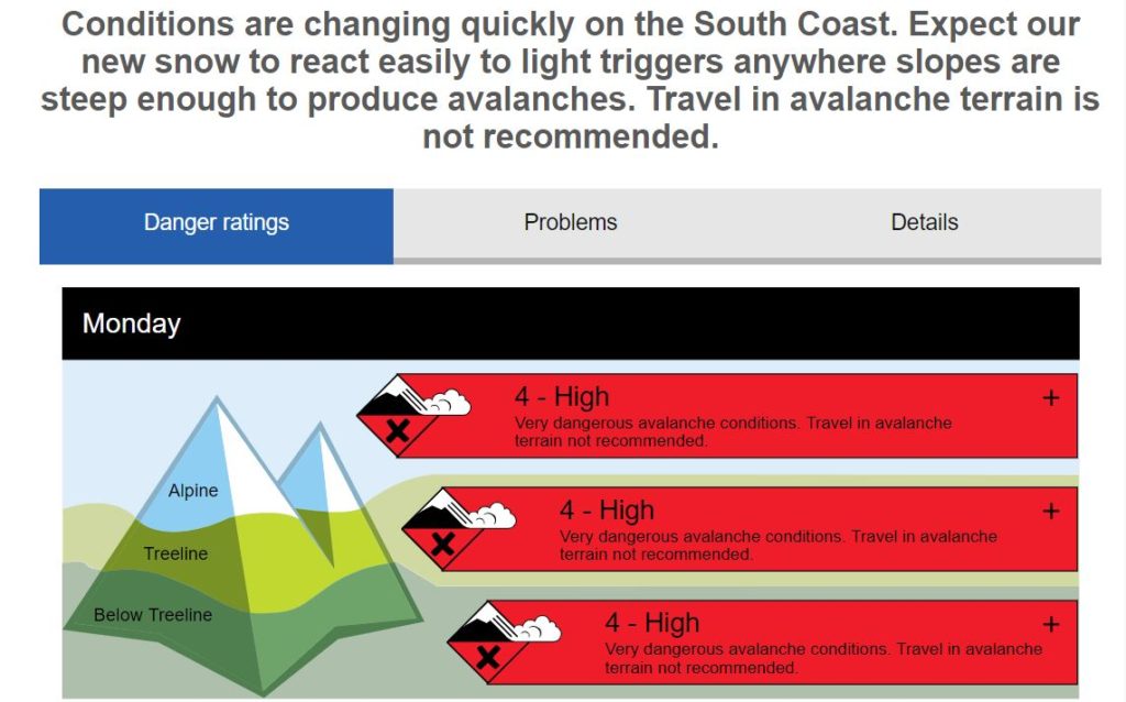
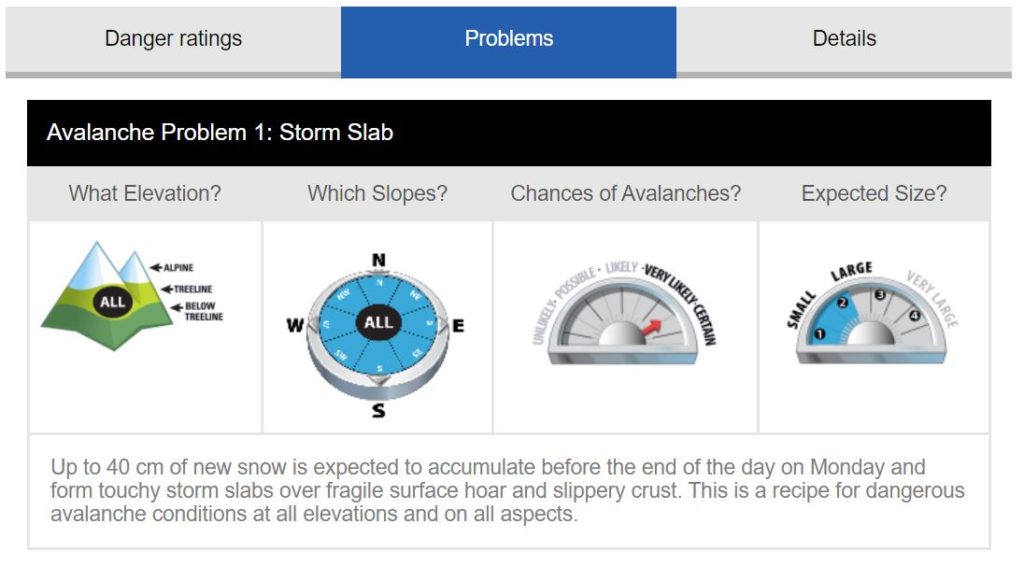
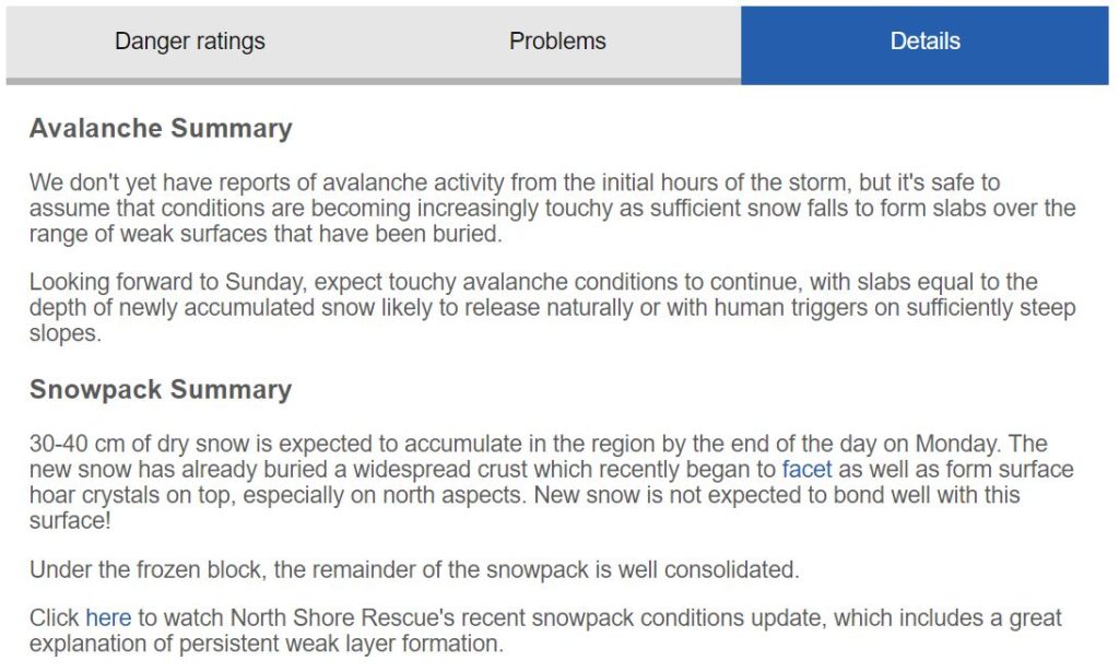
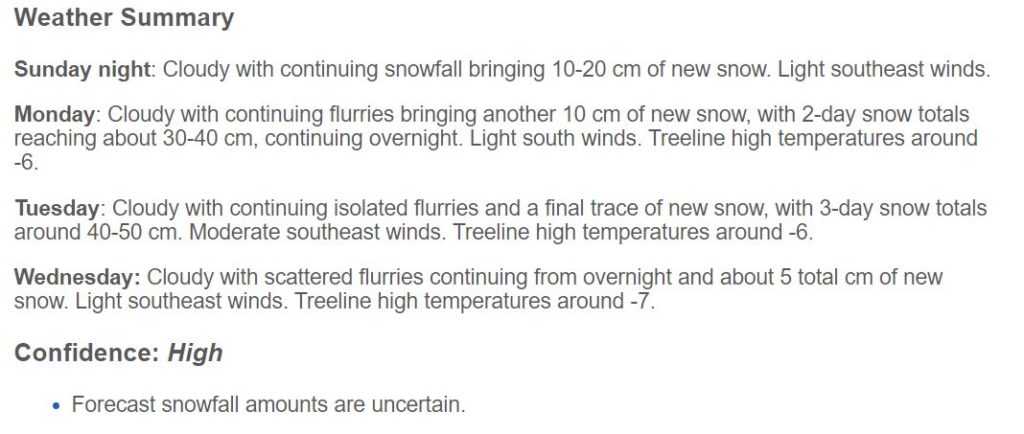
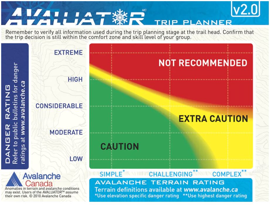
We also reviewed the Avaluator tool developed by Avalanche Canada. We used the questions on one side of the Avaluator to assess our plan for the next day on Mt. Seymour. The virtual classroom had covered the basics of danger ratings, slopes, snowpack, etc. Going through this forecast for South Coast and Avaluator tool as part of trip planning for our Day 2 session was very helpful.
Google Earth
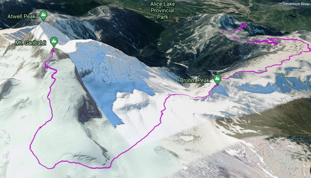
We also spent quite a bit of time reviewing Google Earth and how it can be used to get an overview of the terrain, assess terrain traps and plan a trip. I had actually used a combination of Google Earth and GAIA GPS for my Garibaldi climbing trip last year. It was really helpful in visualizing the climb.
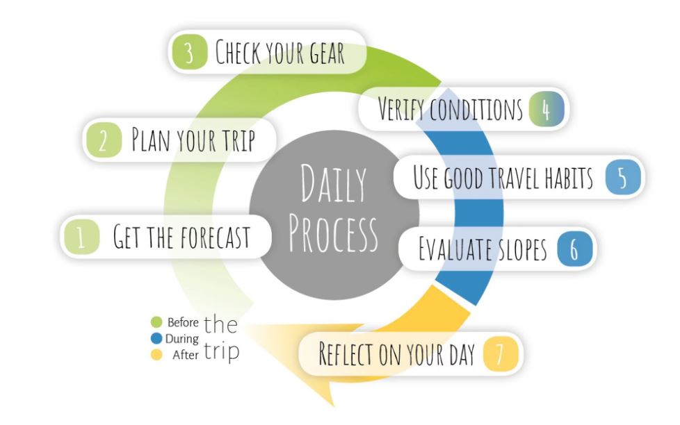
Now I could combine trail and terrain information with the avalanche forecast to plan my trip before heading out. Avalanche Canada highlights these items as part of The Daily Process.
Day 2
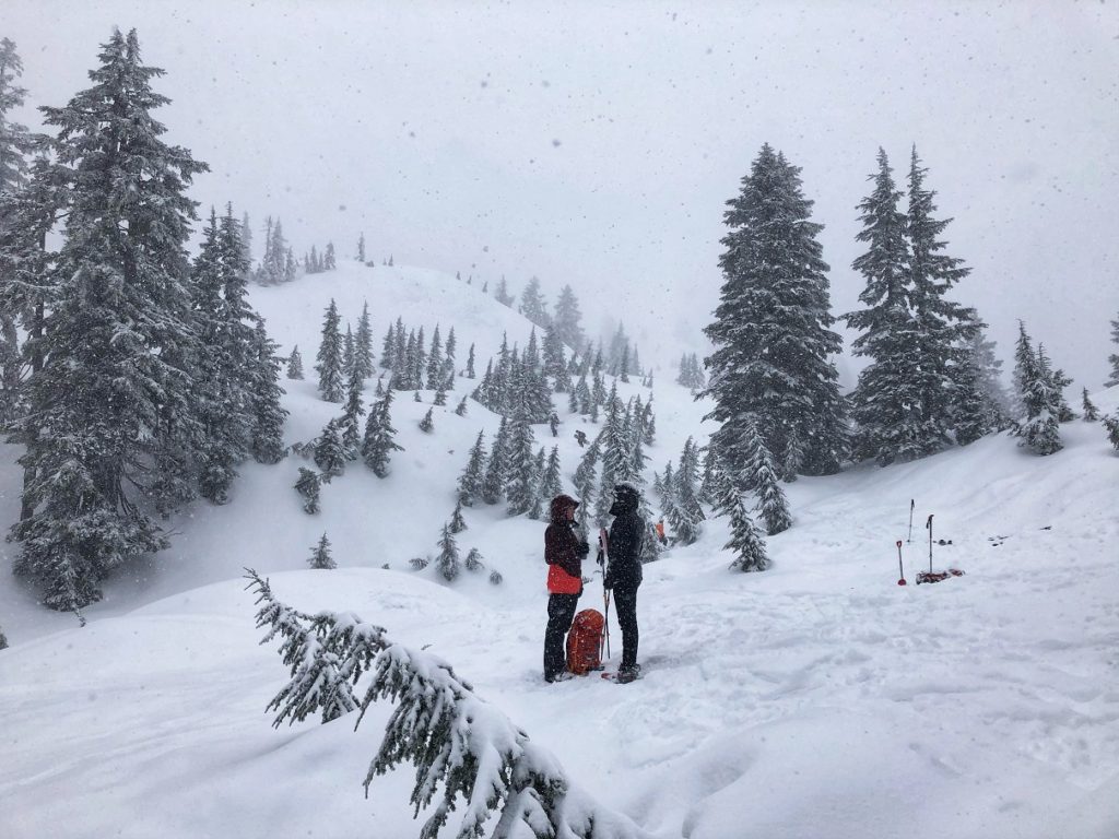
It was an early start on Day 2. I was up at 5 am, and after a light breakfast and tea, I drove to our meeting spot at the Parkgate Community Center in North Vancouver. Several groups were heading out for the AST-1 course with CWMS. Luckily, we got on the first shuttle at 6:50 am, and in 20 minutes, we were dropped off at Mt. Seymour’s upper parking lot.
After gearing up and a quick debrief, we were on the Mt. Seymour trail. Just past the trailhead, we did a quick transceiver check. One person would walk ahead, put the transceiver on search mode and then check for signal as others (with transceiver in send mode) passed one after another. The last person in the group would then check the first person.
Mt. Seymour Backcountry
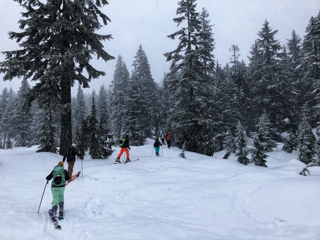
After about 20 minutes on the trail, Richard guided us into the backcountry. The terrain was relatively easy for snowshoers but was tricky for skiers.
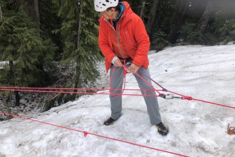
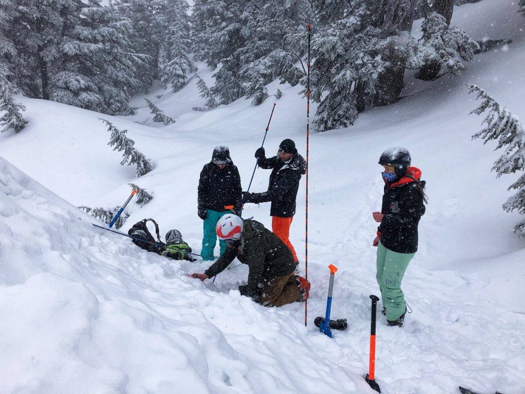
Soon, we took a break for our first exercise of the day. We paired up in groups of two and practiced shovelling, probing, and searching with the transceiver.


We also took turns in finding the transceiver buried by Richard. The slope angle added another complexity relative to a flat ground while doing the fine search and probing. Shovelling was obviously the hardest, and my paddling intensity would drop off within a minute.
Jalen did an excellent job of digging a snow pit, and Richard used it later to review the snowpack with the group. It was interesting to see different snow layers and characteristics (thickness, softness, etc.) of each layer.
Later, we made our way to Brockton Point by navigating the backcountry terrain just west of the Mt. Seymour trail. We were split into two groups – snowshoers (Madeleine, Dana, Shawn and Shashi) and skiers (Richard, Catherine, Jalen, Woo-Ree and Clinton). Here again, as the terrain got steeper, it was relatively easy for snowshoers to hike up.
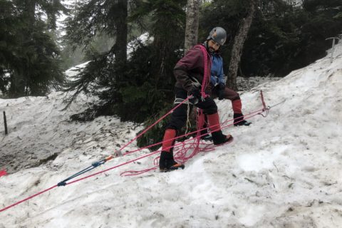
Just past the Brockton point, we took another break for our second exercise of the day. We would now practice companion rescue scenarios as a group.
Companion Rescue – Group Practice
Our group was up first. Richard played the role of a confused hiker who had just been in an avalanche. We asked Richard a few questions and did an initial scene assessment. Richard had a concussion and didn’t know how many of his “friends” were buried.
With our transceivers on search mode, we spread out and started the search. We all picked up a signal from a nearby slope. As I got closer, I let the group know that I would be doing the fine search and asked Madeleine to take out the shovel and probe.
While two of us were digging at the first site, Shawn and Dana’s transceiver kept pointing them back to the first site. Even after marking the first site, the signals were confusing. That’s when Shawn asked Richard, who was standing nearby, if he had his transceiver in send mode. He did, and after he switched it off, we were able to locate the second transceiver.
Digging the second transceiver out took a lot more effort, and we could have done a better job of rotating the shovelling at the front. The second group did a much better job of spreading out for their search. They were able to identify the two sites immediately and start the fine search.
After we finished companion rescue practice, we were back on the trail heading down. It had been snowing since morning, and now we had a fresh layer of snow of at least 10 cm.


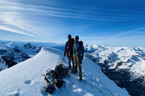
Throughout the day, Richard encouraged us to go off-trail and feel the snow below our snowshoes/skis. This forced us to regularly assess the terrain and watch out for terrain traps. By the end of the second day, I was more aware of the hazards and felt better prepared in my ability to head out in the backcountry. I only wished I had taken this course earlier.
Canada West Mountain School
By 3 pm, we were back at the parking lot. As we were waiting for the shuttle, Richard shared his experiences from different trips. One of the trips he mentioned was when he and Brian (owner of CWMS) supported Christopher Kennedy and Whittaker brothers on their attempt to climb Mount Kennedy. Just a few weeks back, I had watched this documentary, and it was pretty cool to know that Richard had been on that trip.
I had a fantastic experience with the AST-1 course and learned a lot. After Intro to Wilderness First Aid, this was my second course with Canada West Mountain School. The school did a great job with their virtual classroom, planning and communication. Our instructor Richard Haywood was excellent and would recommend Canada West Mountain School for AST-1 course.
Have you taken the AST-1 course? Do you have any questions about AST-1? Let me know in the comments below.
Resources:
Canada West Mountain School – AST-1 Course on Mt. Seymour
Avalanche Canada – Forecast | Avy Savvy – Online Avalanche Tutorial | Recorded Webinars
Weather Forecast – SpotWx | Mountain-Forecast
AdventureSmart – Trip Planning
If you are in Lower Mainland, check out British Columbia Mountaineering Club (BCMC) for trips and courses.
Disclosure: I am a member of BCMC. I am not affiliated with any of the other organizations.
Did you enjoy reading this post? Please subscribe to get weekly updates. Thank you!