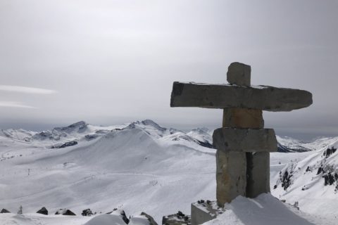
Brockton Point (1265 m) in Mount Seymour Provincial Park is a beginner-friendly backcountry skiing objective in North Vancouver. To reach Brockton Point, one skins up the Mount Seymour Trail and then skis down a combination of Mount Seymour Resort runs to return to the parking lot.
Brockton Point is a beginner-friendly objective because the access is via a well-used winter trail, is short (<1.5 hours return), skiing is on groomed runs and has relatively low avalanche hazards. I say relatively low avalanche hazards, as any backcountry travel carries risks, and one should never underestimate them. Take an AST-1 course to better understand and manage the risks.
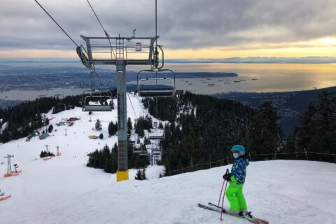
I have been to Brockton Point multiple times over the last three years. For this post, I am using a combination of photos from different trips (Hidden Lake, Pump Peak) in this area when I went to Brockton Point.
Avalanche Forecast
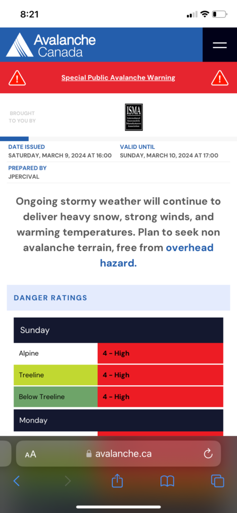
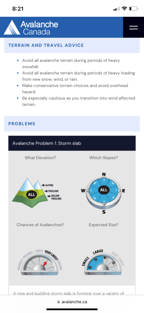
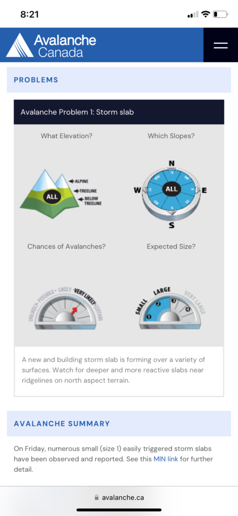
My last trip to Brockton Point was with Jesse on March 10, 2024. The danger rating for the North Shore and the Sea to Sky region was high, so we made a short trip to Brockton Point, avoiding avalanche terrain.
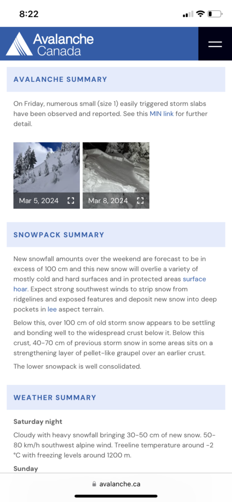
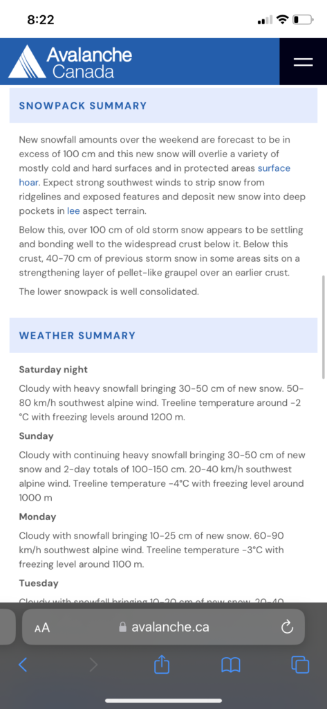
Avalanche.ca forecast for March 10 for the region –
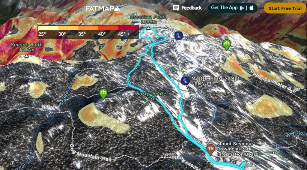
Our route to Brockton Point on FATMAP with an overlay of Avalanche Terrain –
Mount Seymour Trail
In 2024, we needed a BC Parks Day-use vehicle pass for backcountry access on Mount Seymour. Parking lots P1 and P5 are designated for backcountry users.
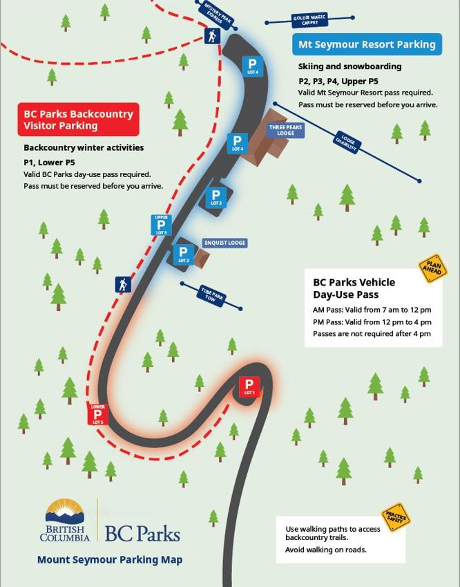
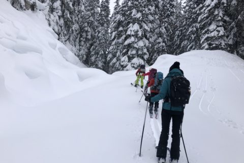
We arrived at Mount Seymour around 7:30 am and parked in the P5 lot. Once we got our gear sorted, we got on the groomed pathway along the road and made our way to the trailhead. From the start of the P5 parking lot, it is about a km to the trailhead.
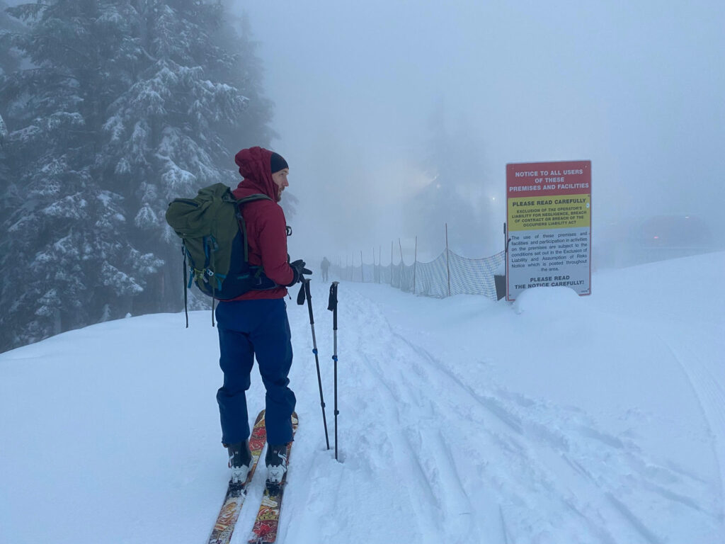
After a quick beacon check at the trailhead, we continued on the Mount Seymour Trail. It had snowed recently, and the conditions were great. The winter trail is well-marked and easy to follow. There are some short and steep sections where I had used the heel risers in the past, but today, I didn’t have to.
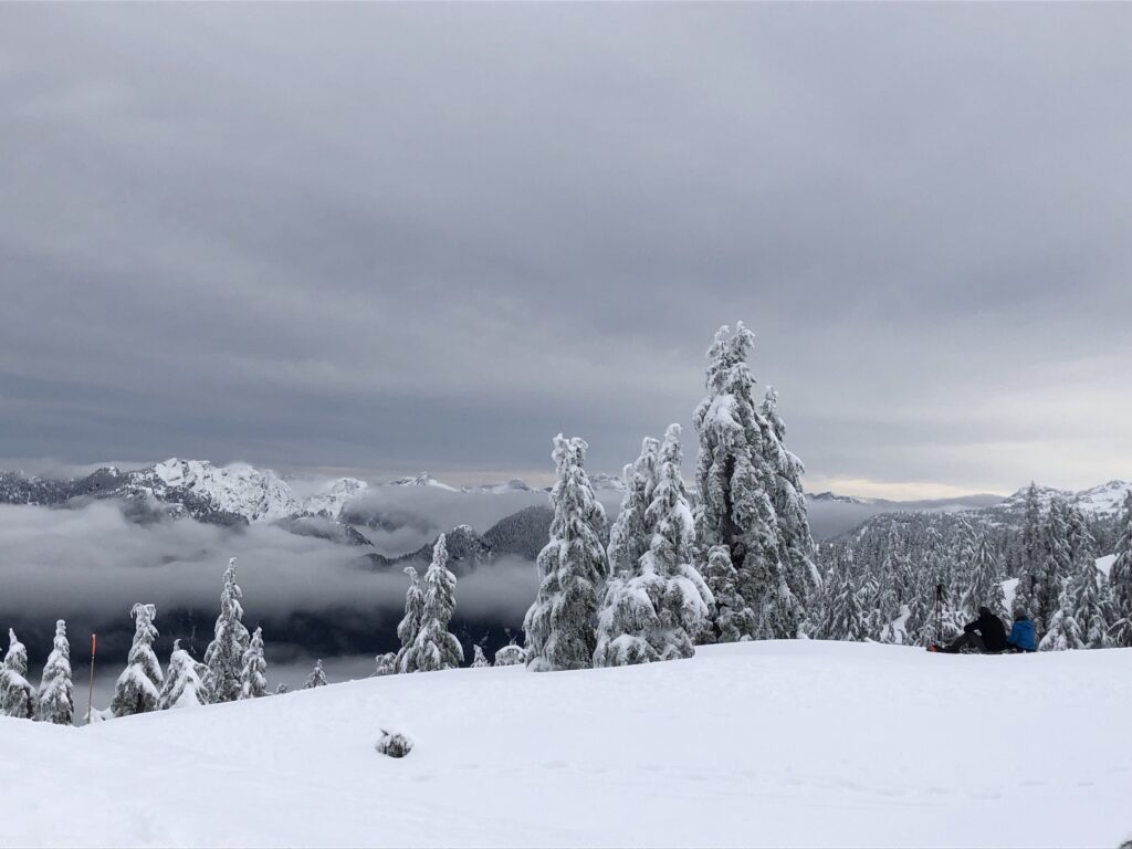
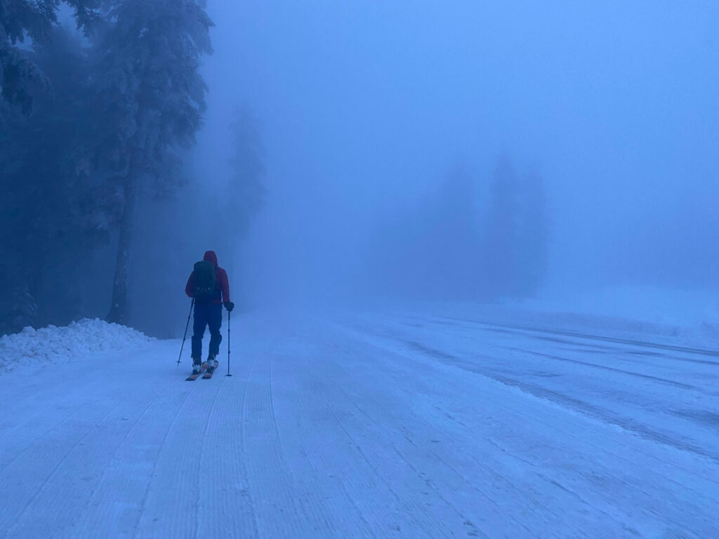
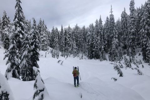
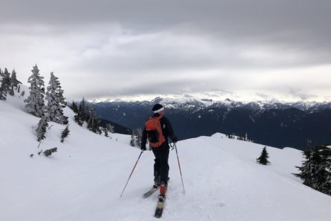
From the trailhead to Brockton Point, it is just over 250 m vertical over two km and took us about forty-five minutes. The visibility was low, but here is a picture from a previous trip –
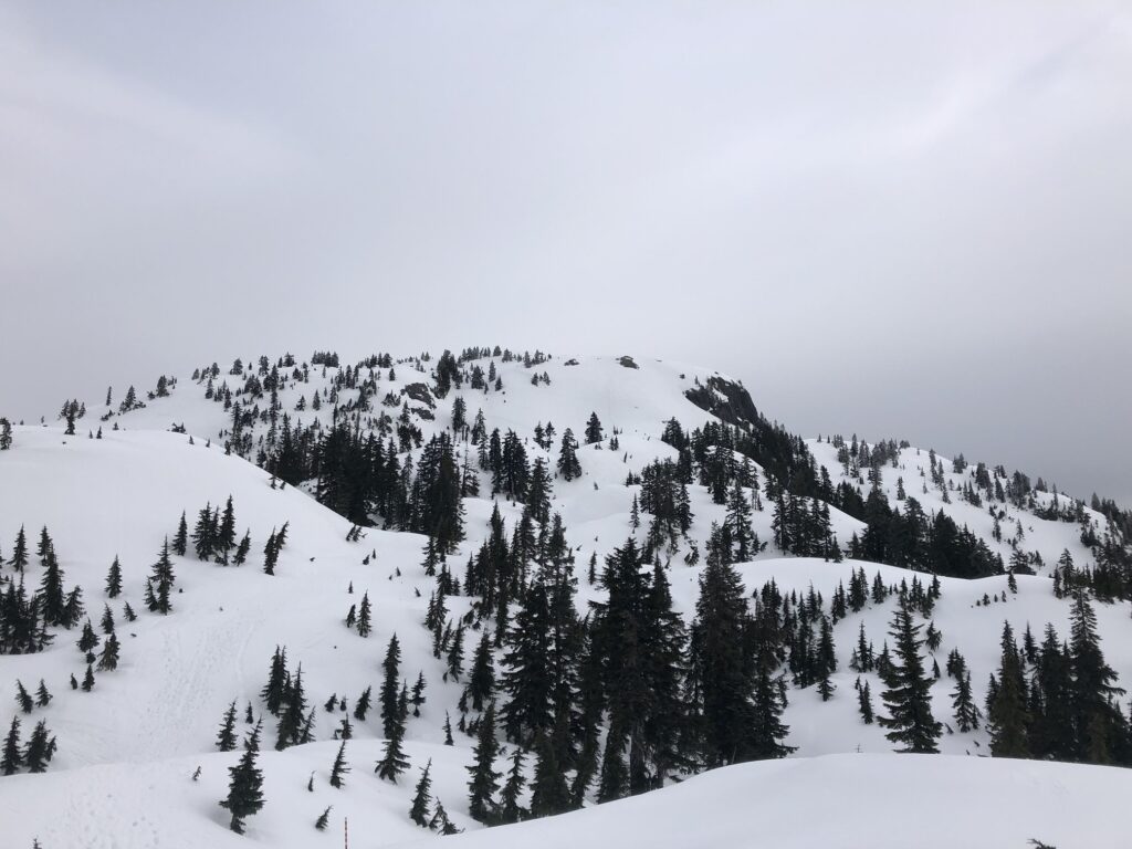
I had been to Pump Peak in the past, but the avalanche hazards were too high, so we had planned to visit just Brockton Point today. The next day, a friend shared the North Shore Rescue Facebook post about a snowshoer who triggered an avalanche on South Face of Pump Peak. She was buried for 15 minutes but luckily, she survived.
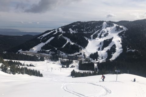
After a short break, we transitioned to ski mode and connected to the ski runs south of Brockton Point. We skied down a combination of different runs – Brockton Gully, Manning and Elevator Shaft. In less than 15 minutes, we were back at the trailhead.
Territory Acknowledgement
I would like to acknowledge that this trip took place on the unceded territory of the Coast Salish peoples, including the territories of the xʷməθkwəy̓əm (Musqueam), Skwxwú7mesh (Squamish), Stó:lō and Səl̓ílwətaʔ/Selilwitulh (Tsleil-Waututh) Nations. I commit to learning about Indigenous peoples and issues and making reconciliation an ongoing effort.
Source: Native-Land Pronunciation Guide: First Nations.info
Resources:
Mount Seymour – BC Parks | Mount Seymour Resort
Avalanche Canada – Forecast | Avy Savvy – Online Avalanche Tutorial | Recorded Webinars
Weather Forecast – SpotWx | Yr.No
AdventureSmart – Trip Planning
Disclosure: The links I have shared in the post and under the Resources section are not Affiliate Links.
Did you enjoy reading this post? Please subscribe to get weekly updates. Please share your feedback in the comments section below. Thank you!
Hi Shashi,
I stumbled on this blog post while I was trying to find info on backcountry skiing at Mt.Seymour. Really great to read through your other posts! I used to climb a lot outdoors (trad/sport) back when I was in California. I ski a lot as well, mostly inbounds but am looking for experienced people to ski in the back country (did AST 1 couple of season ago). I ski Whistler more or less every weekend. Stoked to hear from you.
Cheers,
Aditya
Aditya – thank you for your note. I ski on Cypress every Saturday. Let me know if you can join and we can coordinate.
Yeah sounds good. I believe you’ve my email, can you ping me so we can co-ordinate?