Since last year, I have been using a word document to put together a plan for my alpine climbing trips. My climbing partners found it helpful, so I thought I would share my approach with a few others through this post. I am not an expert, and likely there are elements of planning that I have missed. I would love to hear your thoughts in the comments.
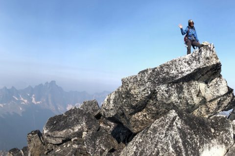
Some climbers do this intuitively, but I find it valuable to break down different aspects of climbing and document them. It also helps communicate the overall plan with the group and discuss it before the trip. For this post, I will use my recent Wedge Mountain trip as an example and the planning I did before the trip.
Route
By the time I am preparing this document, the route we will take has already been finalized based on discussion with the group. So I won’t go into the route selection process.
Mountain: Wedge Mountain
Elevation: 2903 m
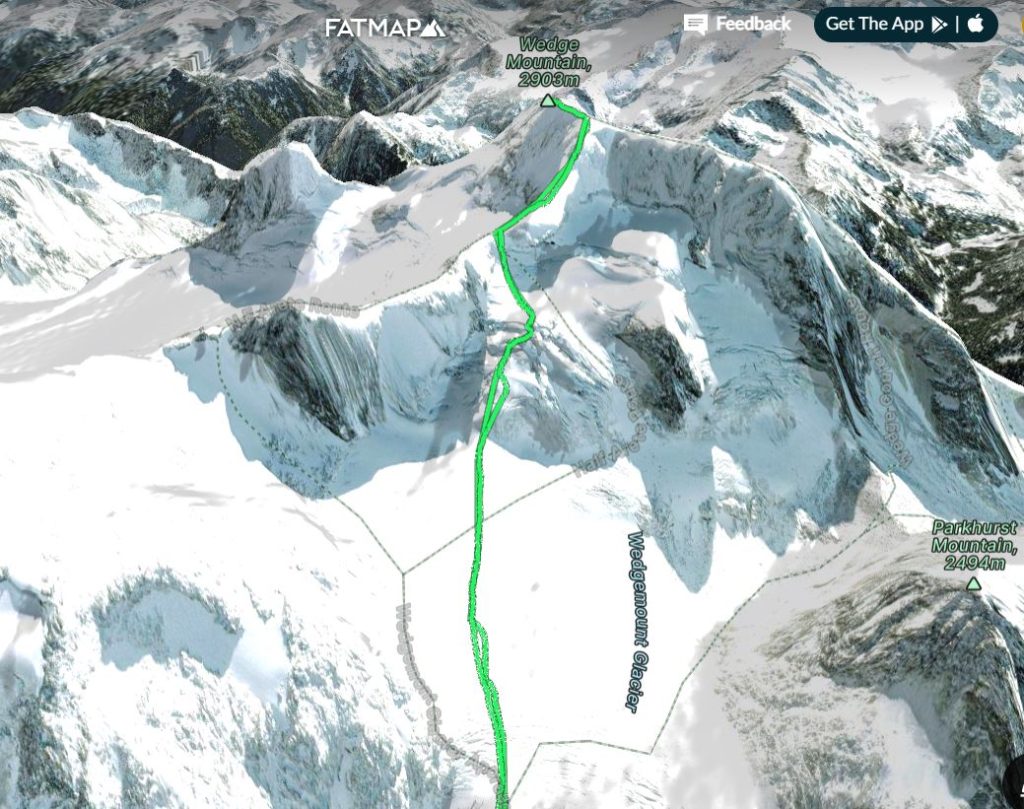
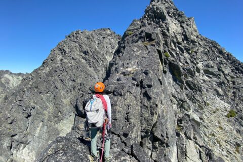
Route: North-East Arete
Alpine Select (guidebook) briefly describes the route and the approach.
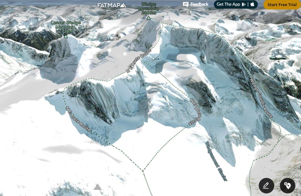
FATMAP
I like using FATMAP to visualize the route and use its different Terrain Overlays, e.g. Aspect, Avalanche. If I have the GPX file from a previous trip or some other trip report, I will import the file to FATMAP. For popular climbs, FATMAP might already have the route on the map.
All the features I am using with FATMAP are free and do not need a Premium (Explore) Membership. Check out the FATMAP How To videos on youtube that might help if you are new to this tool.
Basemap (Summer or Winter) – provides a good overview of the climb and different features along the route.
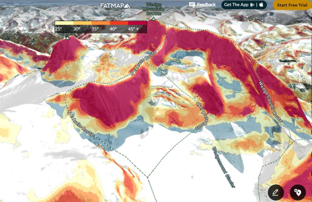
Terrain Overlays – Avalanche – helps to identify avalanche terrain along the route.
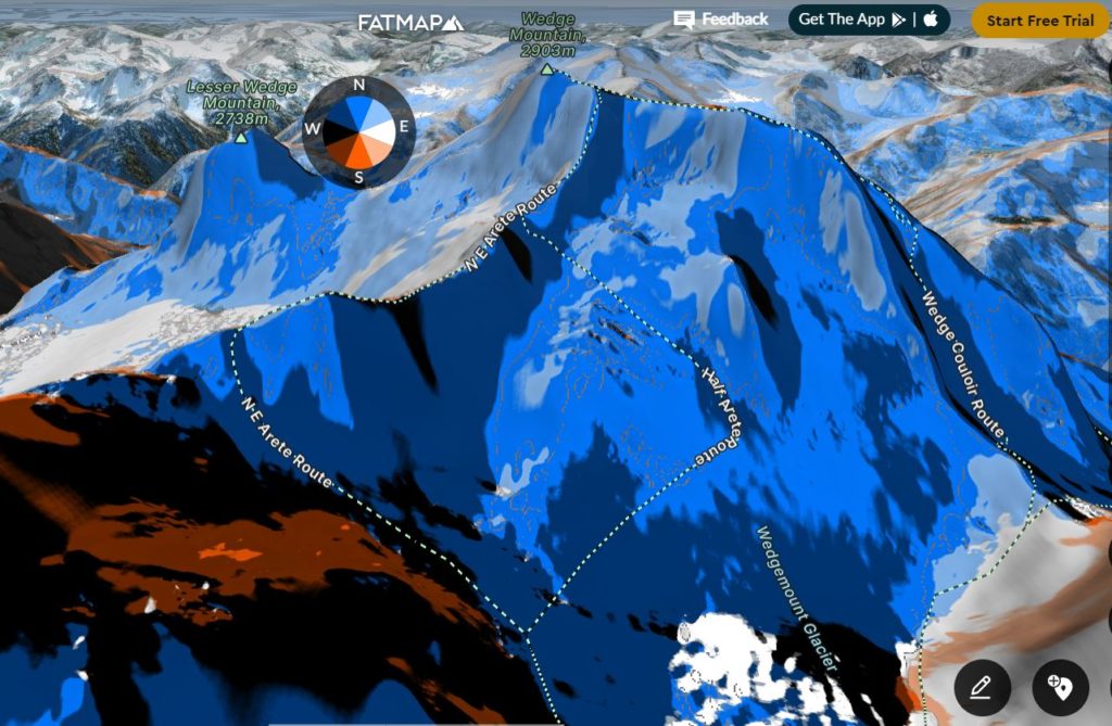
Terrain Overlays – Aspect – helps plan the climb and understand what aspect we will be on early in the climb vs. later in the day and how the sun will impact our ascent/descent.
I like using GAIA during the climbing trip. Typically, I will download the region map (premium subscription required) we will be climbing in and import any relevant GPX tracks. Then, I can have the phone in airplane mode (offline) and still track my progress on the route or see the location on the map.
My friends have also used CalTopo and had a good experience with it. Finally, Bivouac is another tool (premium subscription required) I have used to read trip reports and get GPX files in the past. It has a great trip database but is not user-friendly and lacks more recent trip reports.
Weather Forecast
I use the ‘Funnel Approach’ described in the Avalanche Canada webinar (see below) for the weather forecast. So I start with the big picture of what is happening in the region – British Columbia in this case.
Mountain Forecast on Avalanche Canada provides a good synopsis. Here is the data from June 24 –
The shift into summer is happening now.
As our stalwart upper low characteristic of “Junuary” quickly disappears to the east, a building ridge of high pressure is ready to take its place. This will lead to a sunny day across most of BC today. Expect dramatically rising freezing levels and temperatures to 5-10 degrees above seasonal values by Sunday and Monday. In some places, the combination of recent rain followed by increased runoff due to warming will lead to rising streams and rivers. On the other hand, on the outer periphery of the ridge, the Liard Basin will remain vulnerable to more precipitation this weekend, followed by mild (but not dramatically warm) conditions on Monday.
Then I look at the commentary specific to climbing days – June 26-27 (Sun-Mon) in this case –
The ridge of high pressure remains dominant over BC and the Yukon. Freezing levels will range from 3000 metres in the north to 4000 in the south, and daytime highs will reach 5-10 degrees above seasonal values both Sunday and Monday with mostly sunny days. The only exception is the Liard Basin, where showers are likely on Sunday with freezing levels between 2500 and 3000 metres.
Once I have a rough idea of the weather pattern, I use Yr.No and SpotWx.com to review the weather specific to the mountain.
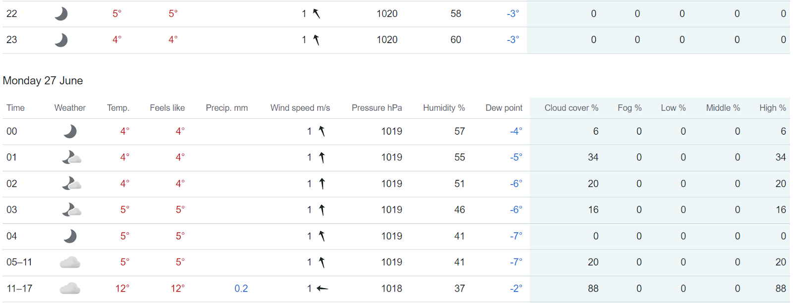
Yr.No forecast for Wedge summit (2903 m)
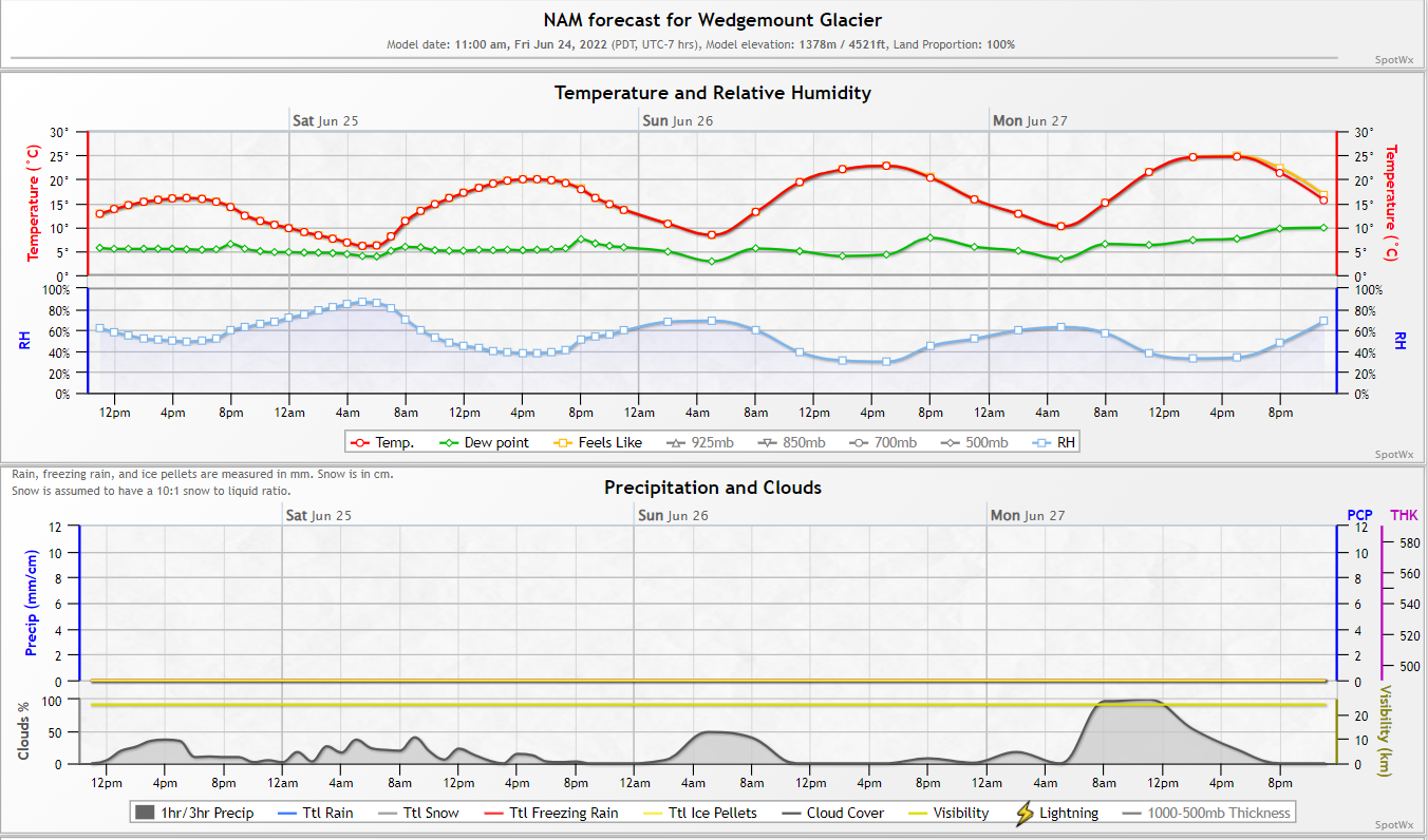
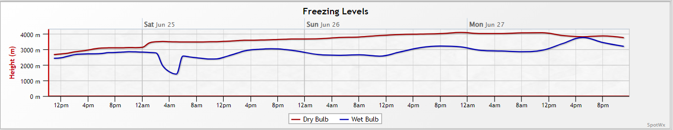
SpotWx.com has different models that you can use. Three days out, I am referring to the NAM model –
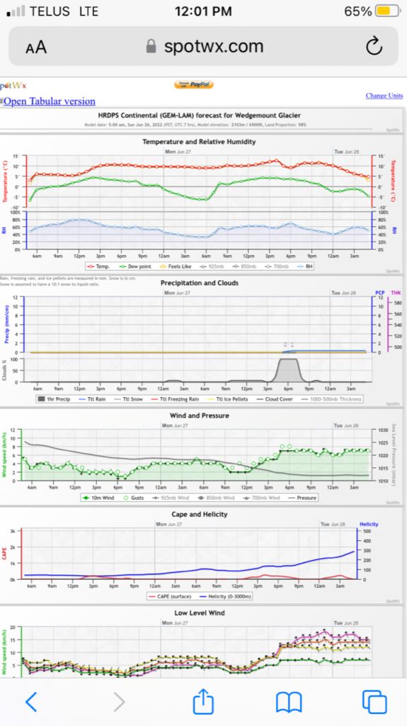
A day before the trip, I am typically looking at the HRDPS model (high resolution – 2.5 km) –
Windy.com is another weather forecasting application that helps in comparing forecasts across models.
Avalanche Risk
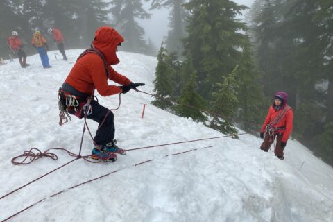
I took my AST-1 in 2021, and since then, I have been reviewing avalanche risks before a winter/spring/early summer trip. In winter, Avalanche Canada does a fantastic job of providing a daily update on avalanche risks with danger ratings across Canada.
In Spring, the danger ratings are replaced with the “spring conditions” icon – highlighting that the conditions might vary throughout the day depending on temperature. This year, we still have spring-like conditions on the mountain, and I used two tools to assess avalanche risk.
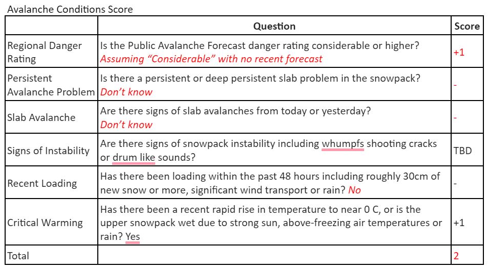
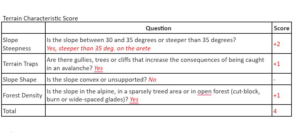
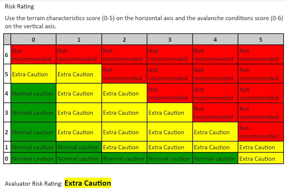
The first one is Avalauator – a tool developed by Avalanche Canada and shared during my AST-1. This tool has two components – Trip Planner and Slope Evaluation Card. VOC has a table that uses the Avalautor model and plots the score from Avalanche Conditions and Terrain Characteristics to get a danger rating. Here is what I had for the Wedge trip before we left and then assessed some unknown factors once we were on the mountain –
The latest tool from Avalanche Canada is Dangerator. It’s used when a forecast is not available from Avalanche Canada. It’s a simple but effective tool to assess avalanche danger.

Based on the weather forecast, we didn’t expect any critical loading but critical warming was a factor that resulted in a “High” avalanche danger rating.
Recent Trip Reports
The next step was to see if there were any recent trip reports from the area. Here are the few places I look for any recent reports –
Instagram – If it is not on Instagram, it didn’t happen. Just kidding!
I searched for #wedgemountain #wedge #wedgemountglacier #wedgemountlake and found one post from June 15. There was no description, conditions, etc. but assuming it was from a recent trip, the conditions looked good.
Searching for nearby mountains/peaks or the park, e.g. #mountweart #parkhurstmountain #garibaldiprovincialpark, might also help.
Online forums/Facebook groups – South Coast Alpine Climbing can have detailed trip reports and updates with pictures from its members.
Mountain Conditions Report – from ACMG guides. You can also access these reports through the ACMG Facebook page. These reports are excellent and have all the information you need about the area or a particular climb.
Trip Plan
With the information I had collected, I knew we would have some clear days ahead. However, even overnight, the freezing level does not drop below 3000 m (the Wedge summit is at 2903 m) and will be warm.
There is still a good chance that we will be able to make the summit if we start early and the conditions turn out to be better than we expected. So we decided to go and see what the conditions were on the mountain.
With that in mind, here is the tentative plan I had for Wedge –
Sunday PM: Hike to Wedgemount Hut (3-4 hours)
Monday AM: Alpine Select provides a range of 5-8 hours for the return trip from the hut. With warm temperatures and soft snow, it might take longer.
Time Range – Our location
1-2 am – Leave Wedgemount Hut
5-6 am – Mt. Weart-Wedge Col
7-8 am – Summit
11 am – 12 pm: Back to Hut
4-5 pm – Back to the parking lot
Emergency Plan
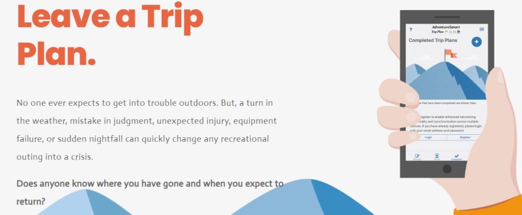
I also created a trip plan using BC Adventure Smart and sent it to all trip participants and their emergency contacts. In case of emergency i.e. we were not back by Monday night, the plan had all the information about our group, vehicles, trail, climbing route, equipment, etc.
Based on our previous trips, we knew we could get network at the lake (and even had it on the summit), but I still carried a Garmin inReach mini.
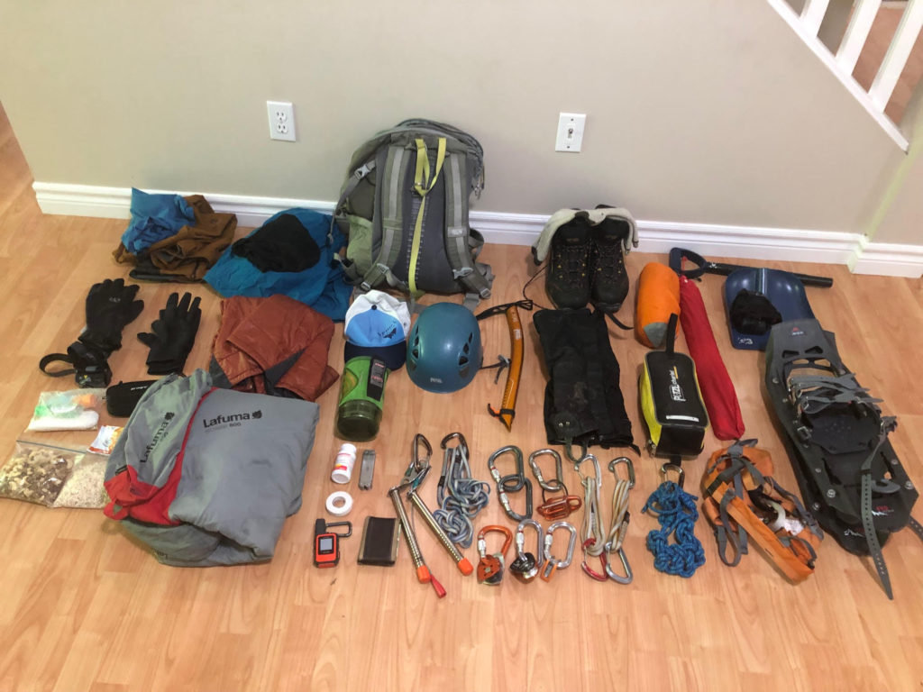
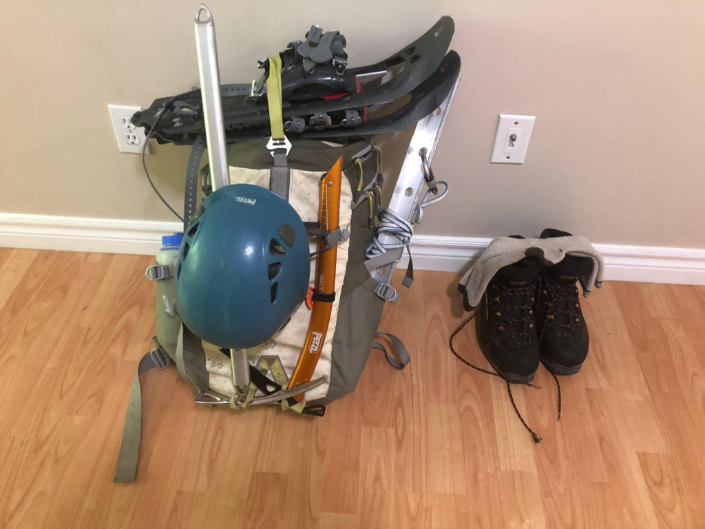
Gear List
Finally, it was time to put together a gear list and pack our bags. Here are some examples of gear lists that you might find helpful –
Fortunately, Rohan already had an online list from our Sky Pilot trip, and I just edited it for this trip. Given the conditions, we decided to carry Avy gear and snowshoes.
When it comes to packing, I found Steve House’s video very helpful –
Post Trip Update
Fortunately, the conditions were much better on the mountain than we expected, and we had a fantastic day. Here are my comments after the trip –
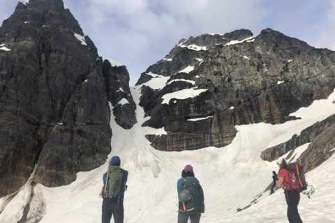
Sunday PM: Started from the parking lot at 4:30 pm and reached the hut around 7:45 pm. Used snowshoes for the steep climb to the hut. Talked to skiers who reached the summit the previous day and they recommended starting early, conditions were soft even after 6 am. Some parties who started at 3 am, turned around due to unfavourable snow conditions.
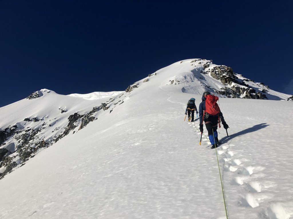
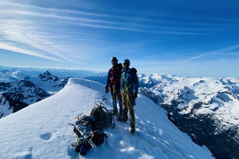
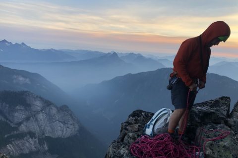
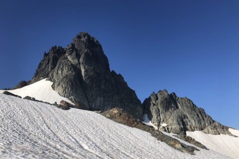
Monday AM: Got up at 12 am and left the hut around 1 am. Roped up close to Tupper Lake an hour later. We decided to go up the Half-Arete route (ended up east/left of the Half-Arete route) to save time. Varying snow conditions throughout the route. Reached the ridge just below the arete at 6 am, an hour past our turnaround time for this point. But the conditions were better than what we expected and decided to continue. For the final arete climb, steps were kicked in by the party from the previous day and it really helped. Summit at 7:30 am. Snow was soft on our descent and any later start would have made it challenging.
Got back to the hut at 11 am and then started the hike down around 12:15 pm. Back at the parking lot by 3 pm. If I was to do this again in similar conditions, would probably leave at midnight.
Route: (Tracked on the Coros watch and then imported the GPX file into GAIA, distance/elevation gain might not be accurate) – GAIA GPS link
As we drove back from the trip, Anna mentioned that a debrief about the trip at the parking lot would have been great. We didn’t do it, but here is a good template from Alpine Mentors (based on the AMGA evaluation form) you can use after your next trip.
Resources:
Route Planning: FATMAP | GAIA GPS | CalTopo
Trip Planning Basics: Ortovox
Weather: Mountain Weather Forecast – Avalanche Canada | Yr | SpotWx | Windy
Avalanche Risk Assessment Tools: Avaluator | Dangerator
Recent Trip Reports: South Coast Alpine Climbing | Mountain Conditions Report – ACMG
Alpine Principles: Video Series
Leave a Trip Plan – Adventure Smart
Disclosure: The links I have shared in the post and under the Resources section are not Affiliate Links.
Did you enjoy reading this post? Please subscribe to get weekly updates. Please share your feedback in the comments section below. Thank you!
Good collection of resources Shashi. I also spend some time checking gear – battery status on spots, beacons, lamps, cameras. Core shots on skis that need repair, skins, is my belay device on the right harness, etc. packing for a winter trip I also make sure I have a jump starter (battery pack), traction devices in the truck and a solid shovel to dig myself out.
Thank you Prakash for your feedback and for sharing some great points. That reminds me I have to take the batteries out from my beacon 😉