The weather looked promising for July 10-11 weekend for an alpine trip. I first considered the standard Northeast Spur (PD+, ice/snow) route up Mount Matier, but Lily suggested we look into some multi-pitch routes. Southwest Buttress (AD+, 5.7) was one option, but we finalized the West Buttress (D, 5.9). Based on the reports, West Buttress had better quality rock and better protection for the climb.
Lily reached out to her network and got some great beta on the route and conditions. We planned to hike up to Anniversary Col Friday evening. Then, Saturday morning, we would traverse across the glacier to the base of the climb. We would climb seven pitches on West Buttress, scramble the ridge to get to Mount Matier summit, and then come down the Northeast Spur route. Then, hike back to the car before it gets dark Saturday evening.
Gear
This climb is rated the same as that of the Nesakwatch North Spire Southwest Ridge climb on the Alpine Rating scale. However, the glacier travel and a higher camp added more gear to the pack.
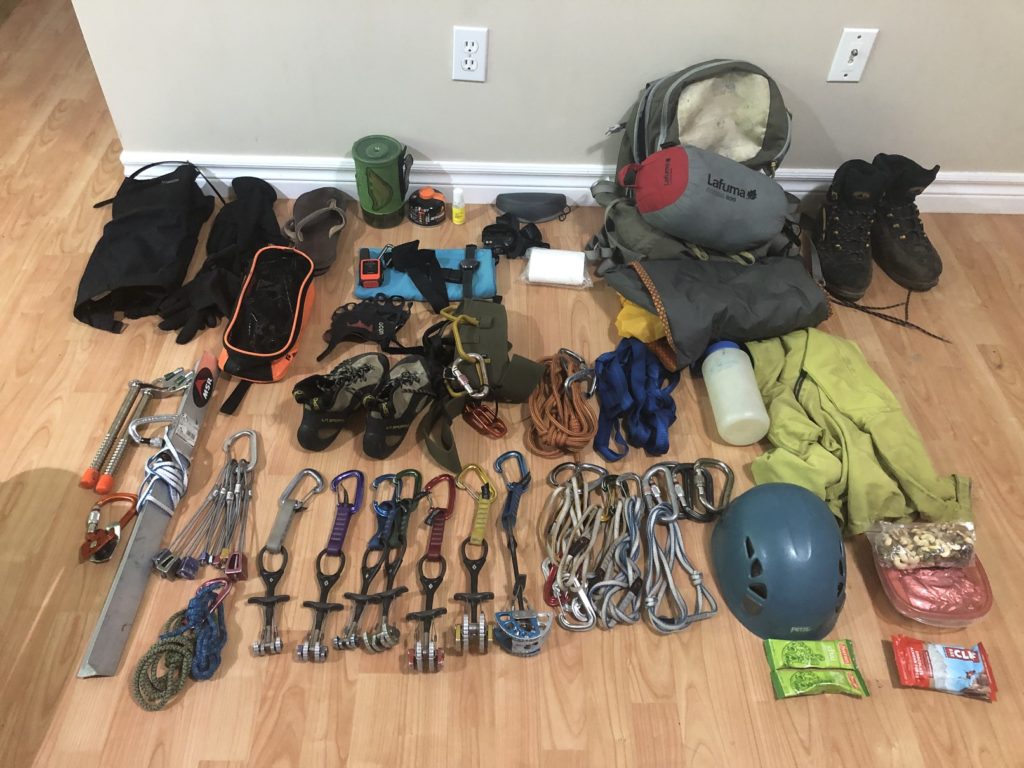
Without the rope, the pack weighed about 25 lbs. and was able to fit everything in my 35L pack. I would be borrowing a lighter Petzl Ice Axe and an emergency bivvy bag from Lily.
Cayoosh Creek Crossing
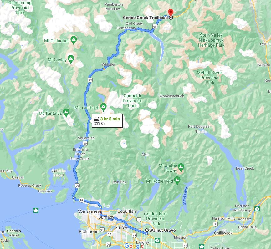
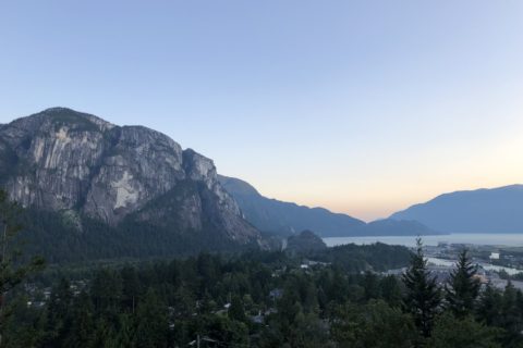
I took half a day off on Friday and left home around noon. I picked up Lily from North Vancouver, and after a brief stop in Whistler, we continued our drive to Cerise Creek trailhead (roadside parking).
It was around 3:50 pm by the time we started our hike. Within a few minutes, we were at the Cayoosh Creek crossing. The creek appeared to be more than knee-deep, and we briefly looked around to see if there was another option to cross the creek. Lily had shared pictures of someone attaching themselves to the cable by a carabiner for the crossing, but it seemed like a lot more effort.
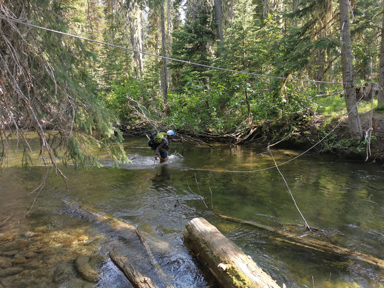
We decided to wade through the creek. I took off my boots and pants and tied them to my pack. The water was cold but not bad compared to freezing Upper Joffre Lake. The creek flow was not too bad, but I grabbed the rope tied to the cable for balance. At one point, the water level was almost two and a half feet.
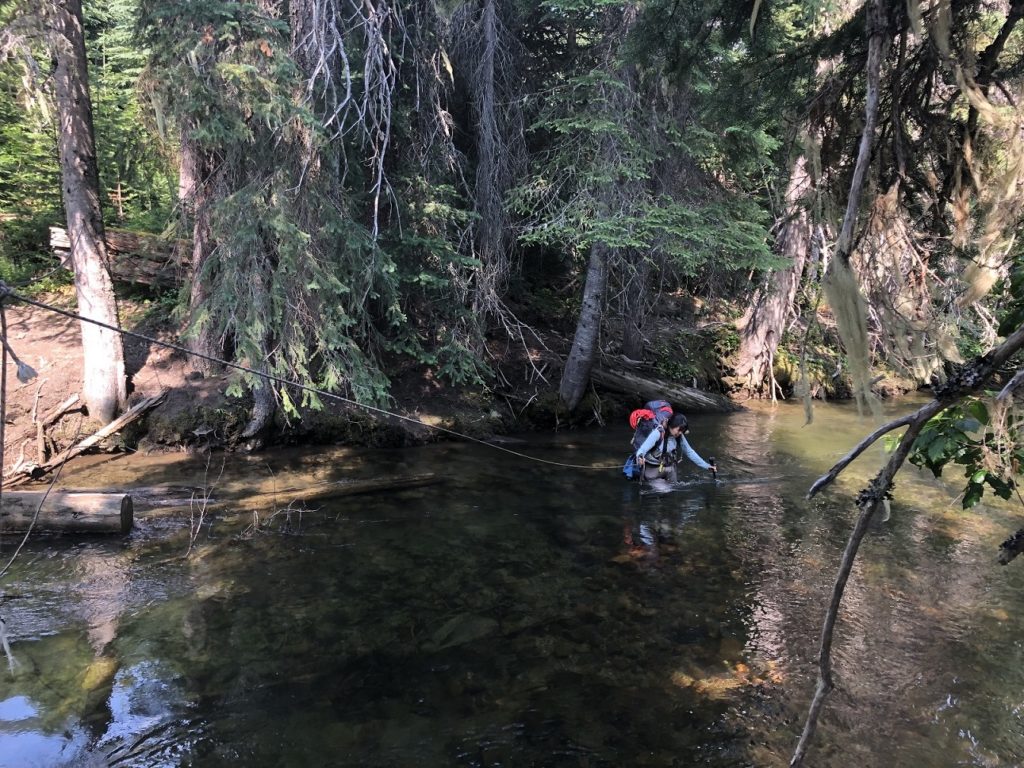
In a few minutes, I was across the creek and tossed the rope back to Lily. Being a smarter climber, she had brought waders, and it made for a relatively easy crossing.
After we got back from the trip, I posted pictures on the BCMC Facebook Group. That’s when Dean, another BCMC member, shared that there is a footbridge just a few minutes upstream. We could have spared the adventure of wading through the creek, but it was an experience.
Cerise Creek Summer Trail
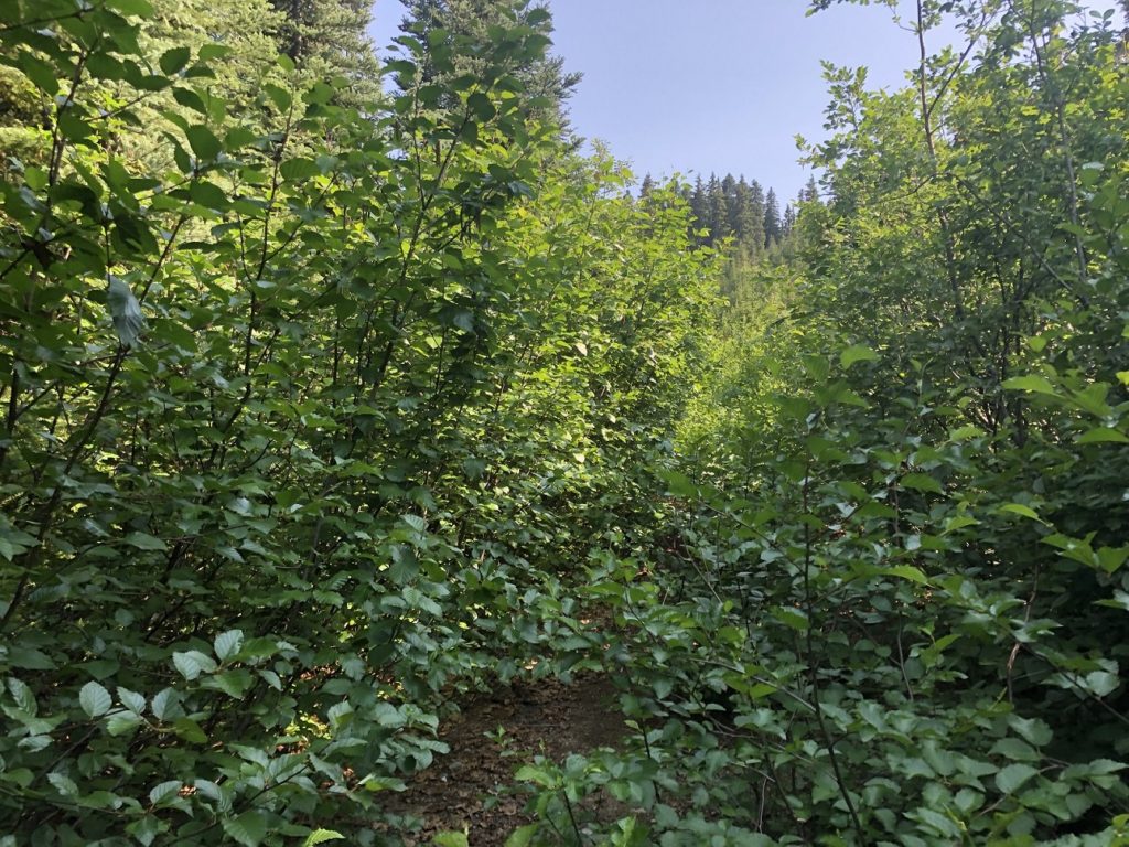
Beyond Cayoosh Creek, we continued on the Cerise Creek Summer Trail, which is to the West side of Cerise Creek. The trail is well marked as we made our way through the forest. About forty minutes into the hike, we were on an overgrown trail.
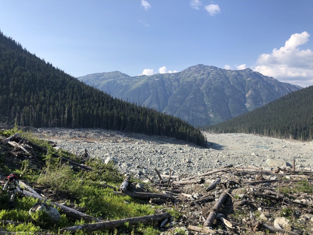
It took us about twenty minutes to hike through this section and arrive at the landslide area, which is about four km in length. Two major landslides (rock avalanches) occurred on the North slope of Joffre on May 13 and 16, 2019. Check out this BC Parks document and this excellent article for a detailed analysis of what happened and the impact of these avalanches.
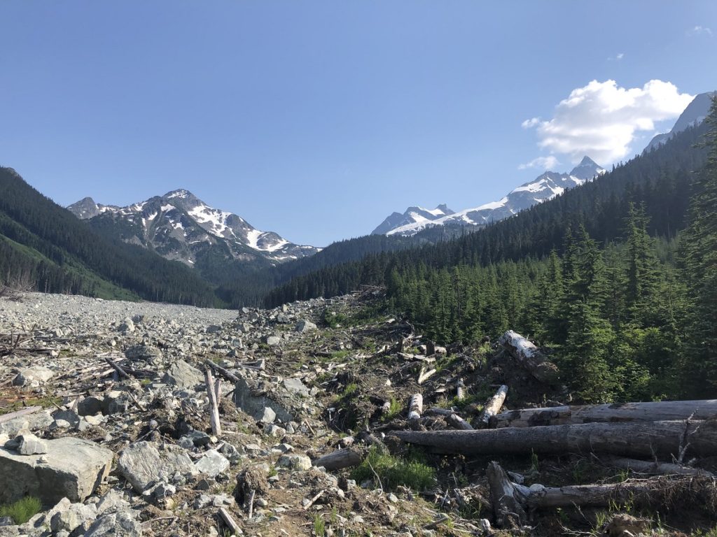
Now, we were following a temporary trail marked by orange paint. We were hopping over boulders, fallen trees and other debris from the landslide.
It took us almost an hour to get to the other side of the landslide and enter back into the forest. We followed a well-marked trail into the forest. But, only on our return, we realized that there are two trails at the end of the landslide area and orange markers mark both.
The trail to the right goes to Keith’s Hut and makes for an easier approach to Anniversary Col. The trail to the left (which we took), takes a more direct path to the col.
Motel 66
We continued our hike through the forest for another forty minutes, and then we were back in the open. It was a good relief from the bugs.
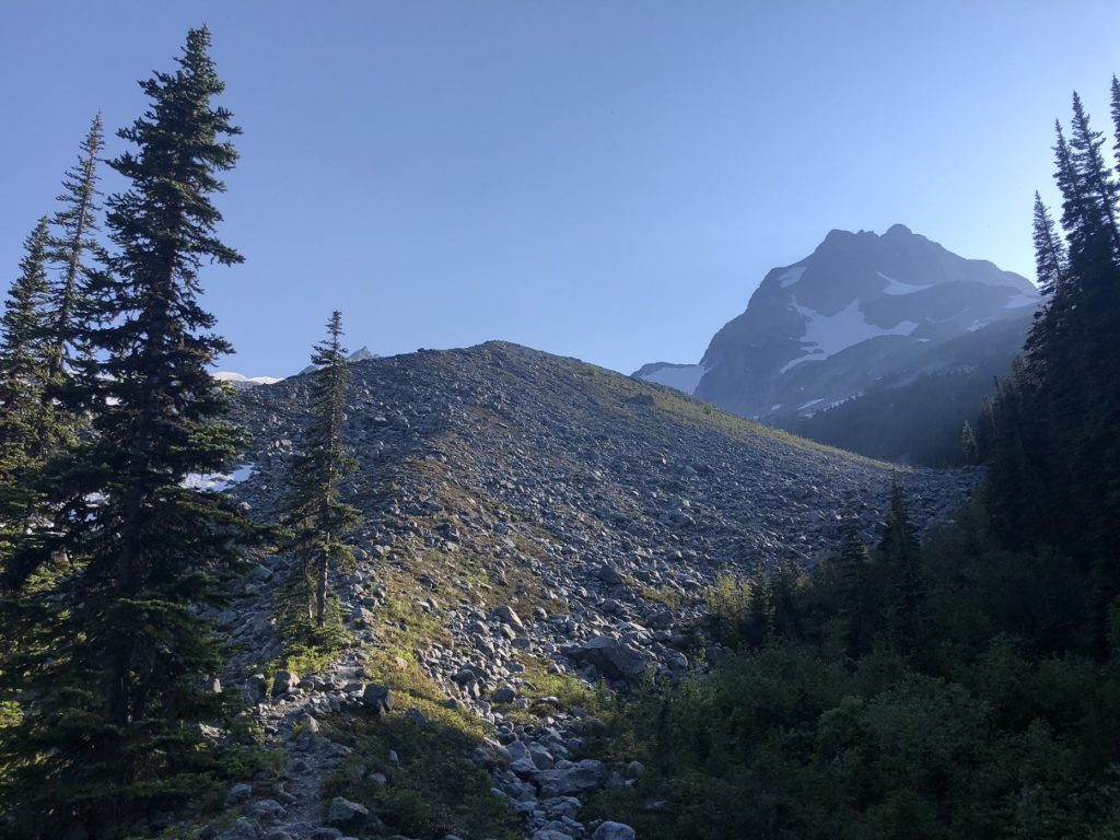
As we traversed across the moraine, a trail went back into the forest towards Keith’s Hut. We went on this trail for a few minutes and then turned around. We decided to continue on the direct path to the base of Anniversary Col.
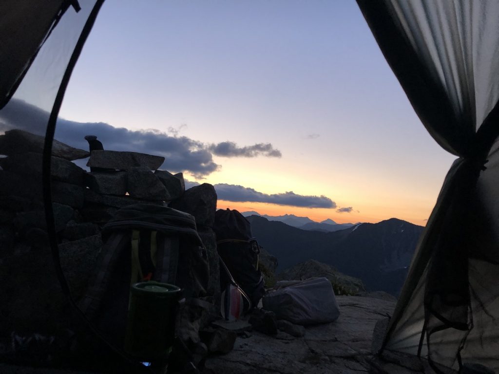
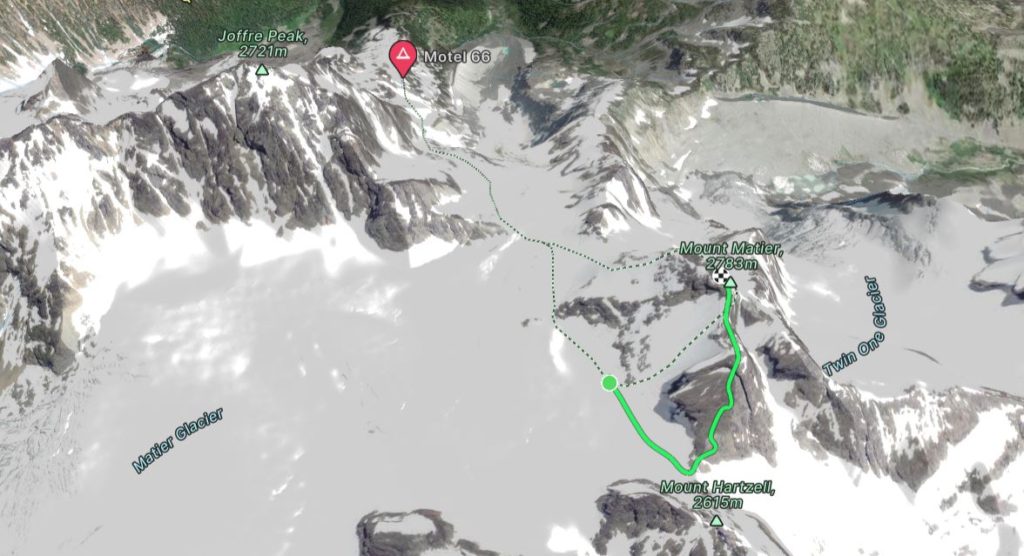
Soon, we gained the ridge and had a better view of the trail ahead. It was a slow climb over the boulders and was around eight pm when we got close to the snow patch leading to the Anniversary Glacier. It would take us at least an hour or so to get up to the col. Considering the time, we decided to camp at Motel 66 – a beautiful campsite at 1990 m, at the top of the ridge approach from Keith’s Hut.
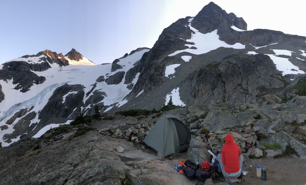
Just as we were finishing dinner, around 9 pm, we saw two climbers come down the glacier. Over the next half hour, I watched the climbers descend the glacier. At one point, instead of traversing to (climber’s) right over the rock band, they went straight down.
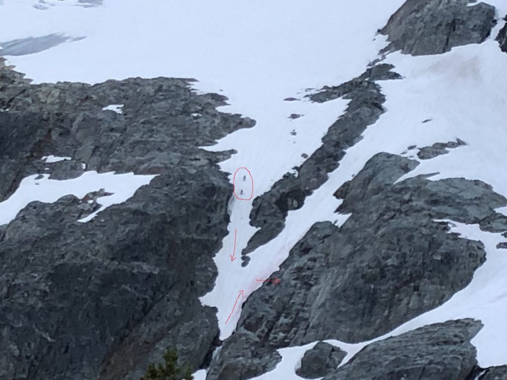
It was a bit scary watching them come down this section as it led to a steep drop and waterfall. Fortunately, the climbers realized their mistake, climbed back up, and scrambled across the rocks to safer terrain.
3.5 Hours Sleep
It was 10 pm, by the time I got in my sleeping bag and tried to get some sleep. Based on my Garibaldi trip experience, I avoided drinking any tea and thought it will help me fall asleep sooner. Unfortunately not.
First, the wind was bad, and it kept pushing the tent wall against my body. Then, a couple of times, it got so bad that it felt like one side of the tent had almost collapsed as it touched Lily’s sleeping bag.
Second, there was a leak in my sleeping pad. I had known about the leak but didn’t realize it was this bad. By 11:30 pm, the sleeping pad was deflated. I inflated it again, closed the valve and tried to sleep. Somewhere around midnight, I fell asleep and got up around two am to inflate the sleeping pad again. And then again at four am. By now, it was time to get up and get ready for the climb.
Approach to West Buttress
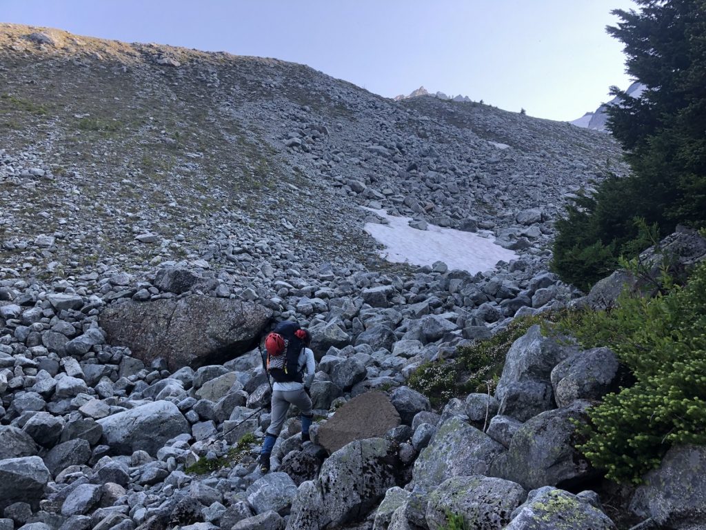
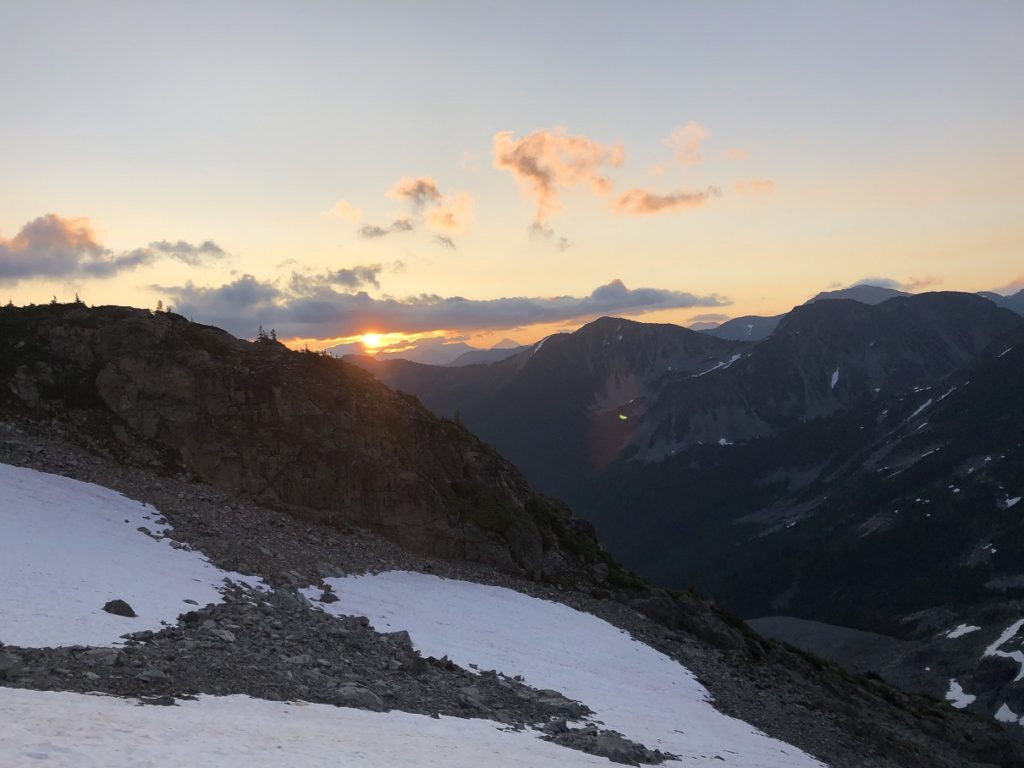
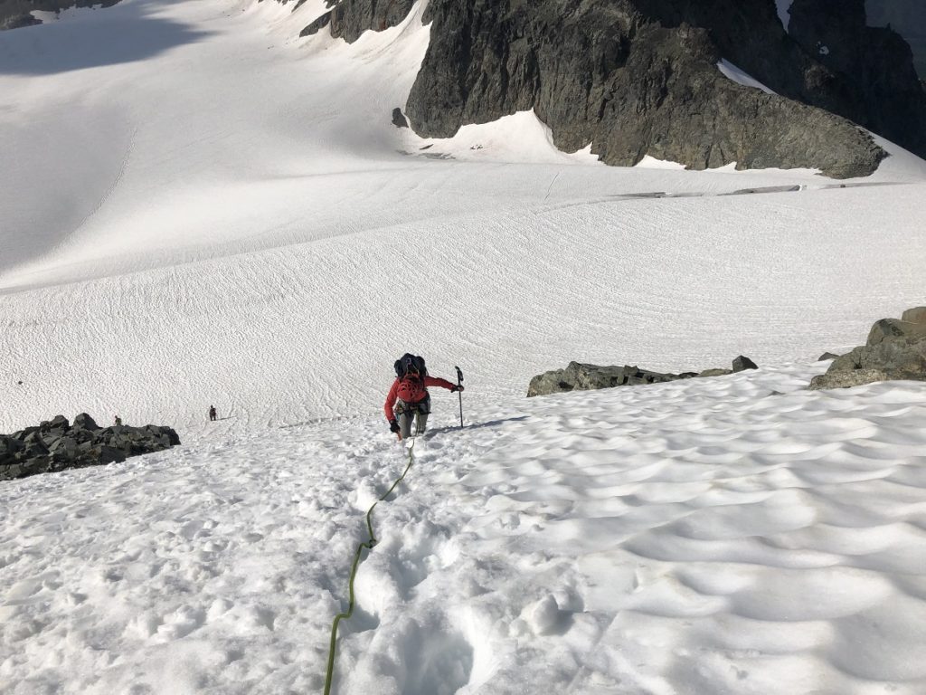
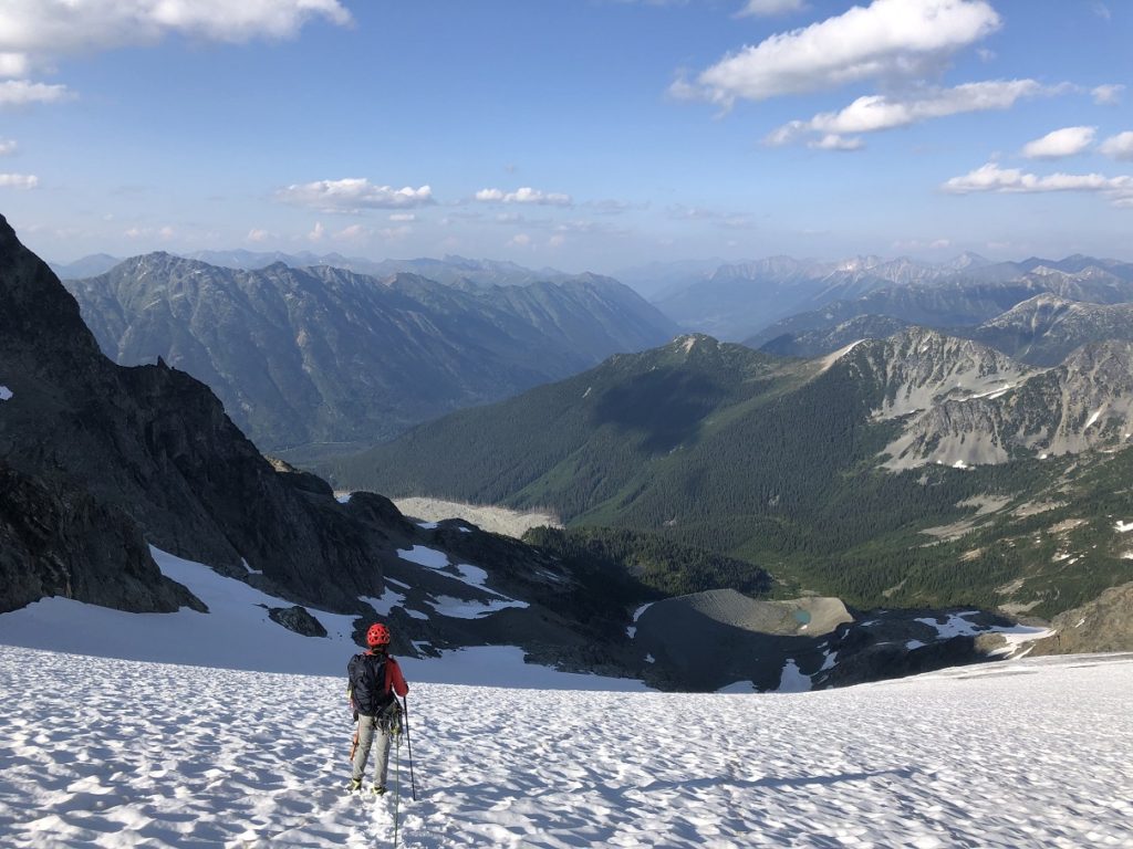
It was 5:20 am by the time we left Motel 66 campsite. We roped up and put on our crampons just before we got on the glacier. Around 5:30 am we paused to see the beautiful sunrise over the mountains.
It took us about one and half hour to get to the Anniversary Col.
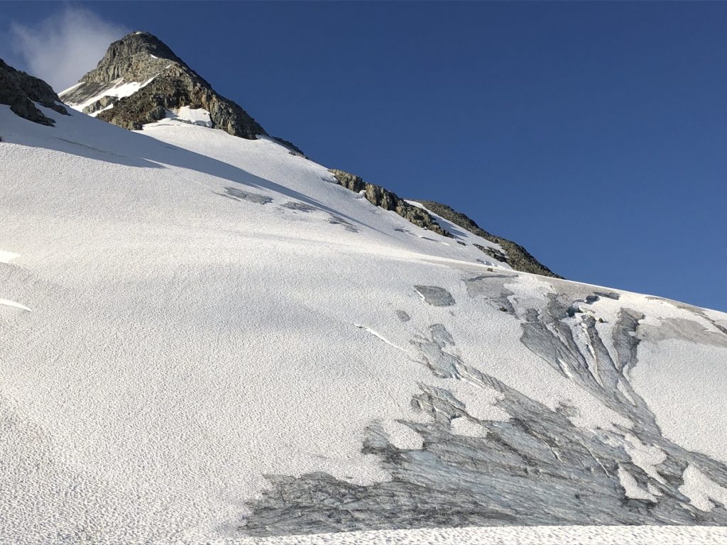
We made our way across Matier Glacier to the col between Mount Matier and Mount Hatzell.
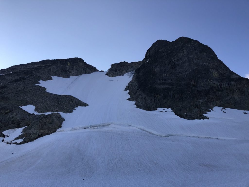
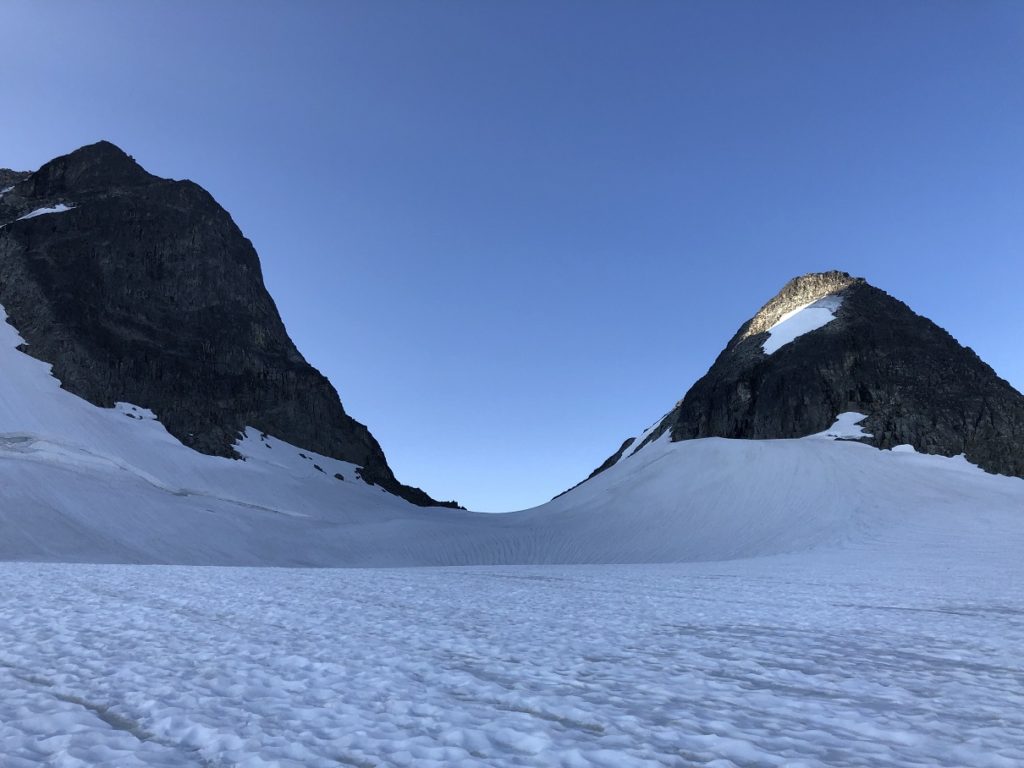
It took us an hour from the Anniversary Col to reach the base of the climb. Total about two and half hours from Motel 66 campsite.
After a good break, we geared up for the climb.
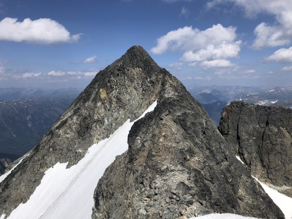
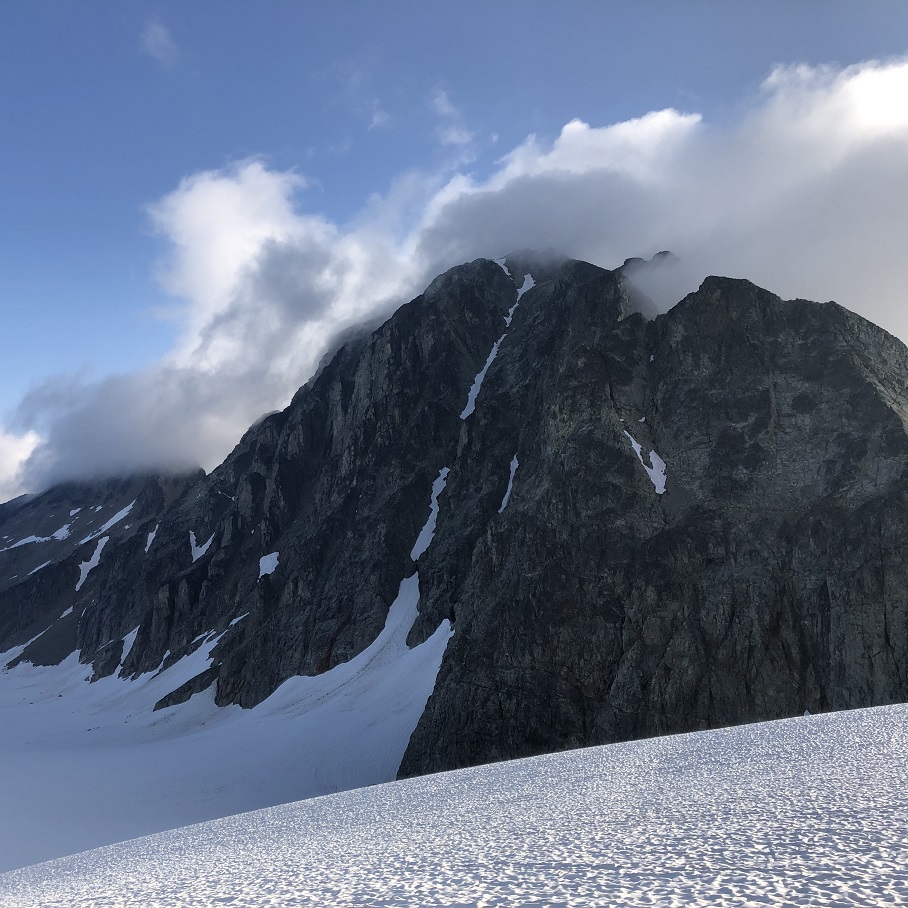
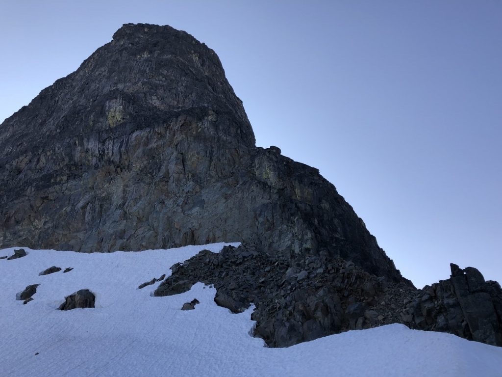
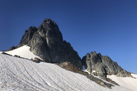
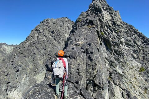
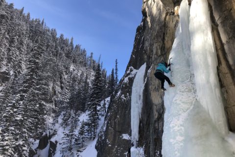
Mount Matier West Buttress
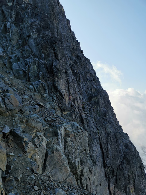
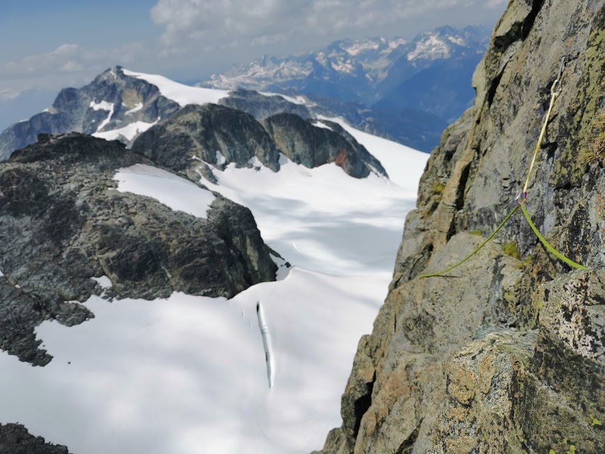
Pitch (P) 1 (5.6): The first pitch starts right of the rockfall area and traverses right. It is technically easy but the traverse over loose rocks makes it a bit challenging. I built an anchor as soon as I found a good spot. Later I realized that I should have gone a bit ahead as it was possible to continue right without much rope drag.
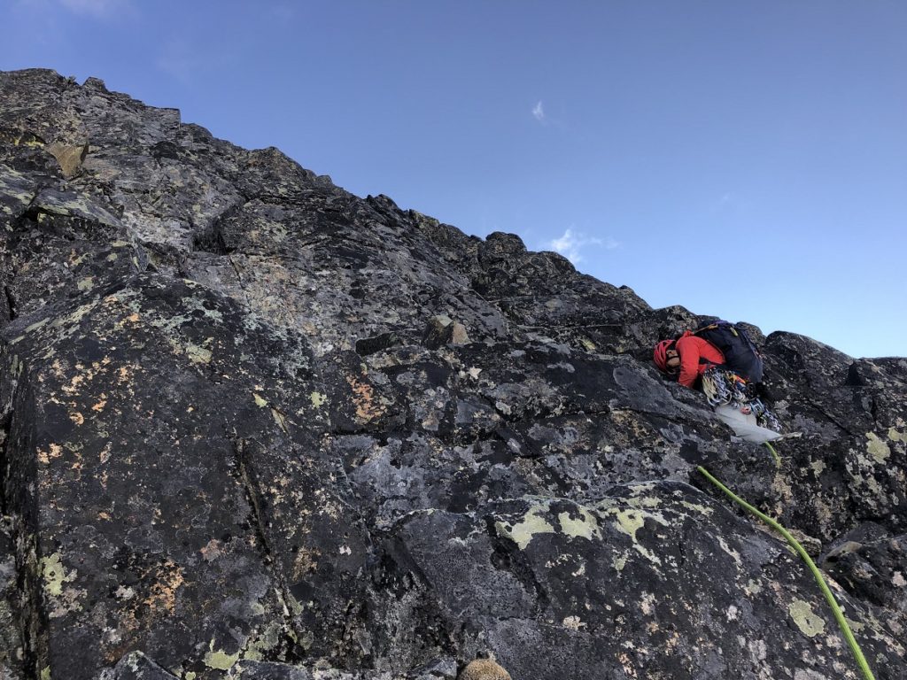
P2 (5.6): Lily led the second pitch.
P3 (5.6): I led the third pitch to what we thought was the base of the next pitch. The next pitch was supposed to be a 5.7 and the route I looked at seemed like one.

P4 (5.7): This ended up being the toughest pitch we did and was probably 5.8-5.9. The crux was the first section which was a bit overhanging and reachy. Higher up, I was on a comfortable ledge and belayed Lily up.
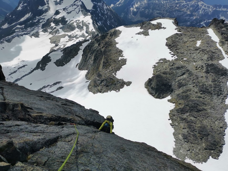
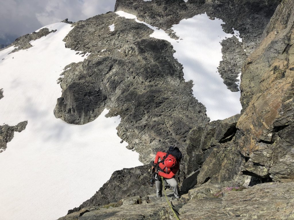
P5 (5.7): Now we were referring to the description in Alpine Select as well as the beta received by Lily from Dean and Marco. Lily led this 5.7 pitch to the base of the yellow band we could see from the ledge.
P6 (5.8): Once we were at the top of the fifth pitch, we realized that we had climbed a bit too far and we should have traversed below the slab. I lowered Lily down and then downclimbed to the base of what seemed like the sixth pitch. It was past 1 pm and I was thinking about rap down scenarios if we didn’t get on the route. Lily led the traverse and got us back on the route.

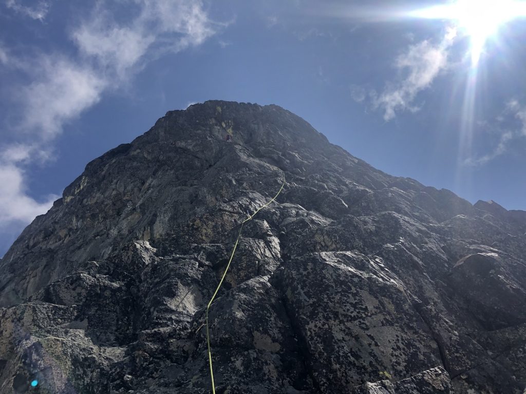
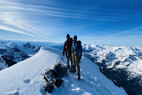
P7 (5.9): Once I got to the base of the climb, it was a huge relief as the Alpine Select description “…left-trending ramp” matched what we were seeing on the route. I led the final pitch to a ledge and then we scrambled to the top of the buttress.
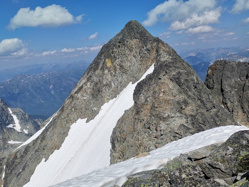
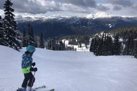
We took a brief break and then continued our climb along the summit ridge. It took us about another hour from the top of the buttress to reach the summit.
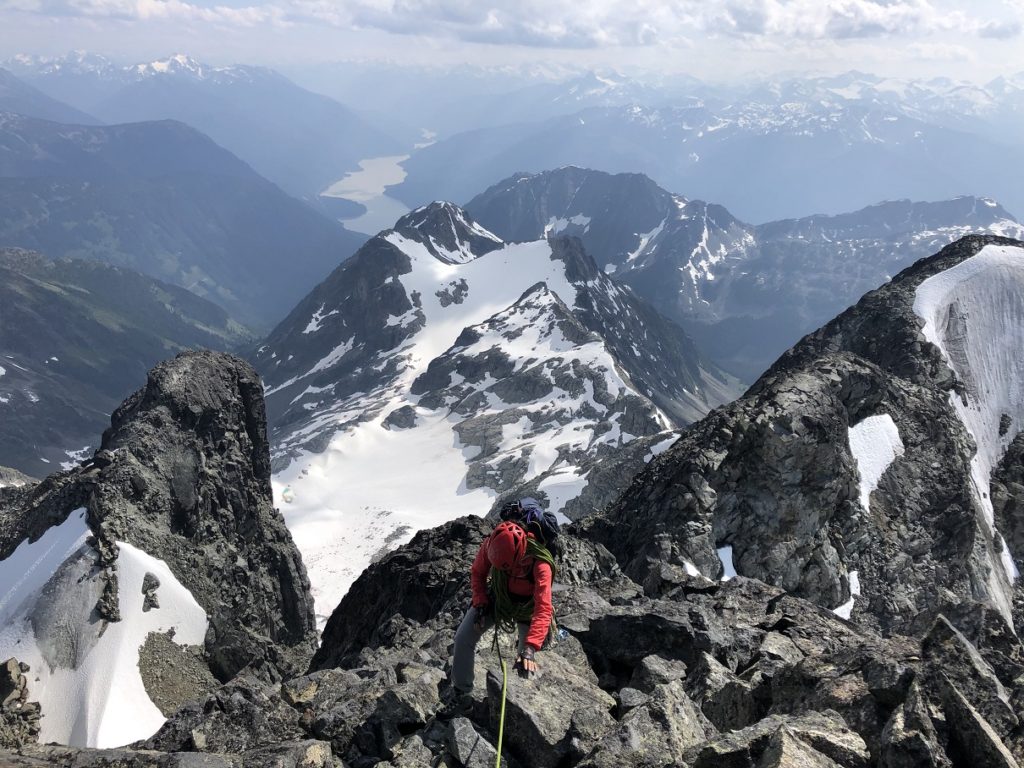
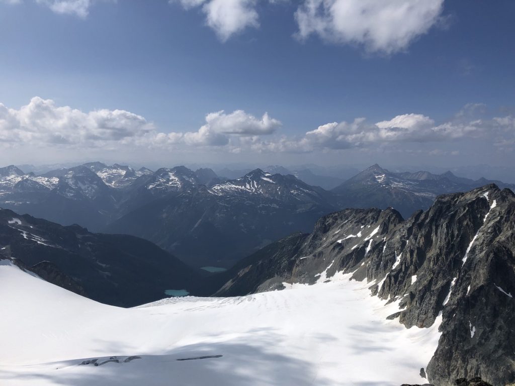
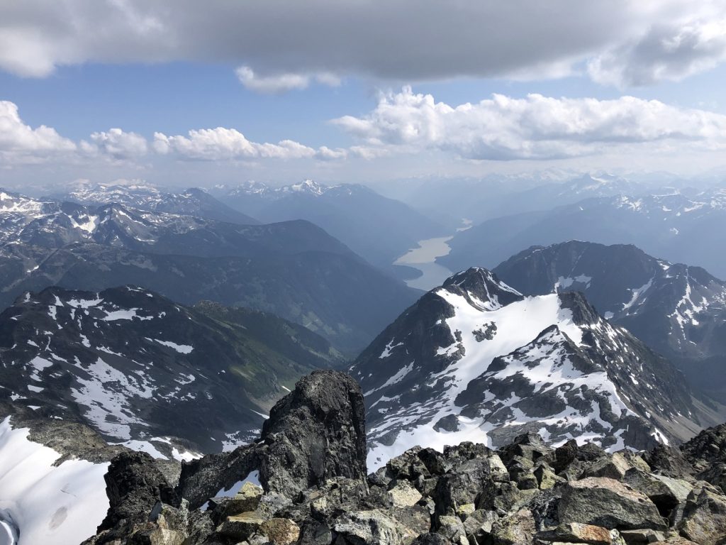
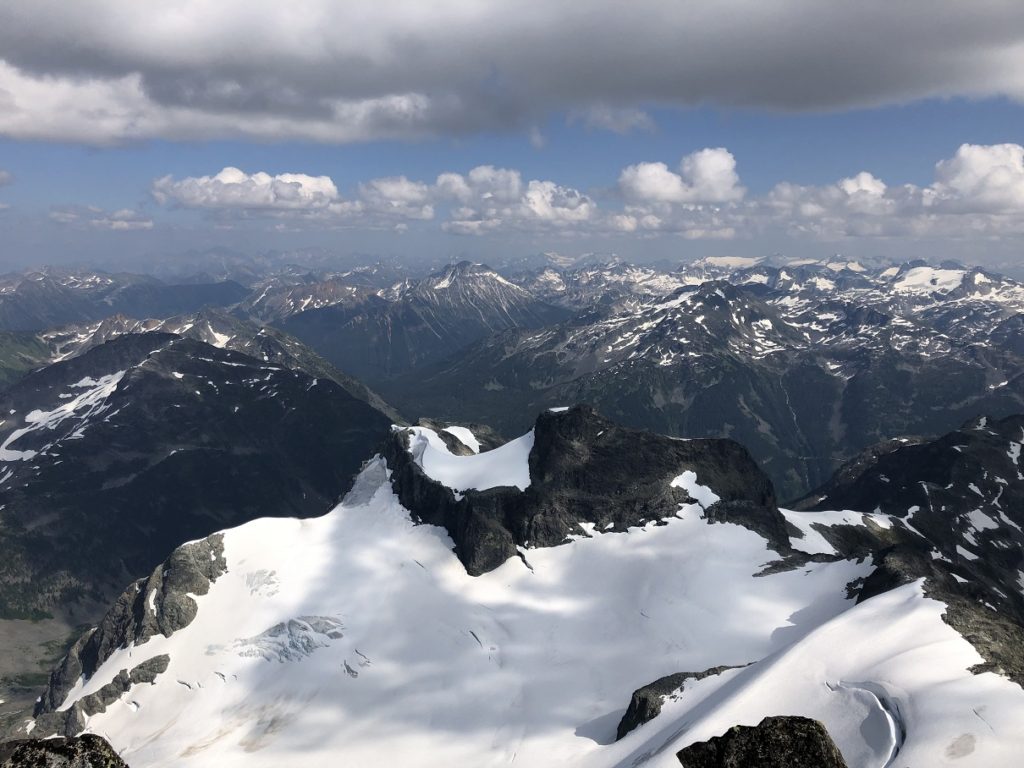
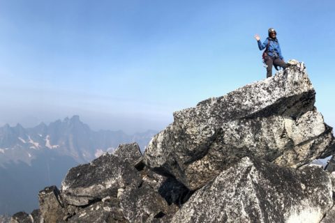
We reached the summit at 4:30 pm. About 11 hours after we had left our campsite at Motel 66 and eight hours since we had started climbing. It was a beautiful day and we had some great views from the summit.
Descent
There was another party of two climbers at the summit, who had climbed up the Northeast Spur route. We took a brief break at the summit and just followed them down to the Anniversary Col. It involved a scramble and then a descent down a 40-45 degree snow slope.
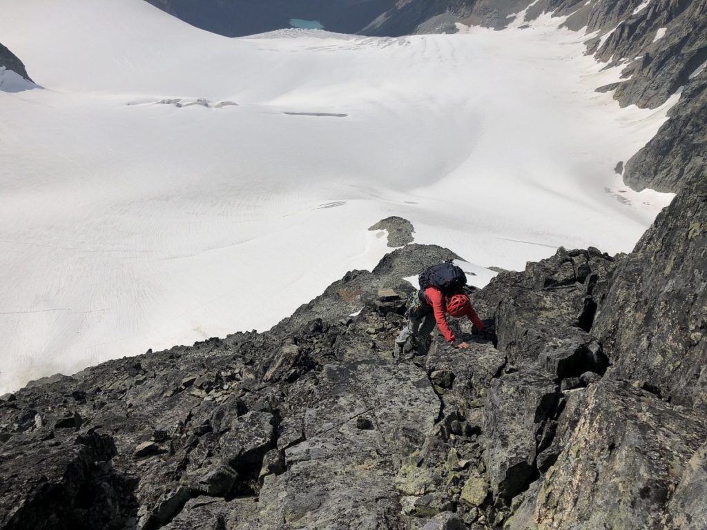
We were back at the col by 6 pm and started heading down the Anniversary Glacier. On our way up, I had made a mental note of the rock band that we need to cross instead of going straight down the glacier. It helped on our descent.
We were back at Motel 66 by 7 pm and took an hour-long break to pack and refuel. Earlier in the day, we had considered spending the night at Keith’s Hut, but after dinner, we both felt good and decided to hike all the way back down. In Lily’s words…”let’s continue and end the suffering today.”
We went down the regular summer route down the ridge and then continued on the trail down the forest to the landslide area. About halfway into the landslide area, we got our headlamps out and did our best to follow to the temporary trail marked by orange paint. We reached the creek crossing just after 11 pm. The current was a bit strong than the previous day, but with the rope, we managed to cross without any issues.
By the time, we reached the trailhead it was around 11:30 pm. We have been out for more than 31 hours and hiking or climbing for most of the time. Although the climbing itself was not hard, considering the approach, glacier travel, route finding and time this was one of the most difficult alpine climbs I had done. It definitely opened my eyes to what was physically possible for me and also made me think about skills I need to develop on my journey to be an alpinist.
Resources:
Guidebook: Alpine Select by Kevin McLane
Glossary of climbing terms.
Weather Forecast: Mountain-Forecast | Yr.No | Spot WX
Leave a Trip Plan: AdventureSmart
If you are in Lower Mainland, check out British Columbia Mountaineering Club for trips and courses.
Disclosure: I am a member of BCMC. I am not affiliated with any of the other organizations.
Did you enjoy reading this post? Please subscribe to get weekly updates. Please share your feedback in the comments section below. Thank you!
Great trip report! Matier is on our list too and now thinking this route might be our best option. Rock looks excellent!
Gwen,
Thanks for your feedback. Yes, based on what I heard rock quality on this route is better than the Southwest Buttress or other routes in Joffre group.