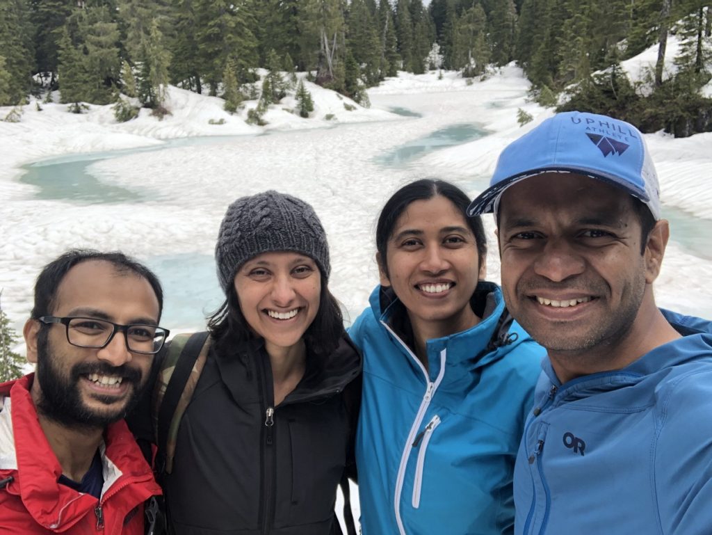
Sterling Loop Trail is about 13 km out and back trail in Pinecone Burke Provincial Park. Kasturi and I did this hike with Neha and Abhishek on June 4.
Harper Road Access
We parked on Upper Harper Road and started our hike at about 8:40 am. The last time we were in this area was to do the Sawblade Falls and Woodland Falls hike in May 2021.
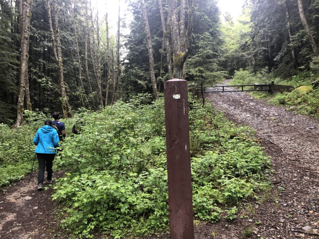
The trailhead for the Sterling Loop hike is the same as that for the Sawblade Falls hike. There are several junctions along the trail and it can get confusing if you don’t have some form of a map. Neha had downloaded the map and the trail GPX, and she helped us stay on the right track.
As we hiked up Harper Road Access, we saw a dog mom looking for her Husky that got separated. She shared her contact number and continued down the trail. About 20 minutes later, we came across her Husky and gave her a call. Soon the family was together again.
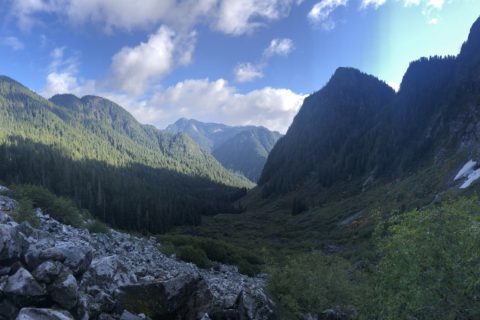
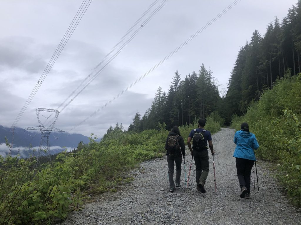
From the trailhead, we hiked on Harper Road Access for about one hour, just over 3 km and then got on the South Slope Trail.
South Slope Trail
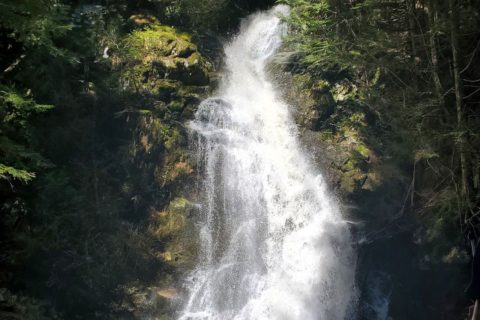
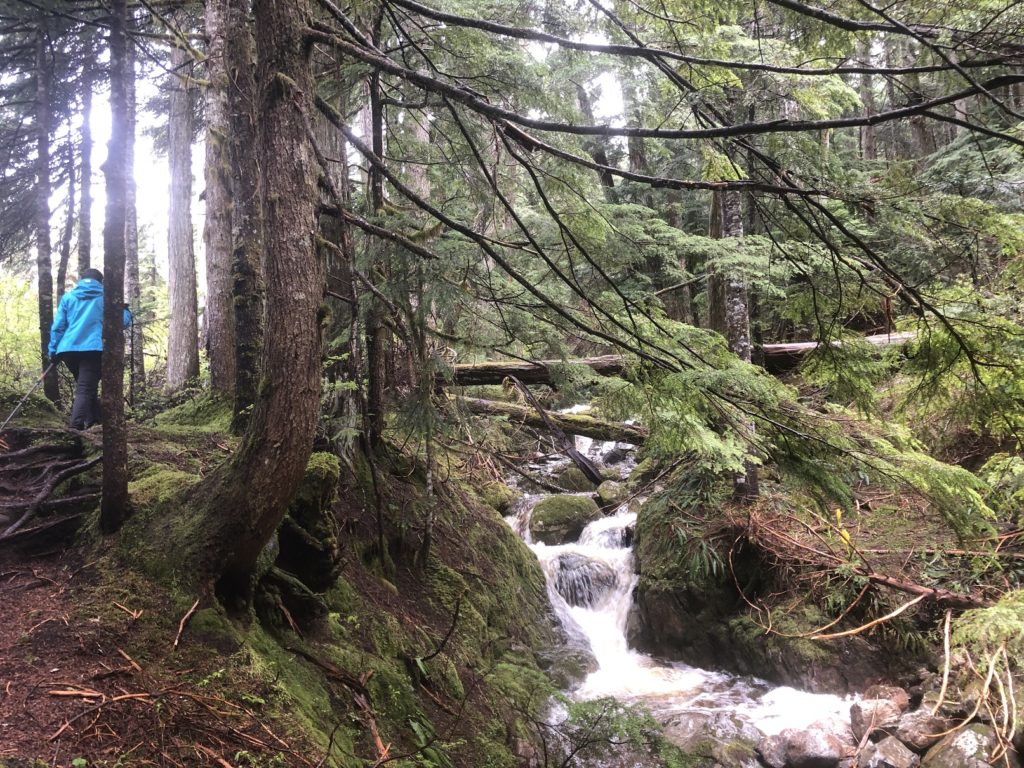
While Harper Road Access was mainly a gravel road, South Slope Trail was more interesting.
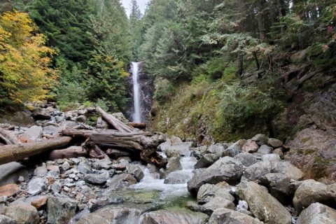
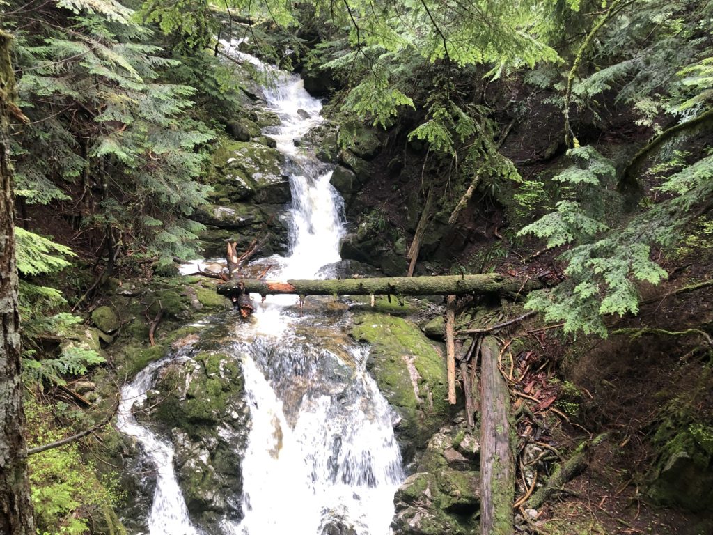
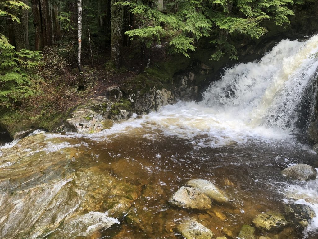
Along this trail, there are some small but beautiful waterfalls.
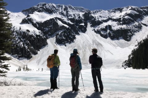
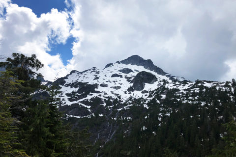
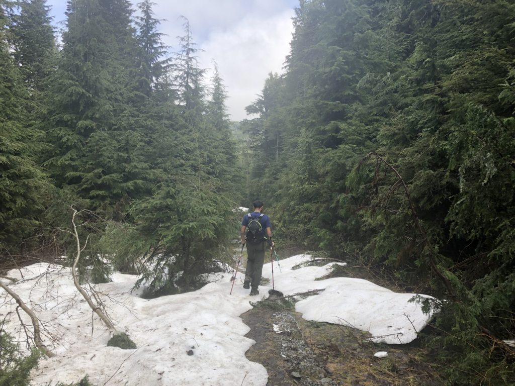
At an elevation of about 850 m, the trail flattens out a bit and there were patches of snow.
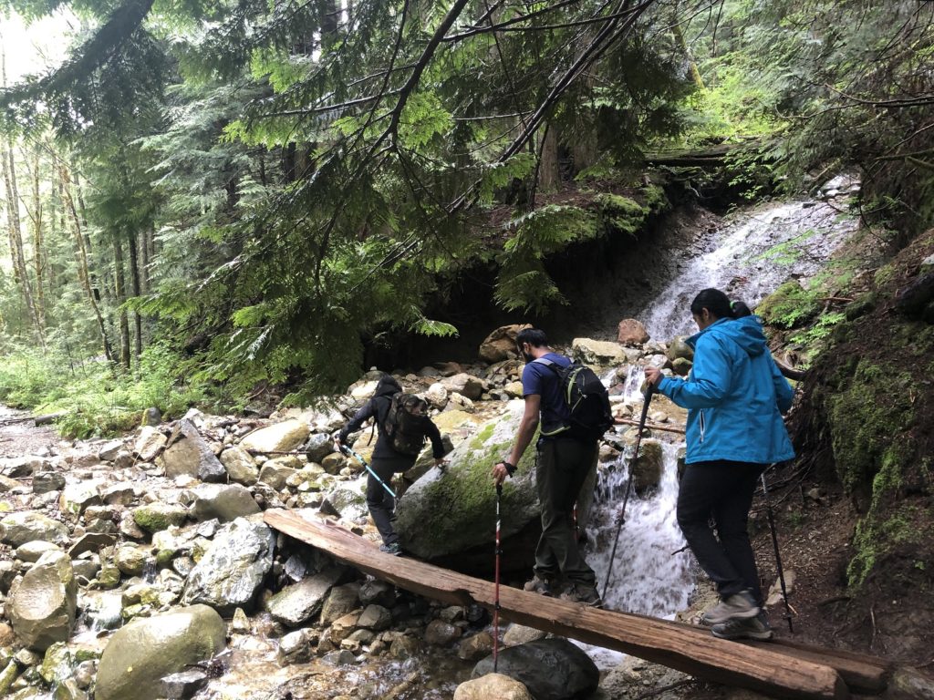
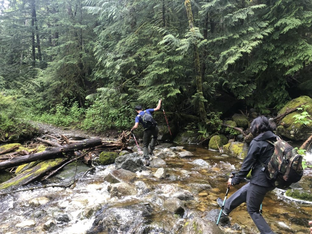
After another hour or about 2 km into the South Slope Trail, we were at a creek crossing and had two options – Low Water Crossing at the waterfall and High Water Crossing.
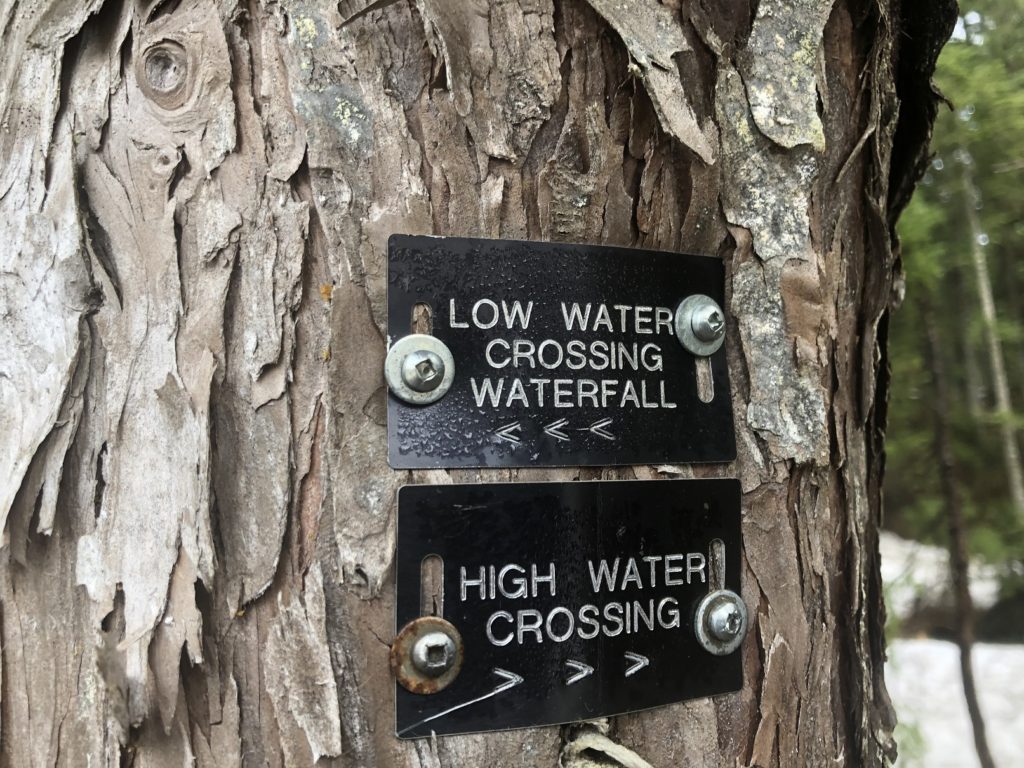
We first checked out the High Water Crossing but didn’t see an easy option to cross the creek.
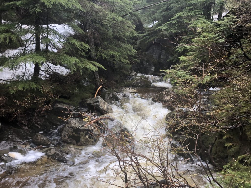
The Low Water Crossing wasn’t much better and had the added risk of being swept away downstream if we slipped.
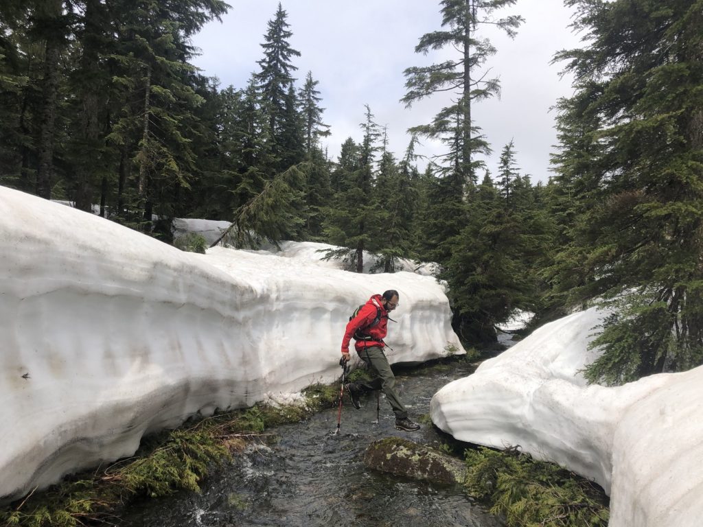
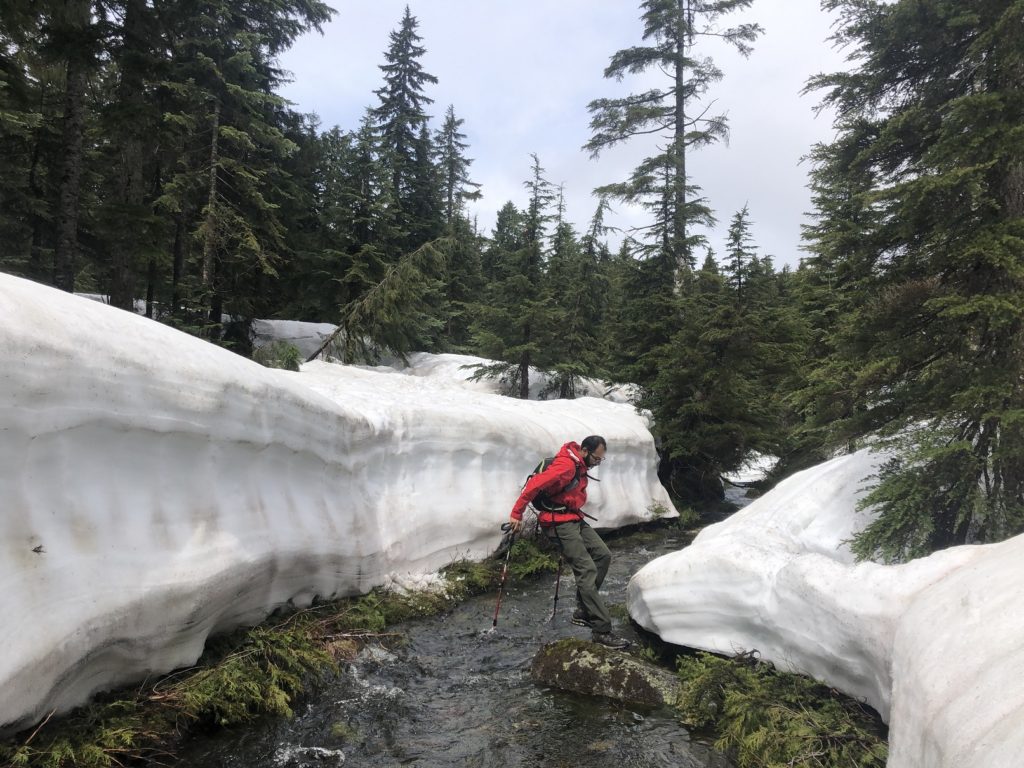
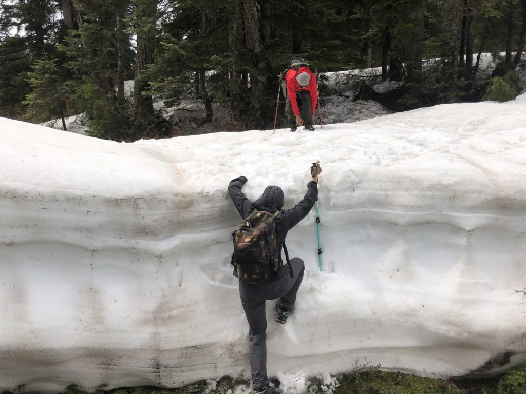
So we made our way up again, and then Neha figured out a way to cross the creek. The only risk was getting our feet wet but no significant injury if we slipped.
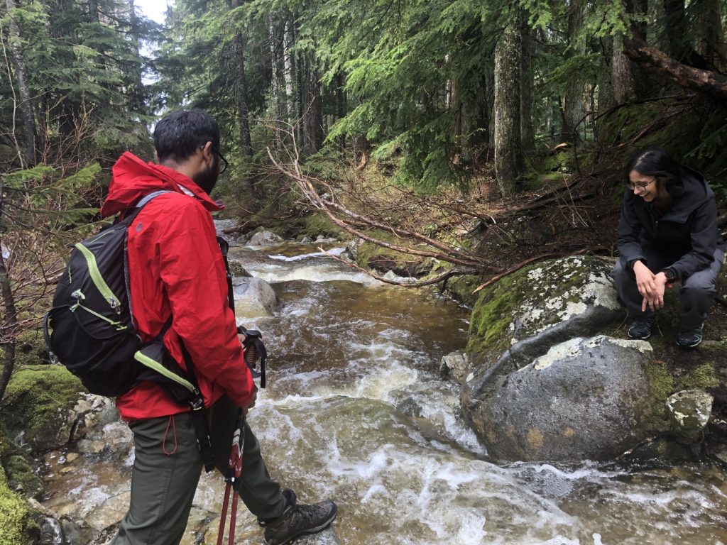
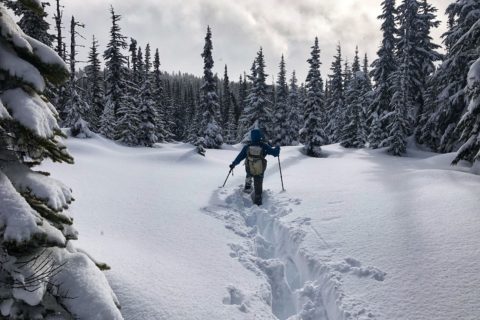
Abhi, Kasturi and I followed. I managed to get some water in my right boot, and it was cold. Higher up on the trail, we had consistent snow on the ground. There are markers/ribbons along the route, but they are sparse, and we often referred to the map.
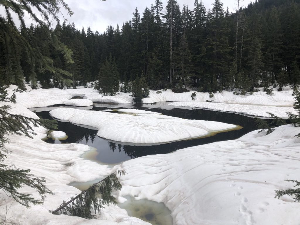
About fifty minutes after crossing the creek, we arrived at Lily Pad Lake. We had our second creek crossing and had to figure out a way to get down the snowbank. Abhi just slid down one of the snowbanks and then jumped across the creek.
The rest of us climbed down a shorter section downstream and then crossed the creek. Soon, we were at another creek crossing, but it was relatively easy.
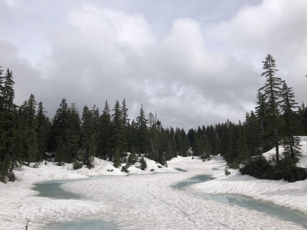
Hourglass Lake
Just before noon, we arrived at Hourglass Lake. It had taken us over three hours to hike the 6.5 km to the lake.
To avoid the creek crossings, we checked the maps for any alternate trails leading back to the parking lot. But we didn’t see a good option. So after a 30-minute break, we started our hike back.
On our way back, we climbed up the snowbank close to Lily Pad Lake.
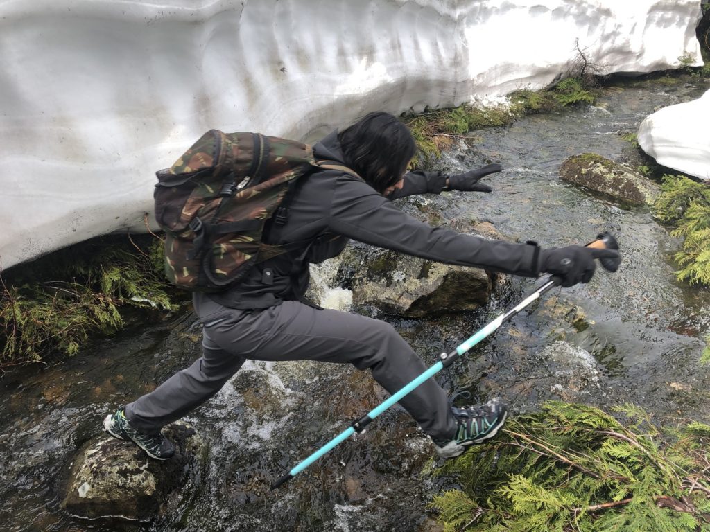
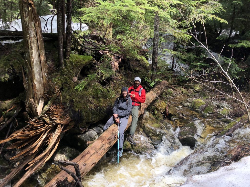
For our second creek crossing, we found a more manageable option upstream relative to where we had crossed earlier in the day. However, Neha and Abhi wanted some more adventure, so they crossed over the log.
It was close to 3 pm when we were back at the parking lot. Out and back, it was a 13 km hike with 783 m vertical. This hike showed us that there is enough adventure to be had right in our backyard in Pinecone Burke Provincial Park.
Territory Acknowledgement
I would like to acknowledge that this trip took place on the unceded territory of the Coast Salish peoples, including the territories of the Stó:lō (Staw-low), kʷikʷəƛ̓əm (kwee-kwet-lum) and sq̓əc̓iy̓aɁɬ təməxʷ (kat-zie) Nations. I commit to learning about Indigenous peoples and issues and making reconciliation an ongoing effort.
Source: Native-Land
Pronunciation Guide: First Nations.info, A Guide to Pronunciation of BC First Nations
Resources:
First Nations Website: Stó:lō | kʷikʷəƛ̓əm | sq̓əc̓iy̓aɁɬ təməxʷ
Pinecone Burke Provincial Park: BC Parks Website
Trail Guide: All Trails
Maps: GAIA GPS
Weather Forecast – SpotWx | Yr.No | Windy
Adventure Smart: Trip Planning
Disclosure: I am not affiliated with any of the above individuals or organizations.
Did you enjoy reading this post? Please subscribe to get weekly updates. Thank you!