Early in January, Neha and I talked about climbing Mount Harvey North Ramp. Coincidentally, Suhrud, our friend, did this climb a week later and reported great conditions. Neha and I decided to do this climb on Sunday, January 26. Bala – who had vowed not to do this climb again after being on the route four times, agreed to join.
Avy Conditions and Weather
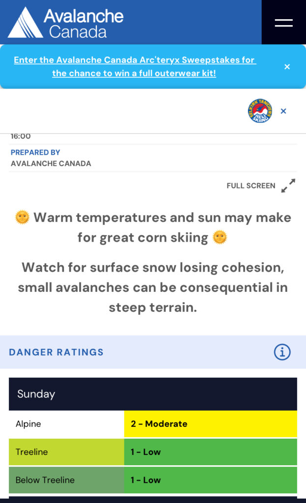
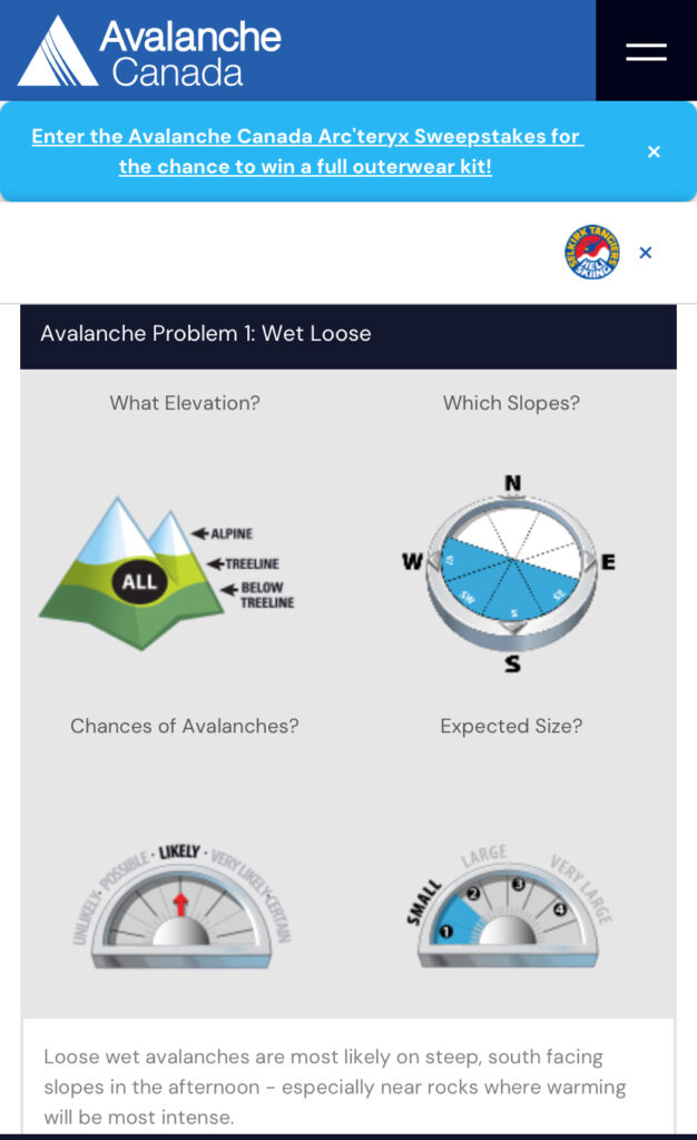
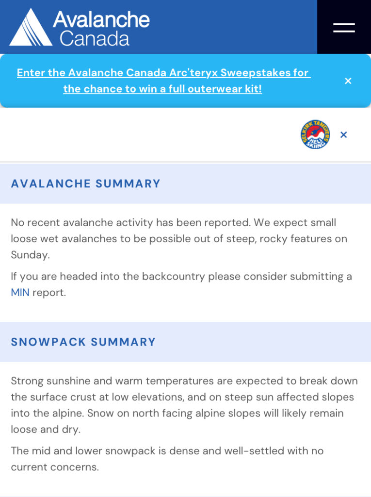
The avy forecast from Avalanche Canada was Moderate/Low/Low. The main concern was the small, loose, wet avalanches on steep south-facing slopes, especially with warmer temperatures in the afternoon.
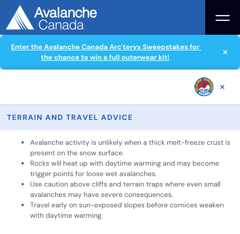
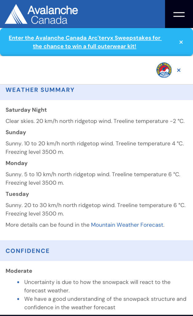
The majority of our climb was on the North side of Mount Harvey and earlier in the day, where conditions were expected to be more stable.
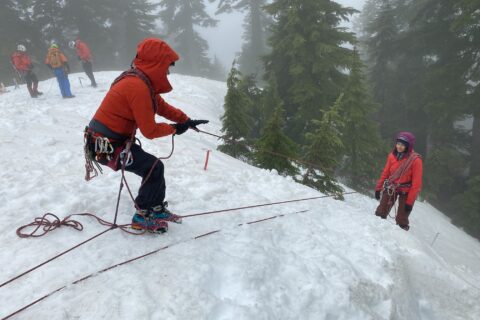
Gear
Most parties reported climbing this route without roping up. We decided to carry all the gear and make a decision on the climb.
Here is what we carried in terms of climbing gear –
- Personal gear (helmet, harness, 120 cm slings, anchor material, locking carabiners, two ice tools/axe, crampons, microspikes)
- 50 m, 8.9 mm Rope, Triple Rated
- Four pickets
- Three long ice screws
Hike to Harvey North Ramp
We parked at the Sunset Trailhead (elevation of around 200 m) in Lions Bay and started the hike around 6:45 am. The last time I was in this area was for a spring attempt of Mount Brunswick in 2022. In the rush of starting the hike, I forgot to pay for parking and only realized it on our descent. Thankfully, I was able to make the payment using the PayByPhone app, and it all worked out.
About 45 minutes into the hike, we reached the first trail junction (2 km) and took the Harvey / Lions trail. After 15 minutes, we were at another junction and took the trail to the left for Harvey North Ramp. The trail to the right is the hiking trail to Harvey that we would use for our descent.
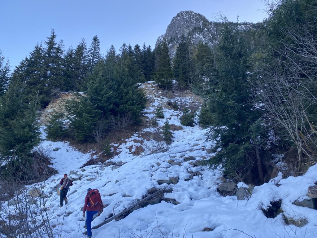
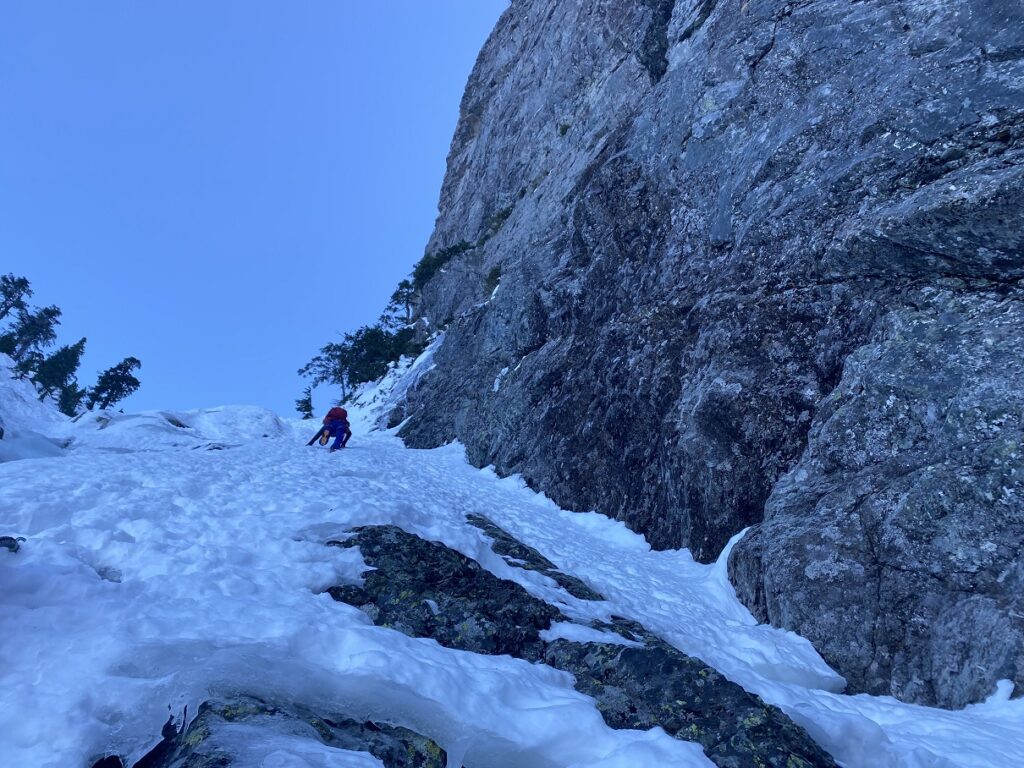
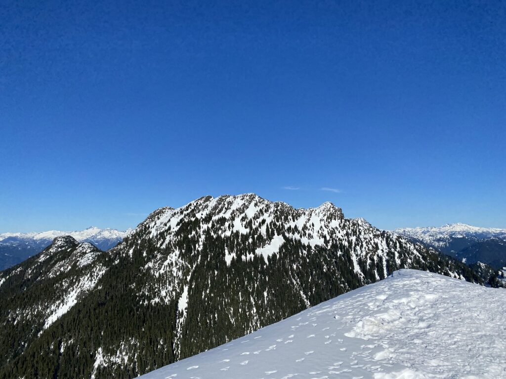
As the terrain opened up, we had our first view of Mount Harvey. We had snow on the trail at around 900 m elevation, where we crossed a small boulder field. There is a bigger boulder field at the base of the Harvey North Ramp.
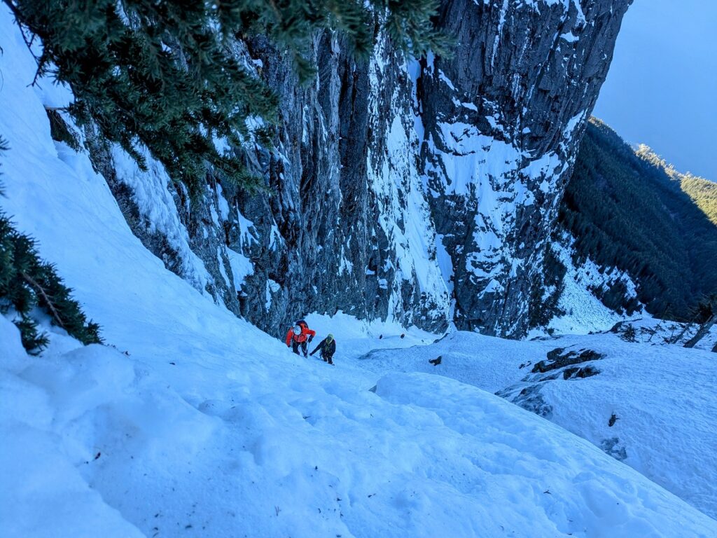
After hiking for just over two hours, we reached the base of the North Ramp (approx. 1100 m). A party of two was roped up and pitching out the climbs on the ramp. We had a long 45-minute break to rest, gear up and refuel.
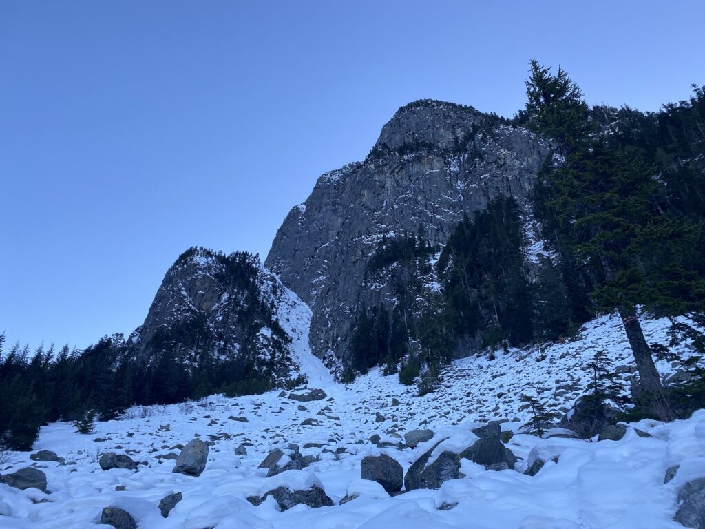
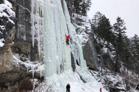
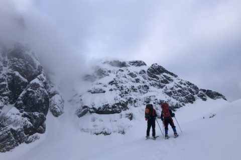
Harvey North Ramp
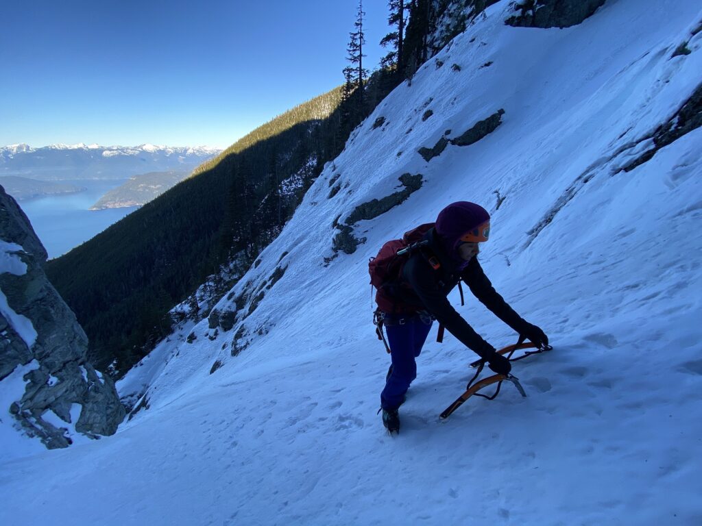
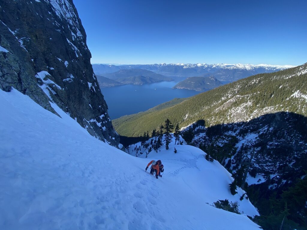
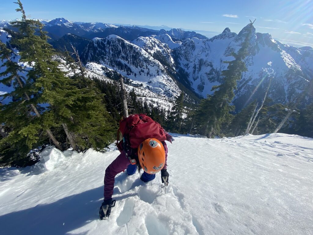
It’s been a while since I have climbed up a steep slope. I think the last time was on Sky Pilot East Face via Gunsight Couloir. These slopes always look scary from a distance. Especially when considering the entire climb (500 m long) of Harvey North Ramp with 45-degree slopes.
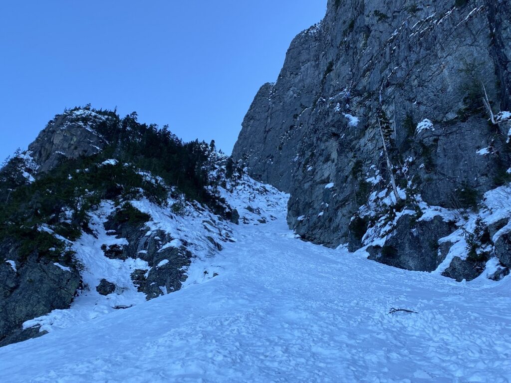
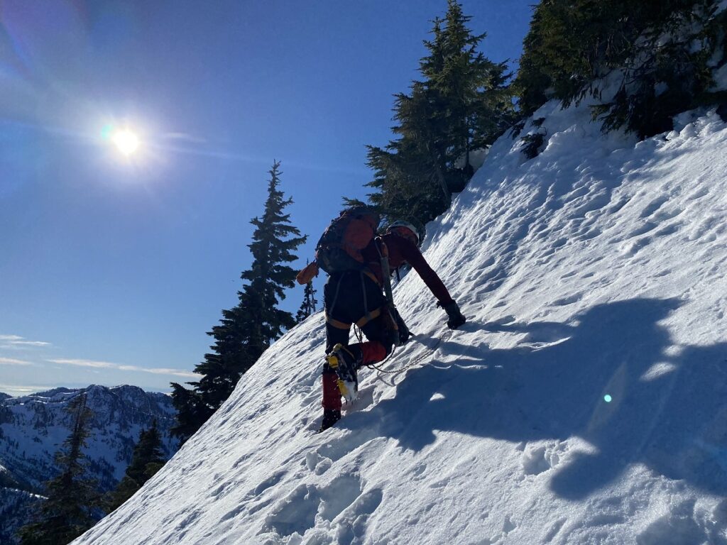
But as we started from the base of the ramp, the climb seemed much more manageable. The initial section was easy enough to use the French (flat foot) technique and, at times, the American (Hybrid—one flat, one front point) technique with an ice axe/tool in a cane position.
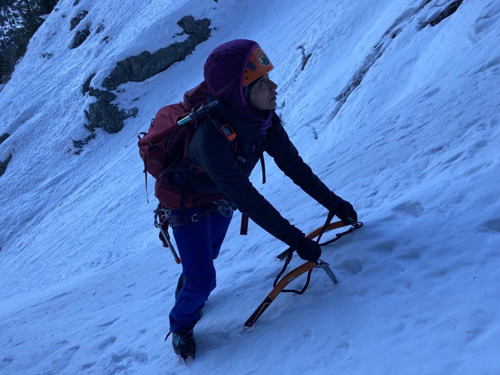
Within the first few minutes, I felt a cramp in my left thigh and soon on my right thigh. I asked Neha and Bala to go ahead while I straightened my leg and drank some water. I took it slow, and thankfully, I didn’t feel the cramps again. As Neha said, it was likely the movement after the long break. I should have warmed up for a few minutes.
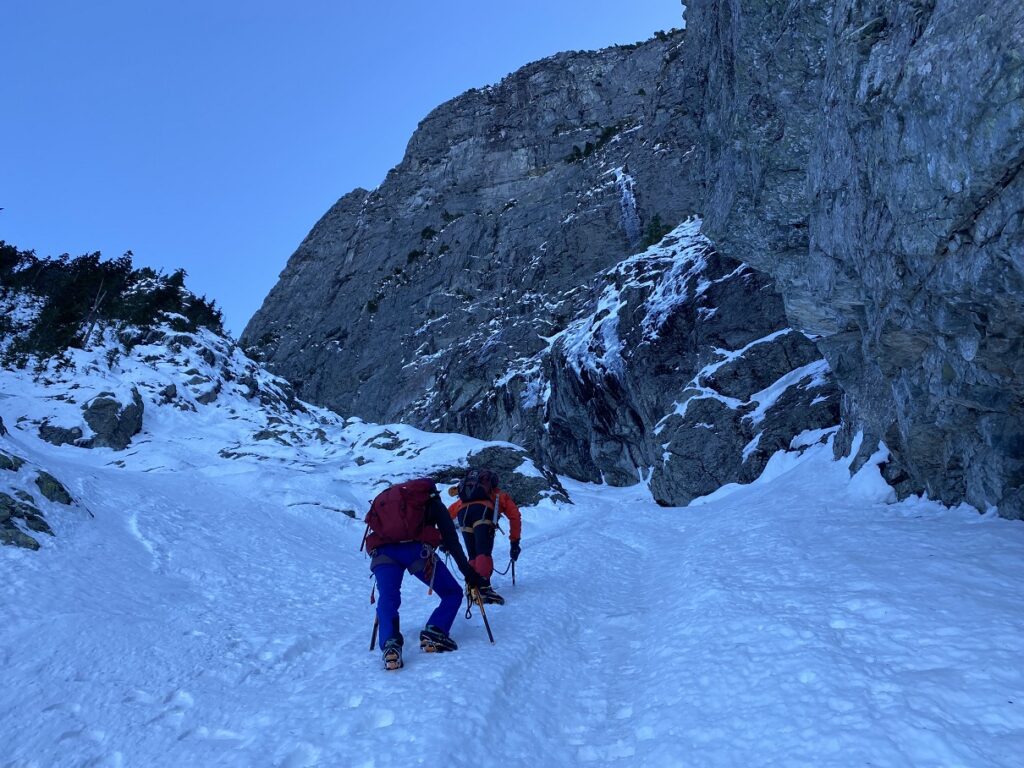
In some sections, we were now front-pointing and using the tools in a dagger position, driving the pick into the slope. Higher up, the rocks were exposed on the ramp, but it was possible to get around these sections. In one section, I misjudged the amount of snow and was soon hitting the rock underneath with my tools and crampons. This was probably the only tricky section on the climb.
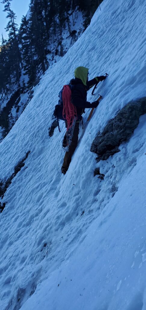
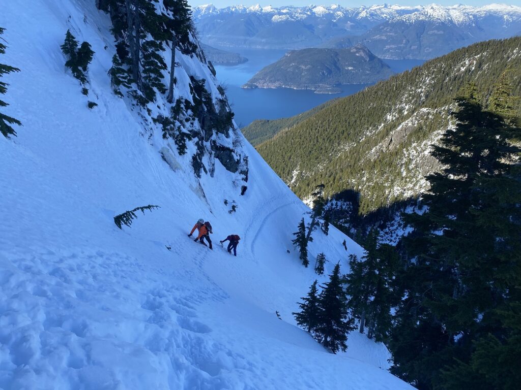
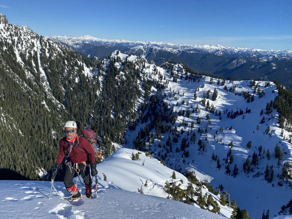
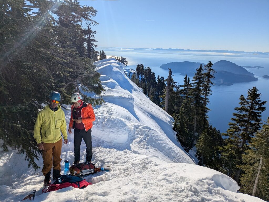
Soon, we passed the climbers ahead of us. Neha was in the lead now and took us to our next break stop near a big boulder. It was 11:15 am, and we had been on the ramp for almost one and a half hours and had gained about 300 m in elevation from the base of the ramp.
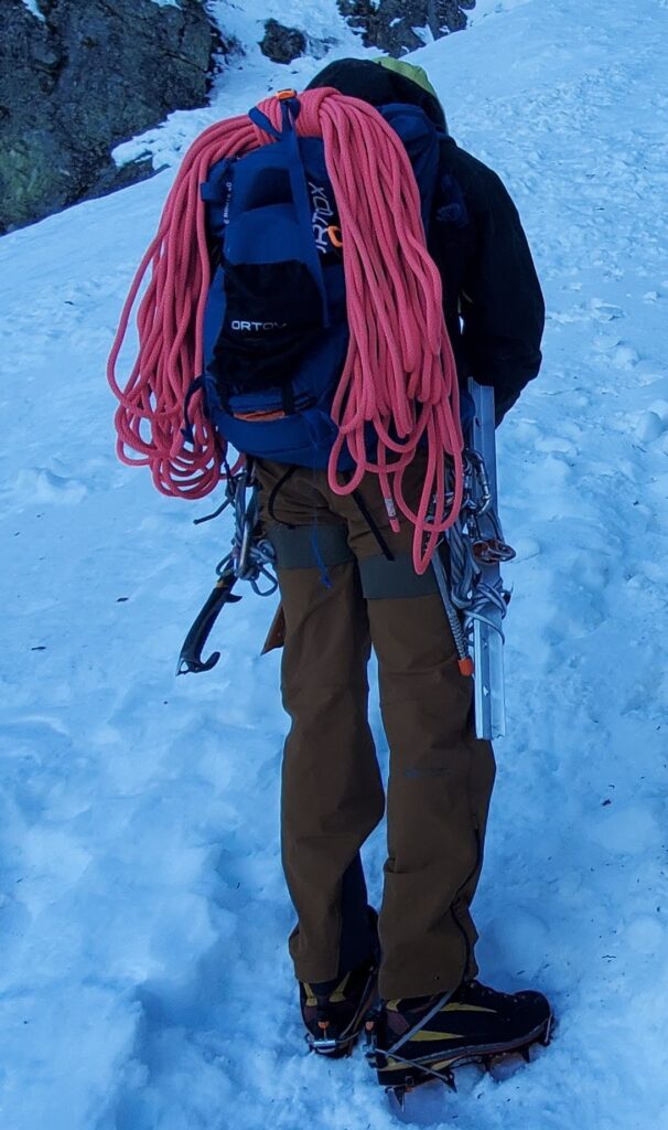
Right: Bala and I climbing up to the break spot. Photo by Neha
Traverse on Harvey North Ramp
After a short break, we were back on the ramp and, soon arrived at a plateau, which could have been a good break spot as well.
From here, it was a short climb to the start of the traverse. Bala was still in disbelief that we were already at the traverse. He kept saying that there would be a steep section before the traverse, but I guess all the steps that have been kicked in made it much easier. The traverse was no different.
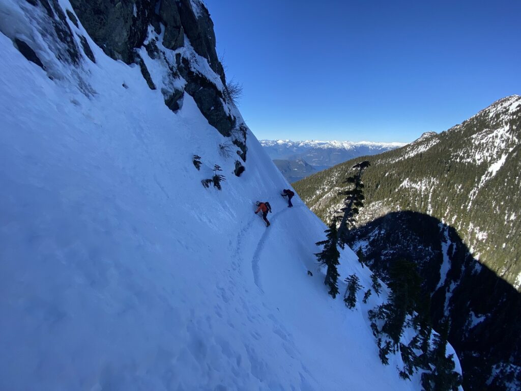
Earlier, Bala was nostalgic as he showed us the direct line he had climbed up and had topped out after a few pitches of mixed climbing. Thankfully, we were not doing that today.
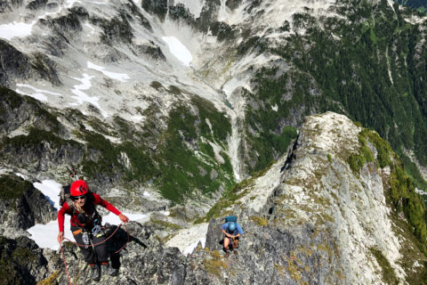
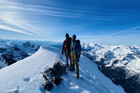
Summit
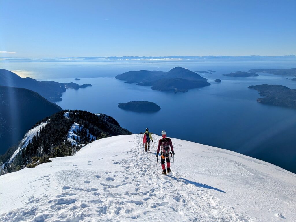
We finished the traverse and climbed up to another plateau. It was sunny and warm. We could see a trail straight up (North side of Harvey) that some climbers had taken but decided to take the other trail traversing to Harvey’s Northeast side. Soon, we were breaking the trail as we climbed up the slopes and made our way around the trees.
At one point, we referred to the trail (GPX) Suhrud had shared. We were only 10 m off, but it helped us get back on the trail to the summit.
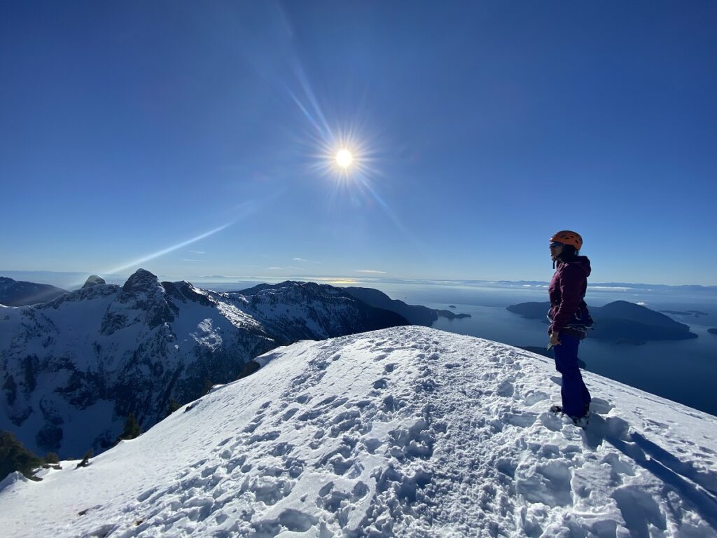
After six hours, we were on the summit of Mount Harvey.
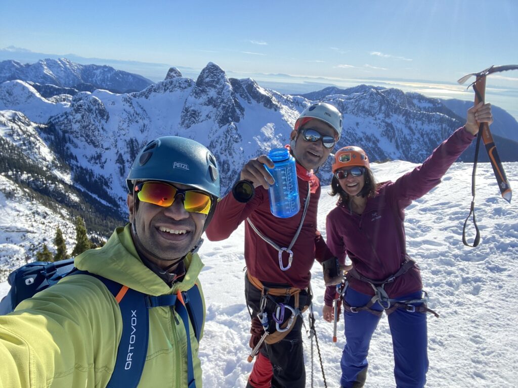
It was a beautiful day with fantastic views of the North Shore Mountains and the Howe Sound.
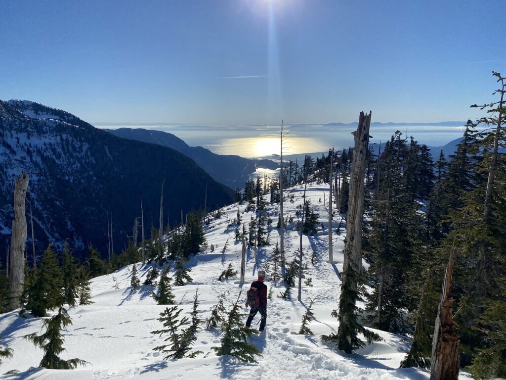
Descent – Harvey Hiking Trail
We hiked down to the trees and transitioned from climbing to hiking. As we hiked down, we stayed well to the left of the corniced slopes.
This AvCan webinar does a great job of presenting the risks of cornice and the fatal accident that happened on the summit of Mount Harvey in 2017.
Hiking down was a slog, and I don’t think any of us took any pictures as we zombie-walked back to the trailhead. We were back at the parking lot by 4:30 pm. As per my watch, it was about 13.3 km round trip with over 1470 m of elevation gain and took us just over nine and a half hours in total.
Ideal conditions, combined with all the climbers that did this climb before us, made the climb much easier than I had expected. The exposure and the risk were still there, and one cannot take the climb for granted, but it was easier. Don’t take my word for it…Bala, who has been on this route four times in all conditions, said this was the easiest.

Territory Acknowledgement
I would like to acknowledge that this trip took place on the unceded territory of the Coast Salish peoples, including the territories of the xʷməθkwəy̓əm (Musqueam), Skwxwú7mesh (Squamish), Stó:lō and Səl̓ílwətaʔ/Selilwitulh (Tsleil-Waututh) Nations. I commit to learning about Indigenous peoples and issues and making reconciliation an ongoing effort.
Source: Native-Land Pronunciation Guide: First Nations.info
Resources:
Trail: GAIA GPS (GPX from Suhrud)
Avalanche Canada – Forecast | Webinar – Mount Harvey Case Study
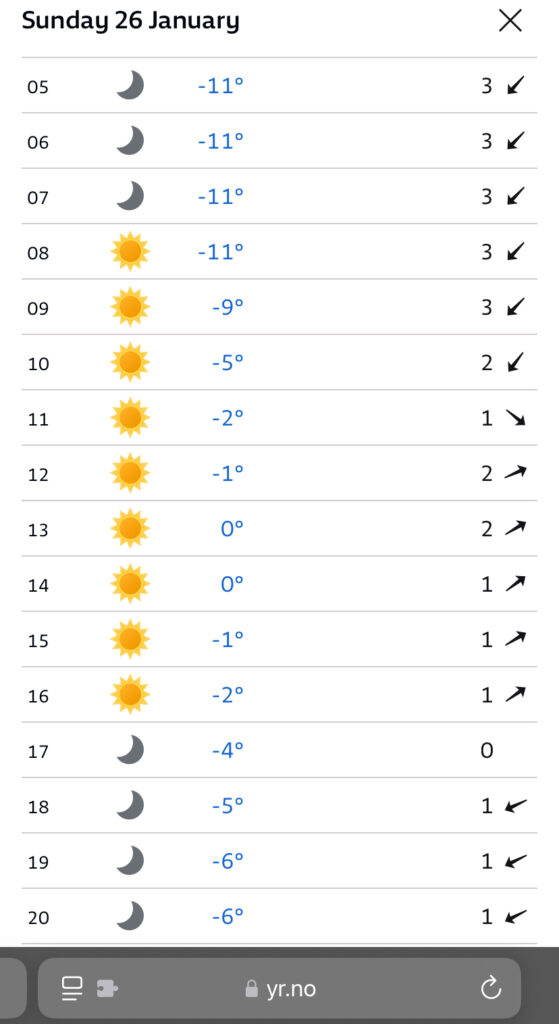
Weather Forecast – SpotWx | Yr.No | Windy
AdventureSmart – Leave a Trip Plan
Disclosure: The links I have shared in the post and under the Resources section are not Affiliate Links.
Please subscribe to get regular updates.
congratulations
Thanks Sujeet