Last week, after a long dry spell, we had a couple of days of good snowfall. By Saturday morning (Feb 1), North Shore mountains had 40 cm of snow, and more was in the forecast. Oudi and I were thinking of doing something locally, but then we joined Raph, Roger and Tim and decided to go backcountry skiing at Zoa in Coquihalla.
Avy Conditions & Weather
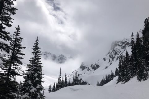
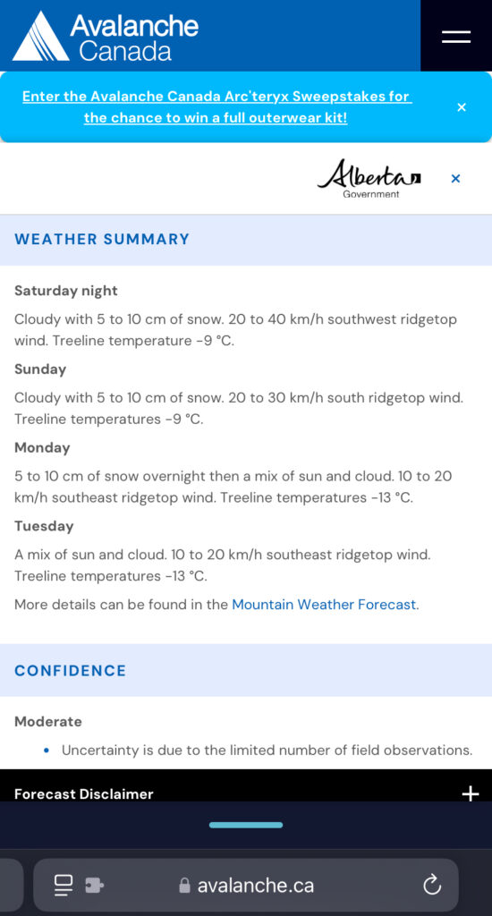
In Exploring The Coast Mountain on Skis – John Baldwin’s book, Zoa Peak is categorized as Difficulty Level 2 with challenging terrain. As per Avalanche Canada, the avy forecast was Considerable across Alpine/Treeline/Below Treeline. The recommendation was to choose simple, low-angle terrain with no overhead hazard.
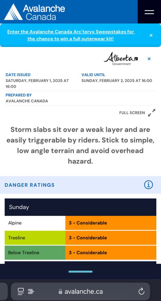

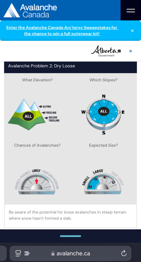
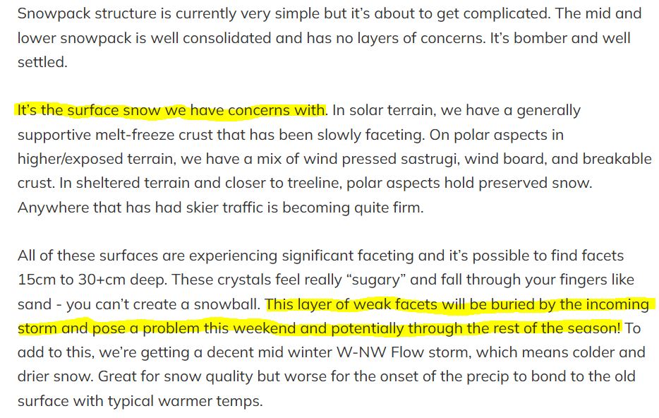
The two avalanche problems shared in the forecast were Storm Slab and Dry Loose. On Jan 30, I hosted Eric Carter on BCMC’s first Speaker Series as part of the Mentorship and Training Program, and he raised similar concerns when asked about weekend conditions. He reiterated these concerns in the weekly Zenith Guides Snow Newsletter. Here is a snapshot from the report –
If you have not subscribed to this newsletter, I highly recommend it. It provides excellent commentary on the conditions and is a great resource for anyone venturing into the backcountry in the Sea to Sky region.
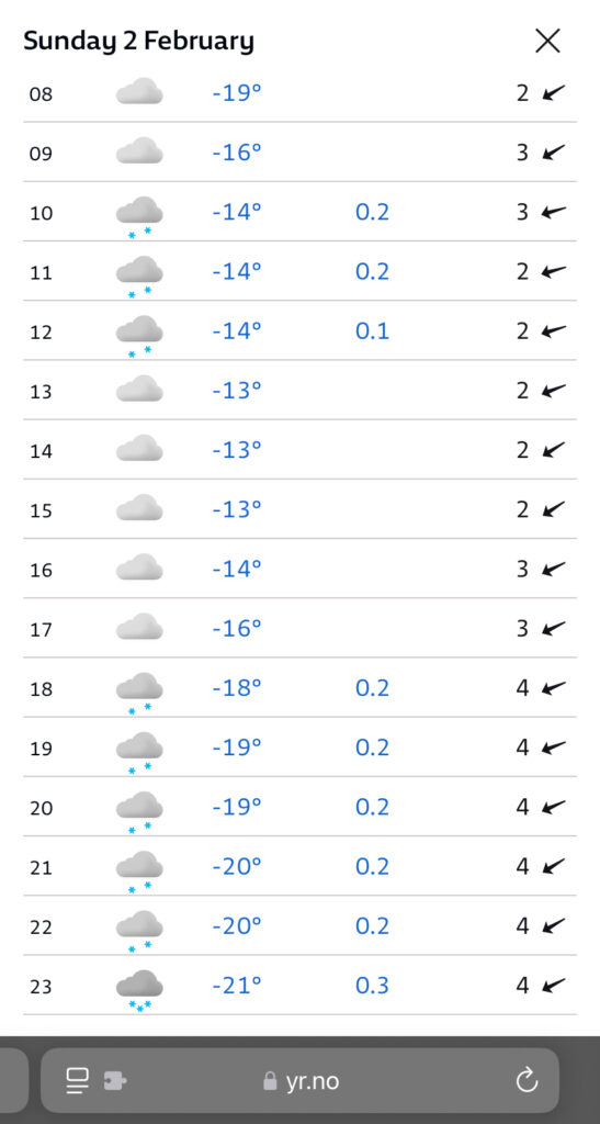
Weather-wise, the forecast for Sunday was about -14C at the summit (1860 m) and some fresh snow during the day.
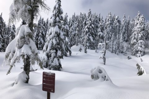
Zoa Peak Trail
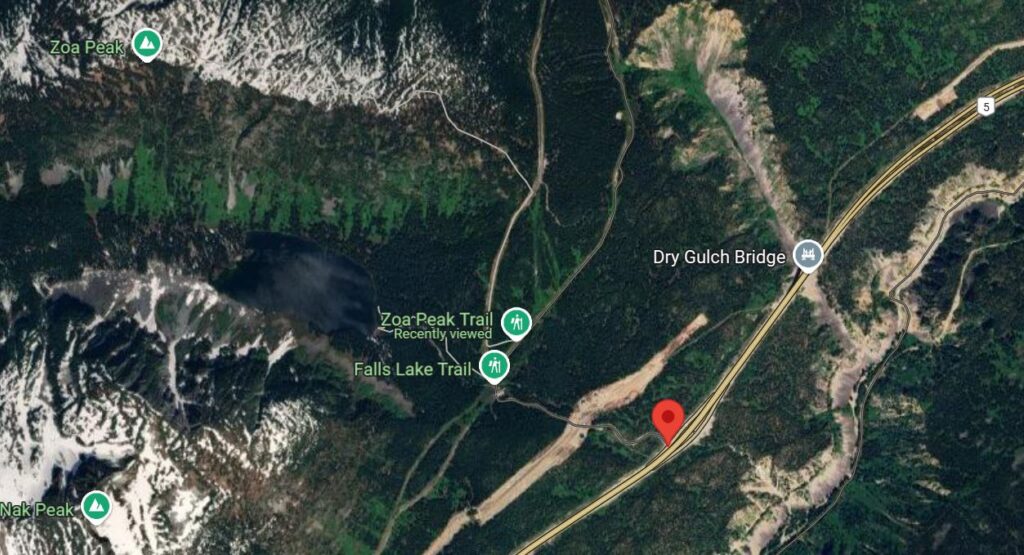
On Sunday, I left home at 7 am and met with the rest of the group in Abbotsford at 7:30 am. After a short break, we made our way to Coquihalla. We took exit 221 on Coquihalla Hwy and parked at the start of the Falls Lake Road.
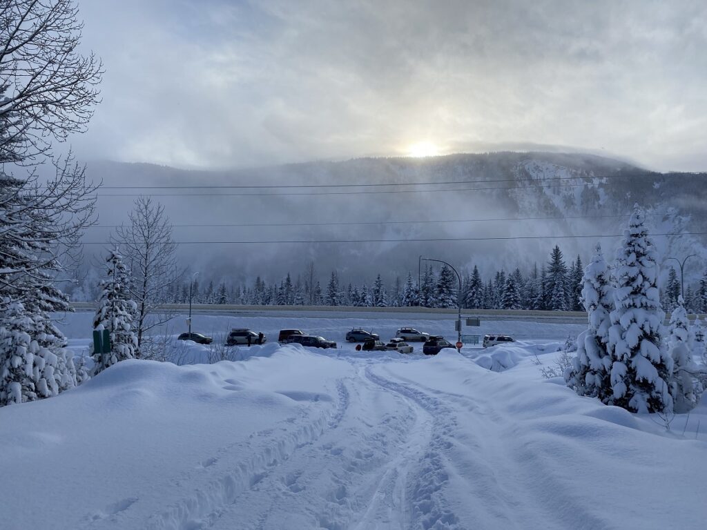
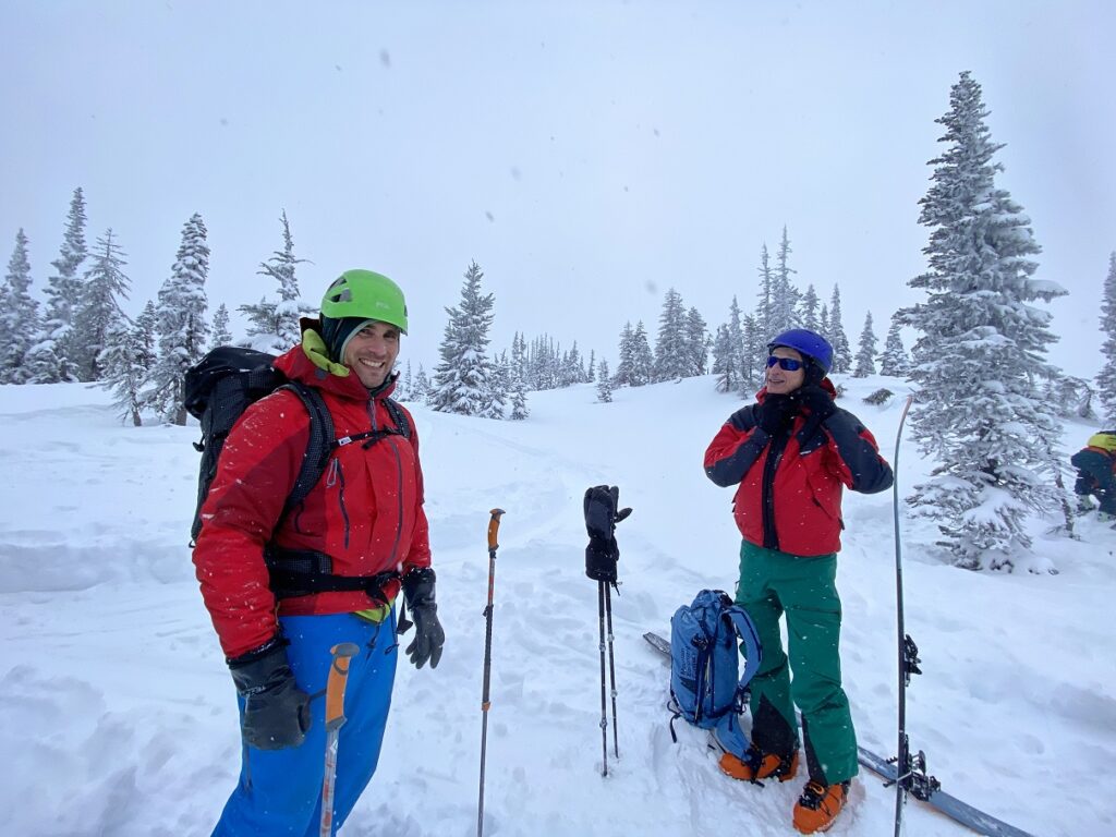
There were already a few cars parked. It was 9 am and around -12C at the parking lot (elevation of 1190 m). Colder than expected. But it was clear and sunny.
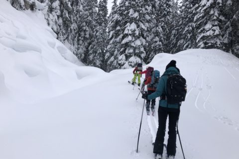
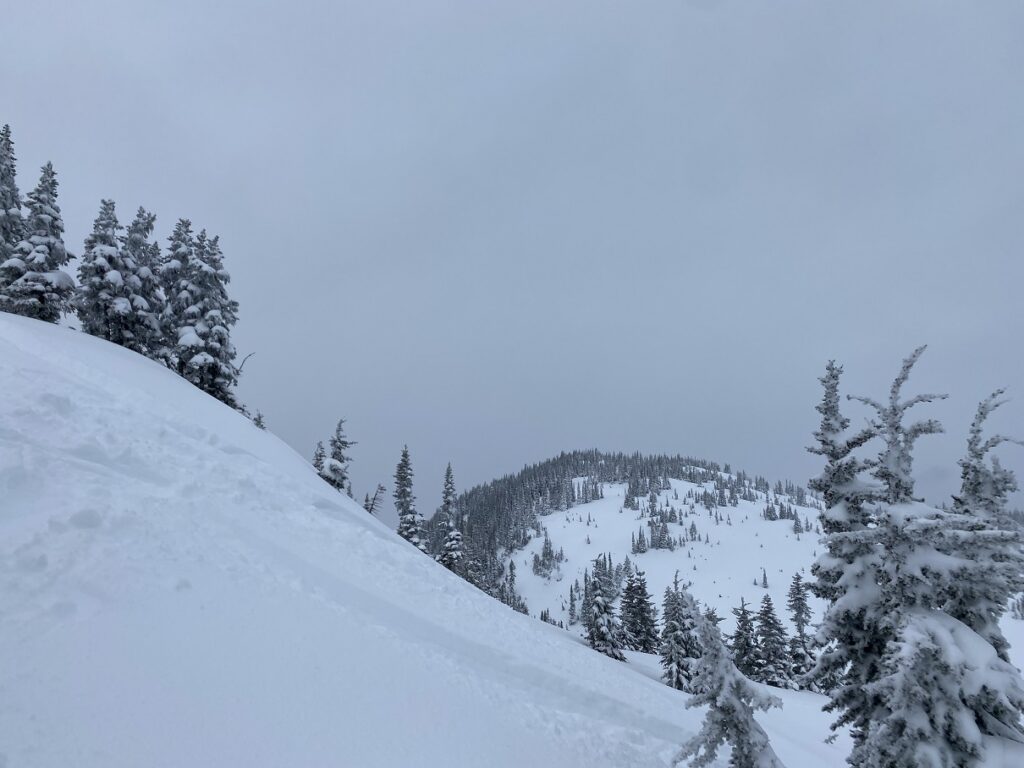
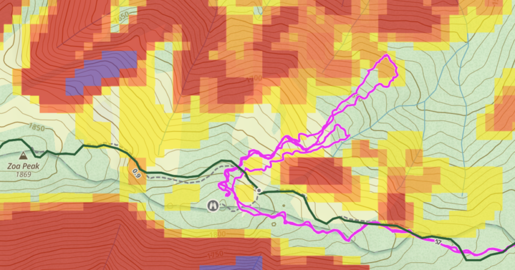
After gearing up, we started skinning up the Falls Lake Road. Soon, we had views of Thar Peak in front of us.
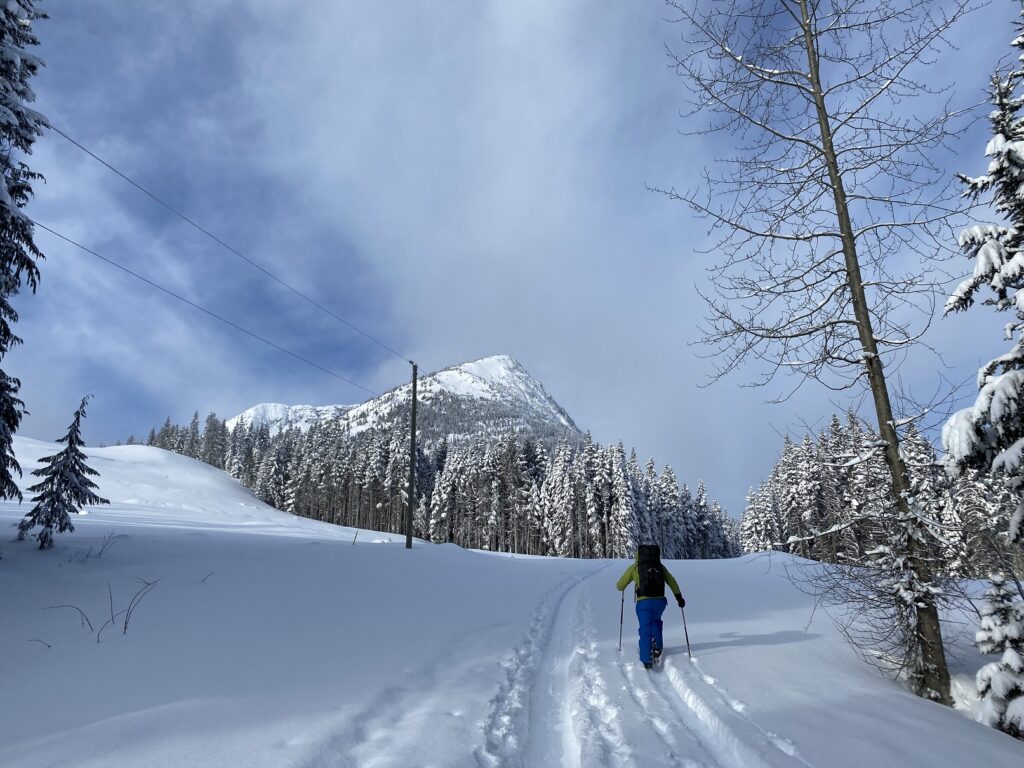
About a km in, we were at the Falls Lake (summer) Parking area. From here, we crossed the Falls Lake Creek over a narrow wooden bridge and continued straight till we were at the base of a clear-cut slope.
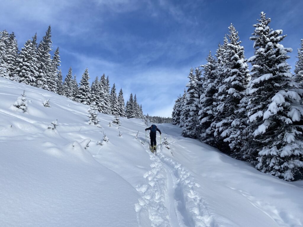
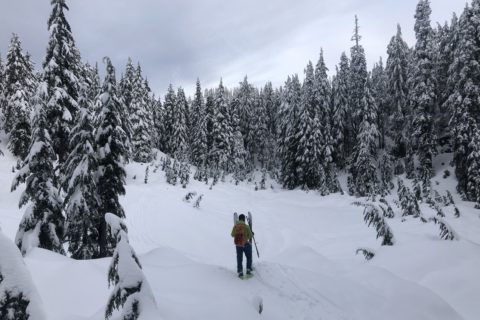
We zig-zagged across the initial steep section of the slope, but the existing tracks made it easy and soon we were on the Zoa Peak Trail. About two km in (from the Falls Creek Road parking), a trail sign marked the (summer) Zoa Peak Trail that went into the forest. We followed the tracks for another 300 m before turning into the forest.

It was a gradual climb through the forest, and fresh snow made for easy travel. It took us about 30 minutes or less to clear the forest and get on the ridge with sparse trees.
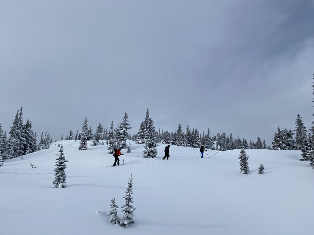
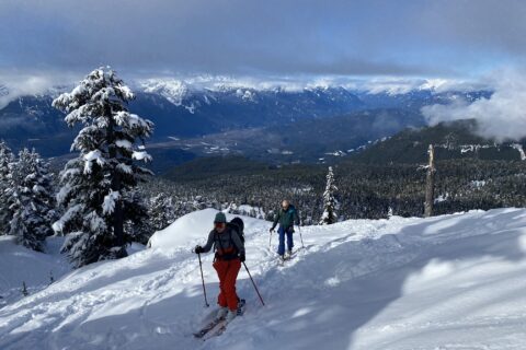
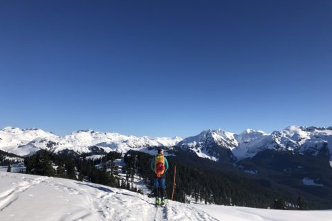
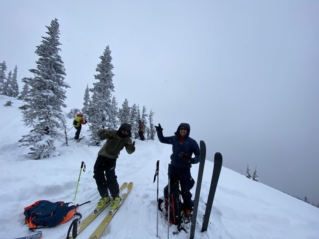
Around 11:30 am, we reached a high point of around 1820 m. A group was getting ready to ski down the North Slopes. Given the fresh snowfall (50+ cm), I asked Oudi about avalanche hazards, and he said we would stick to mellow terrain and avoid convex slopes.
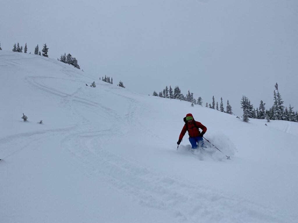
Laps on North Slopes of Zoa
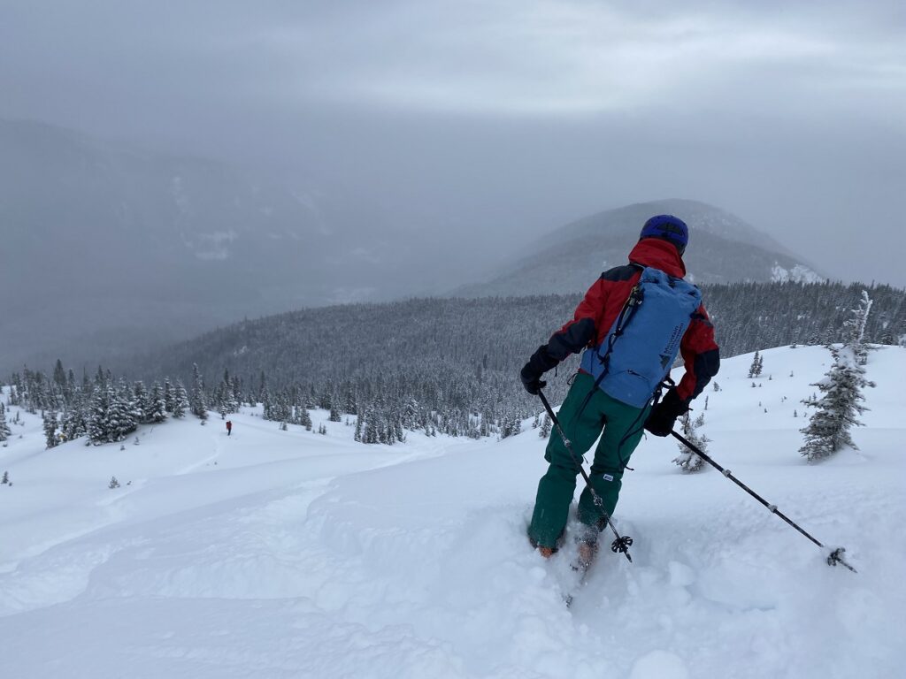
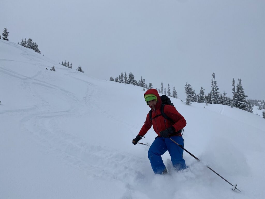
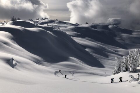
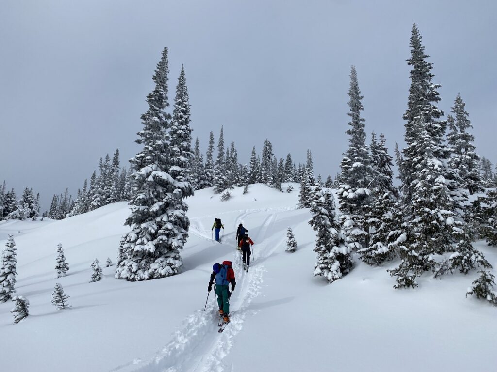
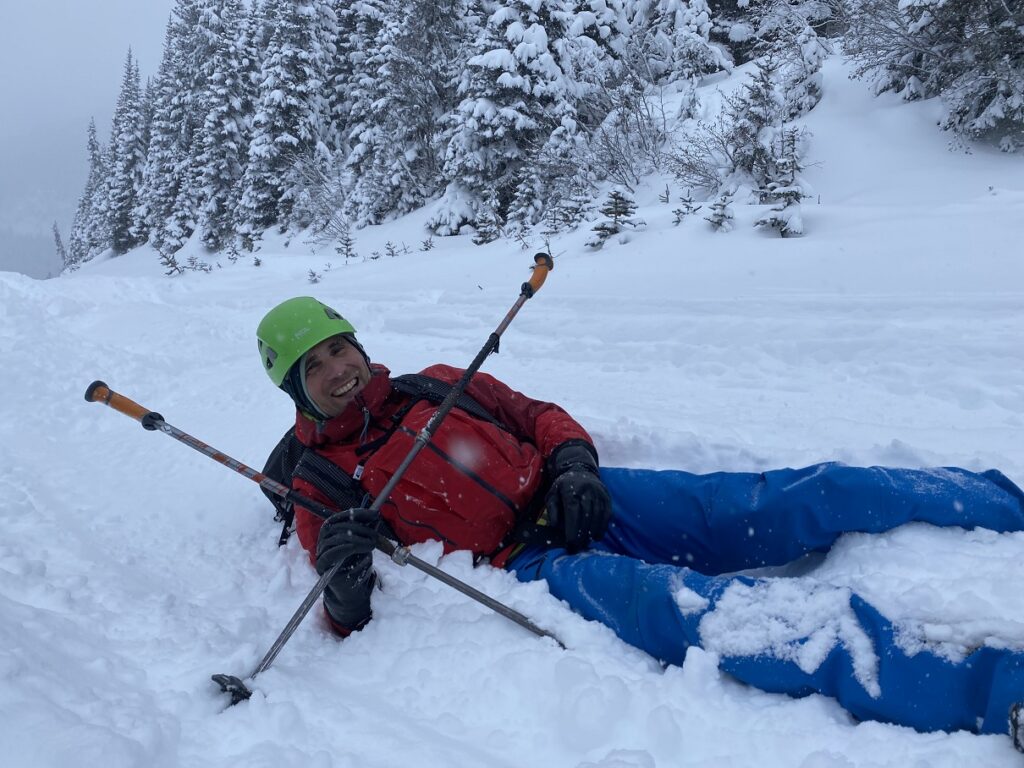
We took a short break and then transitioned to ski mode. Tim, Roger and Raph skied down first. Oudi and I followed. It was fun watching all of them ski the pow with an elegance and momentum that I could only dream of. I was clumsy and slow but made it down with Oudi’s help.
For the first lap, we dropped about 150 m. We were slightly right of others but eventually caught up with them as we skinned up to the top. For our second lap, we skied down more to our left and went even further down with a total drop of about 225 m.
Lost and Found
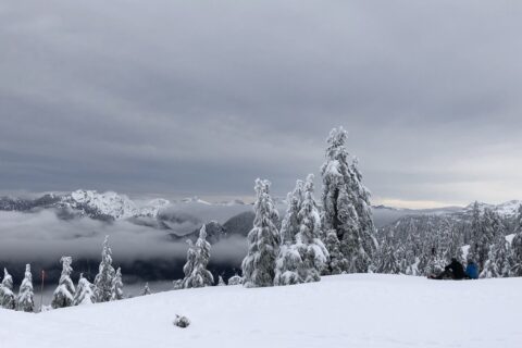
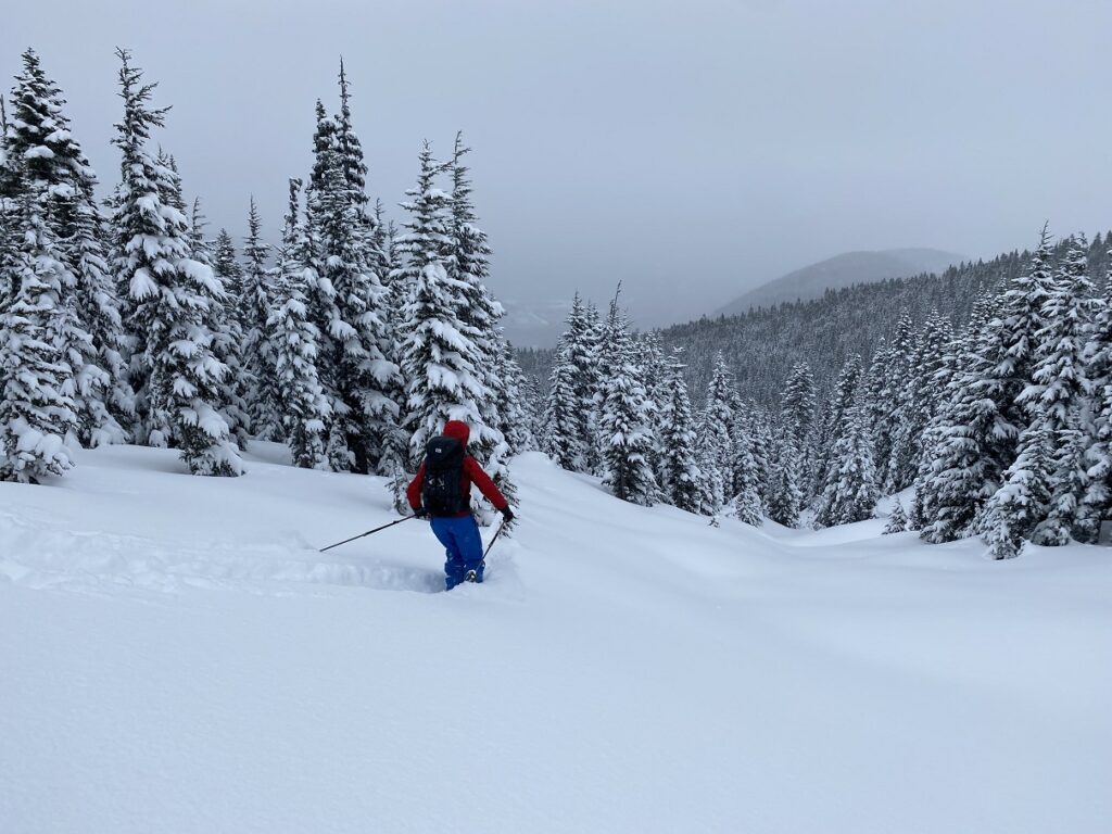
It was a great day to be in the mountains, and the rest of the group went for another lap while Oudi and I made our way down. It was 2:30 pm, and I knew I would be slow going down. I tend to hug trees when I ski down, so I wanted to give myself some extra time.
Fortunately, I did better and actually enjoyed tree skiing, thanks to the awesome conditions. In less than 20 minutes, we would have cleared the forest and arrived at the Pipeline Road. But, at one point, I veered off to the (skier’s) right.
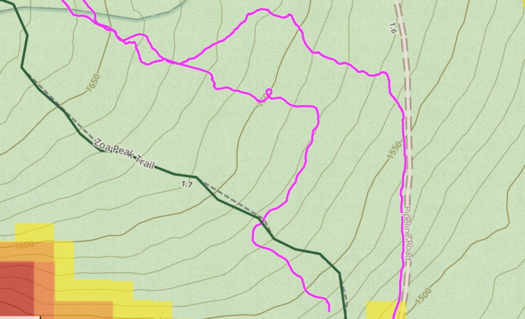
I couldn’t see or hear Oudi. After waiting for a few minutes, I checked the map on GAIA and started heading towards the Zoa Peak Trail. I saw tracks and orange trail markers, but unfortunately, it was the summer trail and not an easy terrain (tight trees and steep) to ski down.
I had to get off the skis and walk across the slopes. Jesse and I had done this on our way down from Gin Peak, so I had practice. Skis in both hands, trudging through the waist-deep snow.
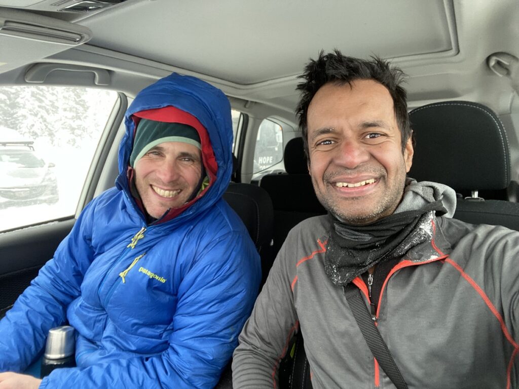
Thirty minutes later, I was back on Pipeline Road. Oudi skied down a few minutes later. He had skinned back to the junction where we got separated. Oudi saw the tracks heading towards the summer trail but thought I wouldn’t go there. He underestimated my need for suffering on a backcountry ski trip.
It was 4 pm by the time we got back to the car. -12C, but now there was a strong wind, and we were freezing. The rest of the group did another lap on the North slopes and were not far behind. On the third lap, Tim saw an avalanche and did a great MIN report.
Overall, it was a great day to be out, ski in deep snow, practice route finding and learn from more experienced skiers.
Territory Acknowledgement
I want to acknowledge that this trip took place on the unceded territory of Syilx Okanagan Nation, Confederated Tribes of the Colville Reservation, Stó:lō (STOH-lo) Nation, Nlaka’pamux (Ing-khla-kap-muh) Nation and Confederated Tribes of the Umatilla Indian Reservation. I commit to learning about Indigenous peoples and issues and making reconciliation an ongoing effort.
Source: Native-Land Pronunciation Guide: First-Nations.info
Resources:
First Nations: Syilx Okanagan | Confederated Tribes of the Colville Reservation | Stó:lō | Nlaka’pamux | Confederated Tribes of the Umatilla Indian Reservation
GPX: GAIA GPS
Backcountry Basics: G3 University | REI Beginner’s Guide
Avalanche Canada – Forecast | Avy Savvy – Online Avalanche Tutorial | Recorded Webinars
Weather Forecast – SpotWx | Yr.No
AdventureSmart – Trip Planning
Disclosure: The links I have shared in the post and under the Resources section are not Affiliate Links.
Did you enjoy reading this post? Please subscribe to get regular updates. Please share your feedback in the comments section below. Thank you!